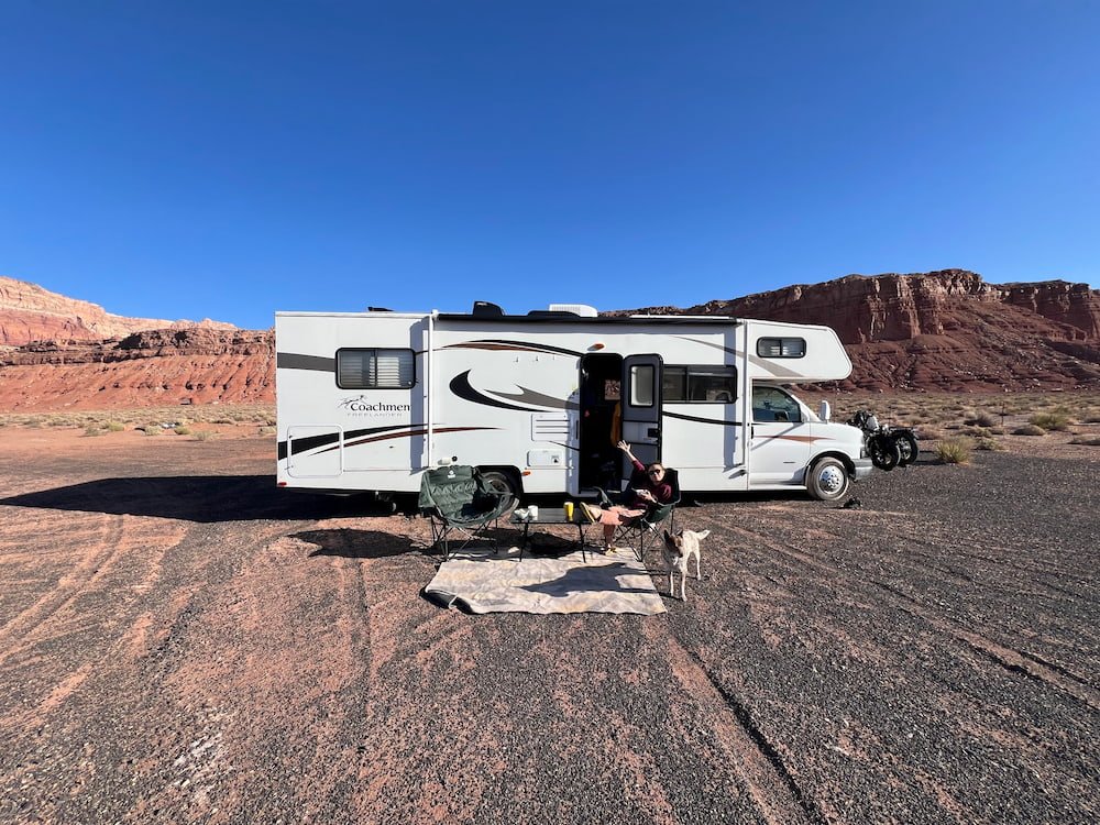
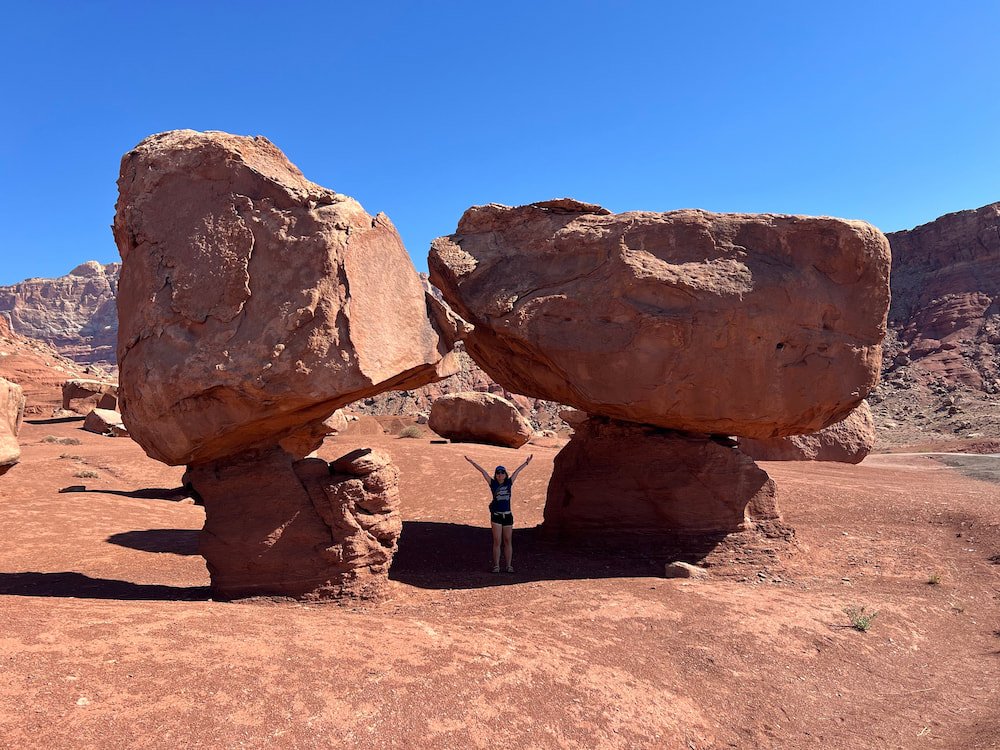
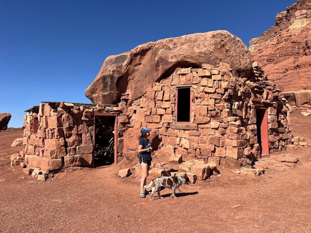
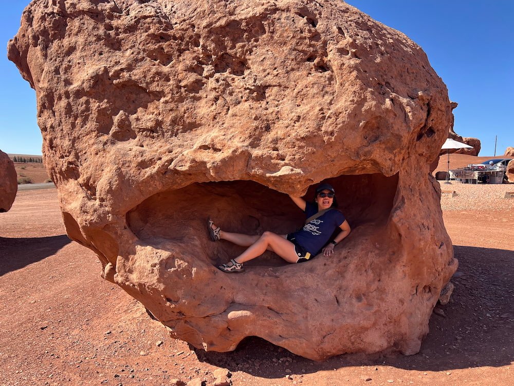
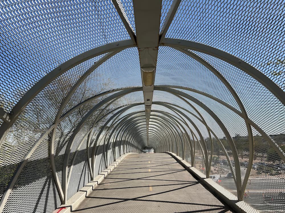
In the morning we woke up to sunny skies so we decided to take advantage of our amazing campsite and have breakfast outside. Afterward we drove to the nearby Cliff Dwellers Stone House for a quick stop before heading for Vermilion Cliffs.
Enjoying breakfast at our campsiteBoulders at Cliff DwellersCliff Dwellers Stone HouseLisette being eaten by a boulder
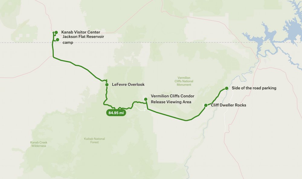
Vermilion Cliffs: Overlooks, Condors and Pronghorns
Vermilion Cliffs National Monument is 280,000 acres of gorgeous red rocks, trails and views, with landscapes like the Paria Plateau, Vermilion Cliffs, Coyote Buttes, and Paria Canyon. It’s tucked between Kaibab National Forest on one side and Glen Canyon National Recreation Area on the other. We drove from where we slept the night before, and loved seeing the brilliant shades of red pigment glistening on the rocks and ground as we cruised along.
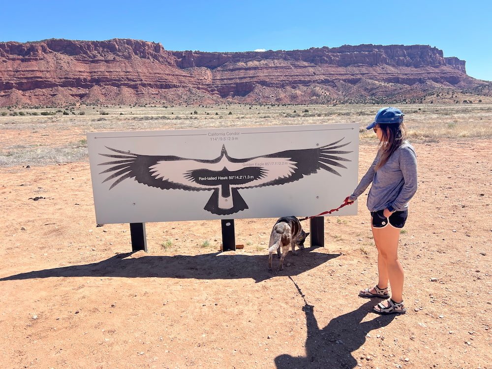
We realized that we needed to drive back down to get to Vermilion Cliffs Condor Viewing Site. It’s a bit of a bumpy road to get there, and as we approached we noticed what looked like several deer in front of us, but later realized that they were pronghorns! We could tell that they were pronghorn because of their antlers and distinct white butt. Pronghorns are the fastest land mammal in the Americas, after the cheetah. While they’re sometimes referred to as the American antelope, the pronghorn’s closest living relatives are the giraffe and okapi.
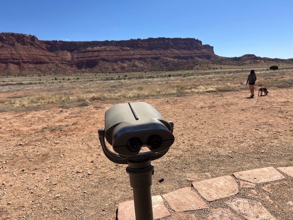
Binoculars for viewing the condorsThey are rather large apparently
We were thrilled to have encountered our first pronghorn sighting, as unfortunately we didn’t see any condor at the viewing site. The site has a small car park, and an area with a spotting scope to try and see the condor up in the rocks straight ahead. The most we were able to see was the whitened rock, discolored from their poop! Apparently over 200 California condors now live in the wild, from a low of 22 condors in 1982. California condors have been released in Vermilion Cliffs since 1996 by The Peregrine Fund, in partnership with the Bureau of Land Management (BLM), so this site gives visitors a chance to see these endangered birds.
When we were at the condor viewing site, we noticed a couple of people who seemed to be fixing up their cars in the lot. No sooner had they left, when Michael realized that they had been pumping up their tires again, as the gravelly road beyond the viewing site was incredibly bumpy and best to do with deflated tires. If we had driven onwards we could have made it to The Wave, one of the most popular destinations in the area (and to take photos of). Because of its popularity, a permit from BLM is now required to see it, with only 64 people allowed per day. However, because of the rough drive to get there, we had to skip progressing on this road, and continued to the city of Kanab, leaving Arizona and crossing back into Utah.
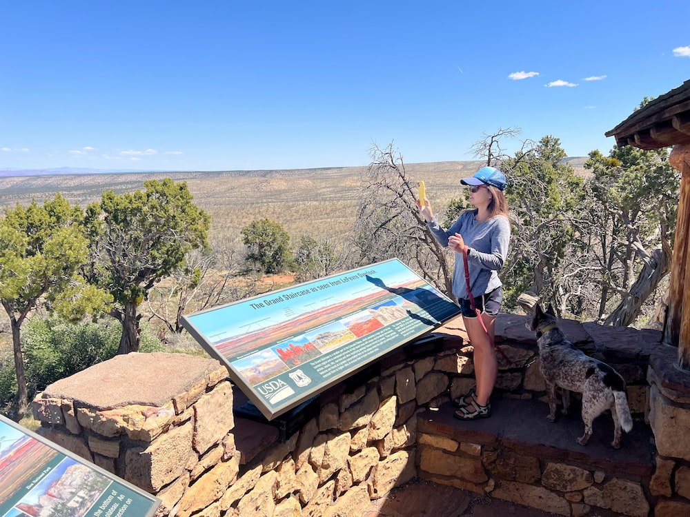
LeFever Overlook
On our way through was a spectacular viewing point -- the Le Fevre Overlook -- where we could look at The Grand Staircase below us, one of the most colorful parts of the Colorado Plateau. Here we could see a vast array of colors, textures, elevations, and how the landscape had evolved over millions of years. The Overlook is just off the highway, making it an easy and amazing stop!
Kanab: The Greatest Earth on Show
Kanab calls itself "The Greatest Earth on Show" (a play on the old circus saying "The Greatest Show on Earth"), thanks to its proximity to many tourist attractions, including Vermilion Cliffs, Bryce Canyon National Park, the North Rim of the Grand Canyon, Zion National Park, and many others. It's also a popular spot to do UTV tours, as we noticed many parked, waiting for tourists to take them for a ride. We figured we'd check out the Visitor Center to orient ourselves to the area, plan where we'd go next, and find a place to rest for the night (hopefully surrounded by beautiful and peaceful scenery as we had the night before). The Kanab Visitor also has some interesting exhibits about the Native American peoples who have inhabited this land, as well as different rock slabs showing how the different colors have formed, from these stacking atop each other over millions of years.
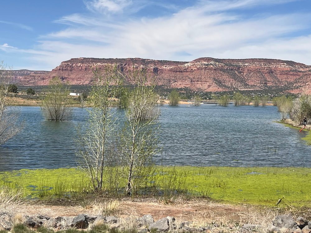
View from our campsite at Jackson Flat Reservoir
One of the recommendations for us to boondock for the night was Jackson Flat Reservoir, a serene spot to walk along the paved trails, go fishing, canoeing/kayaking, or birdwatching (there were a lot of birds, including Canadian geese, in the water). We loved the views of the water and greenery surrounding us as we pulled up in the late afternoon. It was somewhat warm, although the wind did pick up in the evening, with a slight dust storm rolling in as Lisette and Sheila sat outside, perfectly timed to when Michael opened the RV door from inside to see what was happening!
Still, we count ourselves so lucky to have this opportunity to enjoy so many beautiful natural sights, sounds and smells surrounding us. Lisette vowed to make the most of the scenery and take Sheila for a lovely walk first thing in the morning.
Route Map
Day 63: Forrest Gump Hill, Monument Valley and Navajo Code Talkers
Run Forrest, Run!
We woke up to find that the storm had passed, although the ground was still damp in the morning, and there was an icy cold wind blowing so that despite the sun’s rays, the temperature was below 0 degrees Celsius (31 degrees Fahrenheit).
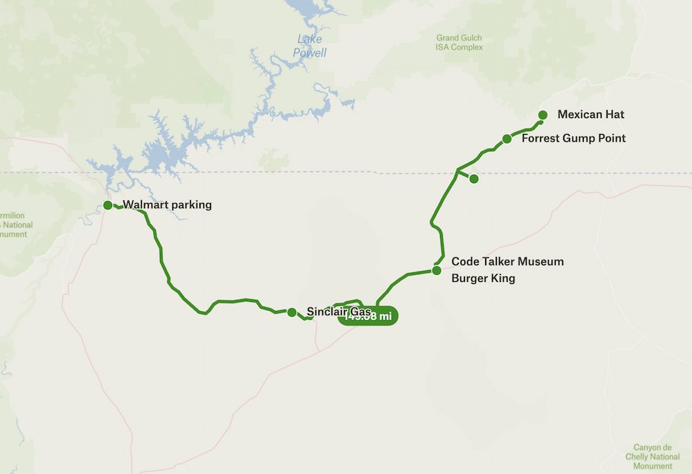
From Mexican Hat we drove straight to Forrest Gump Hill. This stop is famous for a particular scene in the movie Forrest Gump, as the main character runs for miles and years around the US. There’s even a sign a mile out from the spot, informing people of the upcoming attraction.
Looking down the road at Forrest Gump pointLisette doing her best Forrest impression
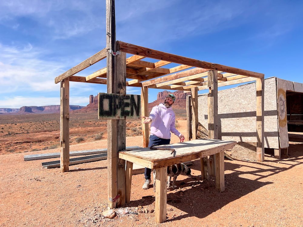
There were several vehicles when we parked, and there was even a vendor stall right by this spot to park on the side of the road (while it was empty, we imagine it gets super busy during the summer months). Of course, everyone takes photos on the road, pretending to run and recreating that movie scene. Everyone had to be careful to continually watch both sides of the road, making sure to move away from oncoming traffic! Eventually the myriad of tourists left, which gave us a lucky chance to take a few more photos when the road was clear!
Michael opened a stall selling a rusty metal barSelfie at Monument Valley
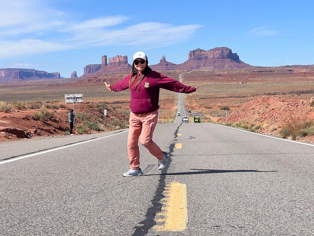
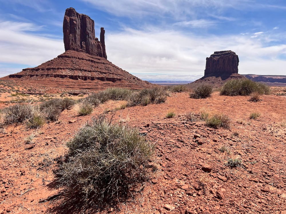
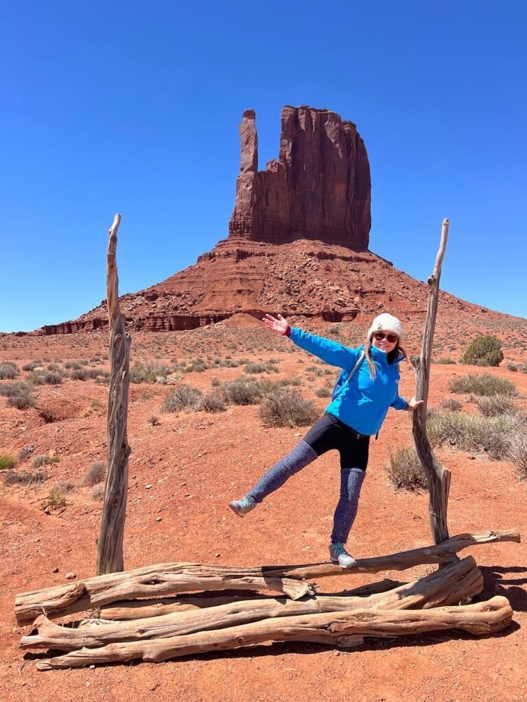
Monument Valley Navajo Tribal Park
We crossed back over into Arizona (which is one hour behind Utah and so kinda confusing for our internal body clocks, which have zigzagged state lines multiple times recently), to visit Monument Valley (which also partially sits in Utah). Monument Valley is well-known for its awesome sandstone buttes and spectacular views, and sits on Navajo tribal land. It costs $8 per person to enter.
Huts at Monument Valley
RVs and motorcycles aren’t permitted to drive the 17 mile scenic trail due to the rough terrain and deep sand dunes, so we had to park in the Visitor Center (luckily, there are a ton of spaces), and decided to do a hike to immerse ourselves in the landscape. There are also tours that visitors can take that are run by Navajo people. These are in open-air vehicles, so it would have been chilly feeling the icy wind breeze past as a passenger!
Ahead of starting our hike we checked out the Visitor Center. The information desk was only open briefly (the person inside was the same person who was at the fee station when we drove in), but we came at exactly the right moment to obtain a map and check in for our hike. While we’re not big on souvenirs, the Visitor Center had a lot of gorgeous Navajo-made jewelry, statues, pottery, dream catchers, and other items. There’s also an exhibit on the floor underneath, and outside the souvenir shop there’s sweeping and picturesque views of Monument Valley. John Wayne fans will recognize the views from his many old Western movies that were filmed in the area.
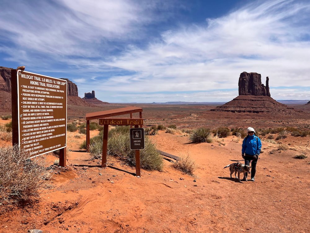
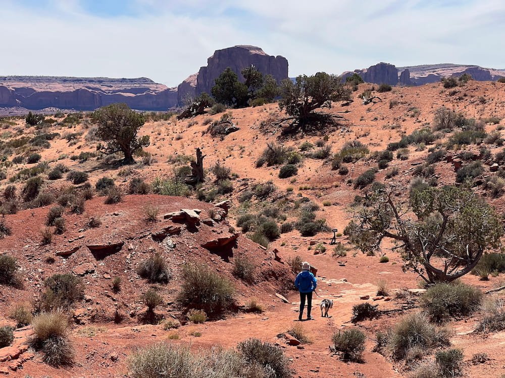
Hiking the Wildcat Trail
It was positively freezing when we started our hike, on the Wildcat Trail, an approximately 5.6 kilometers (3.5 miles) loop. While it was apparently a sunny 8 degrees Celsius (46 degrees Fahrenheit), the wind chill made it feel like -2 degrees Celsius (28 degrees Fahrenheit). Fortunately, we did get some respite in the deeper parts of the valley, so that we weren’t exposed to the icy cold wind the entire time. While we’ve seen markers along hikes before indicating how many miles in we’d walked, this was the first time we saw markers in both kilometers and miles!
Hiking the Wildcat Trail
We enjoyed hiking this trail and seeing what greenery could thrive in such a dry climate, which included gorgeous wildflowers and the distinct canaigre or Arizona dock perennial flowering plant that popped in color in the middle of this reddish-brown landscape. There are no bins along this trail although there are a couple of picnic stops to sit at; we even saw a cooler plopped on one of the picnic seats where visitors could self-pay for water. It was near a small settlement, so presumably the folks living there set this up each day.
Lisette and Sheila between two buttes (hehe)East and West Mitten ButtesRugged landscapeOnly ones on the trail at this point
Insta-worthy moment
As we passed the halfway mark, looping back around to return to the carpark, the wind became much stronger, whipping red dirt into our eyes and sticking to our faces in the areas where we’d applied sunscreen. As we hurriedly made our way back, we had wind-rashed faces and were eager to have lunch, but were happy to have completed this lively trek.
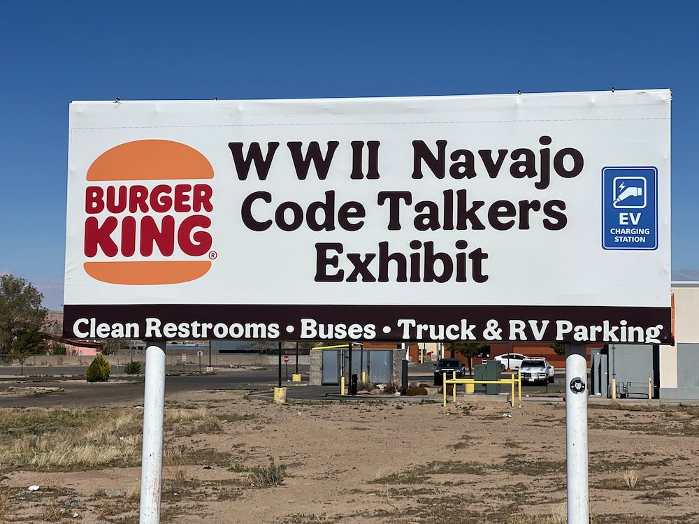
Navajo Code Talkers and Burger King
After checking out from our hike and eating lunch, we continued on to the Burger King in the town of Kayenta in Arizona. Nope, it wasn’t to eat at this fast food restaurant, but to check out the world’s best exhibit on the Navajo Code Talkers.
Burger King sign
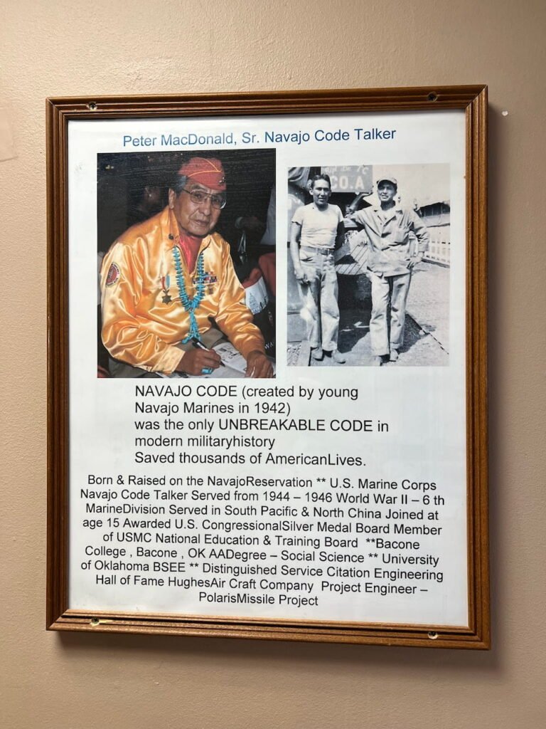
In World War II, the U.S. military’s code was continually being cracked by the Japanese. So they turned to the Navajo Code Talkers. Navajo is a unique language that barely anyone outside the Navajo Nation spoke. The Marines recruited 29 young Navajo men to help build an unbreakable code, achieving incredible feats. During the Battle of Iwo Jima, six Navajo Code Talkers sent over 800 messages without a single mistake. Major Howard Connor later said the Marines couldn’t have taken Iwo Jima without them. The code stayed a secret until the Vietnam War.
Memorial inside the Burger King
Years later, in 1986, a small town in Arizona got its first fast-food spot, opened by Richard Mike, son of a Code Talker. He filled it with his dad’s war memorabilia to honor their legacy, which is what’s in the Burger King today.
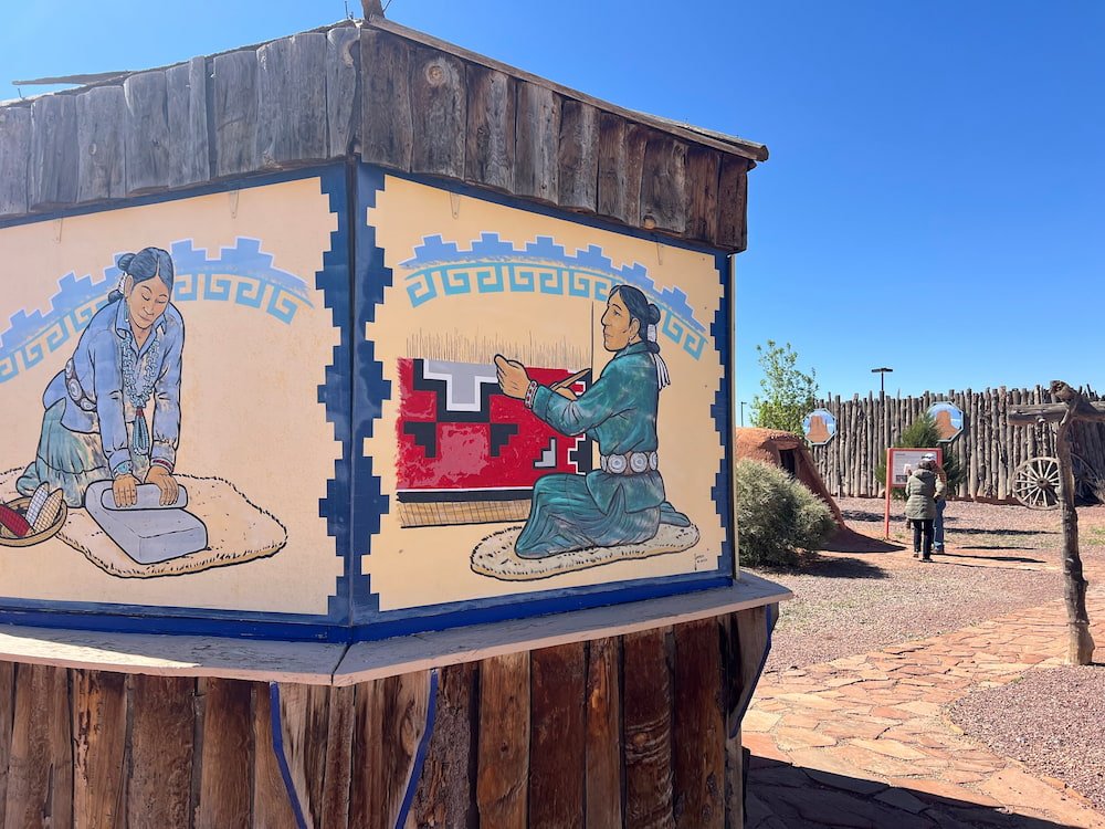
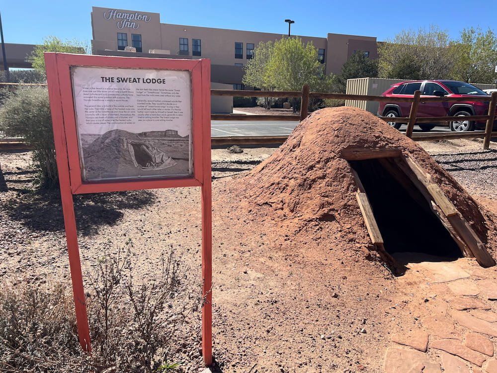
Adjacent to the Burger King, there’s also a small Navajo Cultural Center, open daily. Unfortunately we just missed the museum by an hour, arriving at 4pm (the museum closes at 3pm), but we were able to wander around and still see the Navajo hogans, sweat houses and other exhibits outside.
Nice display considering this was in the Burger King carparkArt at the Burger King museumSweat LodgeInside one of the huts
Tomorrow we planned to visit Antelope Canyon in Arizona. We drove just past it to the city of Page. Here, the Walmart is a very popular overnight spot for campers, we slept among many other RVs, vans, and other vehicles parked here for the night.
Route Map
Day 62: Four Corners Monument and More
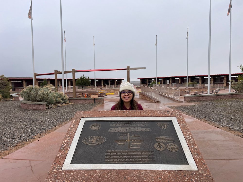
Where 4 US States Meet
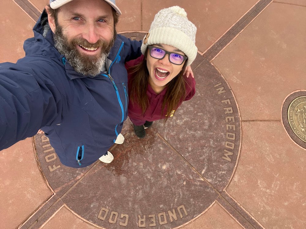
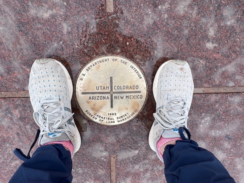
The Four Corners Monument is the only place in the US where four states – Utah, Colorado, New Mexico, and Arizona – meet at one point. The monument also sits on the border between two semi-autonomous Native American nations: the Navajo Nation, which manages it as a tourist site, and the Ute Mountain Ute Tribe Reservation. It costs $8 per person (not vehicle) to enter the Monument.
Four Corners MonumentSelfie standing in all four statesThe center of the monument
It was cold and grey when we drove in, and it was spitting with rain when we drove in, making the dirt ground around the carpark soft and muddy. There weren’t many visitors there, perhaps due to the less-than-desirable photo conditions, and there also weren’t many Navajo vendors yet at the Monument. We saw a still-closed kiosk that apparently sells Navajo tacos and fry bread, and many of the stalls selling Navajo jewelry and other souvenirs were still empty surrounding the Monument.
Fortunately, the benefit was that we had a lot of time to spend at the Monument to take photos at all angles, and have fun dancing around it, spending time hopping from one state to another (or placing both feet on all four states at the same time)!
Twin Rocks Trading Post
About an hours’ drive away from the Four Corners Monument is the Twin Rocks Trading Post, sitting directly beneath the enormous Navajo Twins rock formation. The Trading Post has beautiful Native American selling artwork, jewelry, rugs and other items, and is also an impressive art gallery. Lisette went in and besides seeing all the wonderful handmade creations with the details of the artists, there are two adorable white labradors hanging out inside. One was immediately lying on its back on the rug as Lisette entered, demanding a belly rub, and the other labrador sauntered into the main room from its relaxing bed in a separate gallery room. Definitely say hi if you are in the area!
Mural in front of Twin RocksTwin Rocks and another balancing rock
Next door is the Twin Rocks Cafe, which serves breakfast, lunch, and dinner. There were quite a few people who were enjoying the local Navajo and American specialties, which made it a tempting stop, had we not had a full fridge of food!
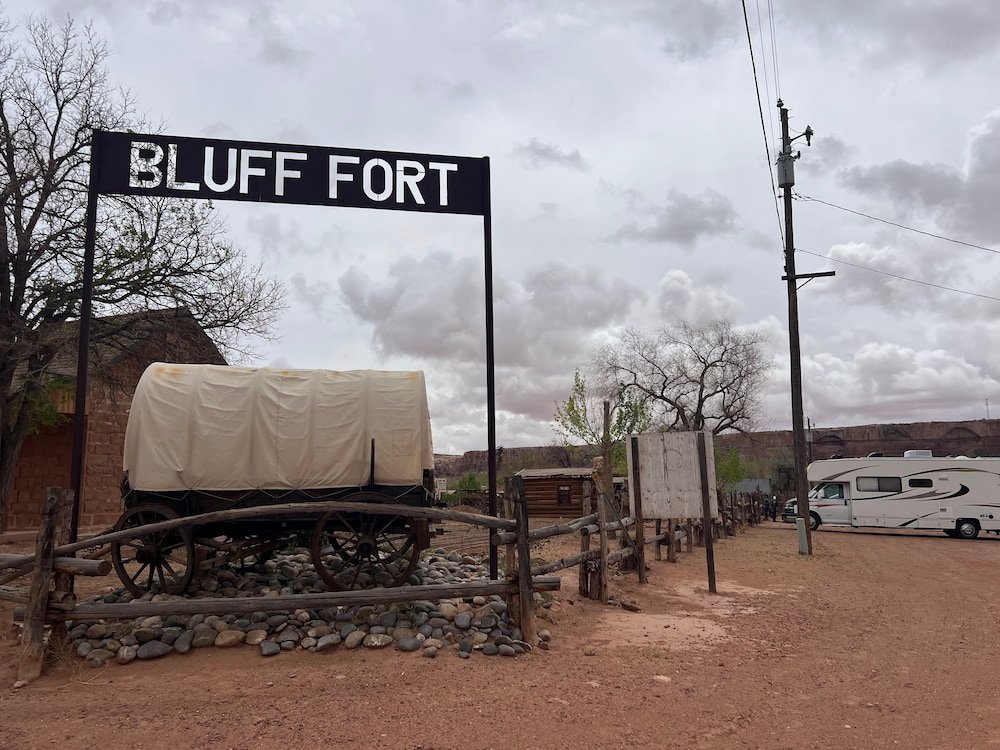
Bluff Fort: A Free Historic Pioneering Site
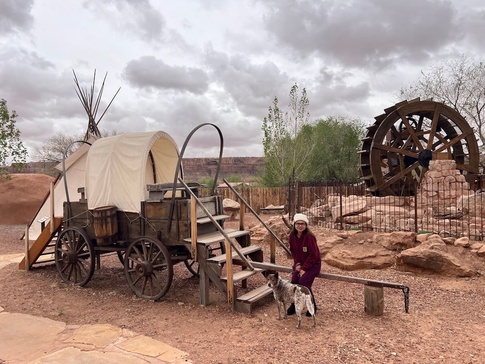
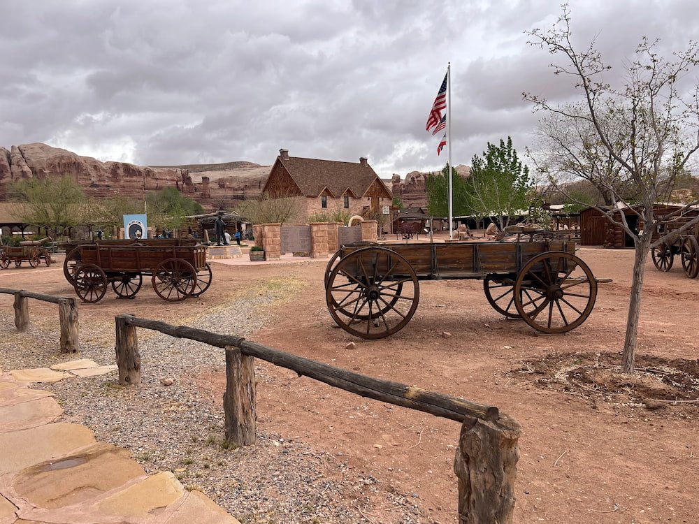
One unplanned and fun visit was to Bluff Fort Historic Site, a throwback to the original town built by Mormon missionaries after they arrived in the San Juan area in 1880. It’s incredibly informative, interactive, and well maintained, which is impressive for a free site run by friendly and helpful volunteers.
Bluff FortA volunteer telling us about the path taking by the early settlers
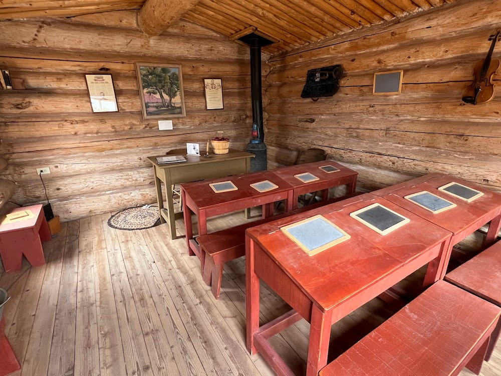
Walking among the recreated log cabins we read about the families that would have once lived in them as we looked at the old furniture and items they would have owned. Within these dwellings and the old classroom, the meetinghouse, the blacksmith’s workshop and other buildings, there are also buttons to listen to audio in several different languages that go into more detail. There are old wagons outside (some donated from Germany), as well as a Navajo hogan and a Ute tipi.
Lisette and Sheila ready to board the wagonReplica classroomSome of the log cabinsPart of the fortMichael practicing for the rodeoSheila looking coy
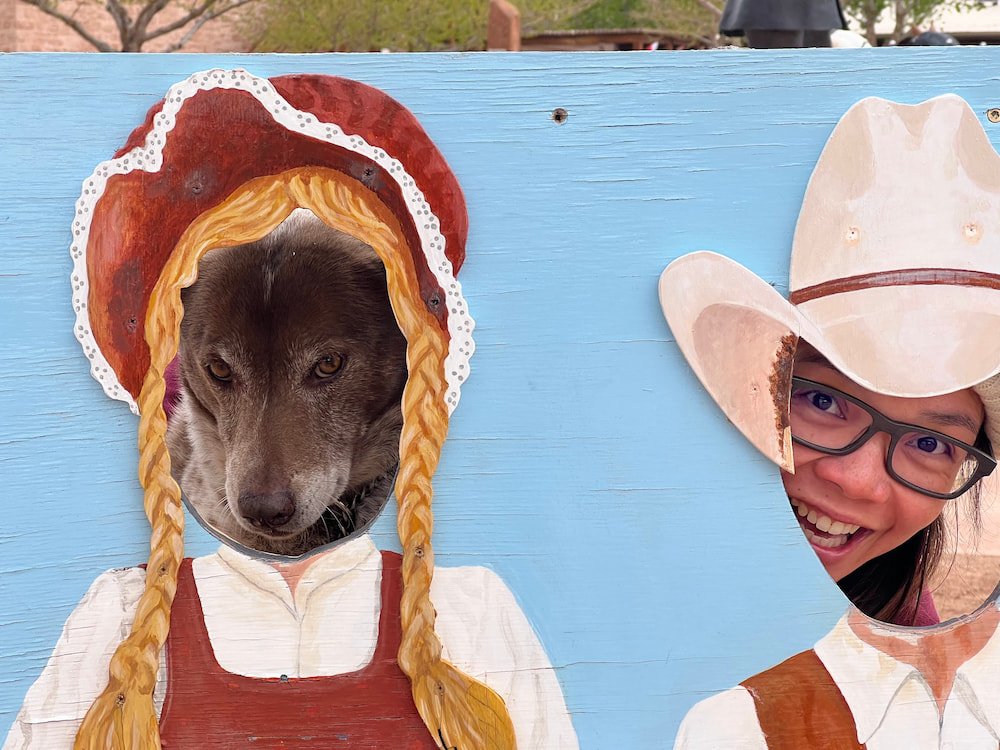
For kids (well, adults too like us!) there’s a lot of fun and interactive activities as well, including a giant waterwheel where visitors can try to pan for gold, and an area where you can try to lasso wooden cattle. Inside the Visitor Center there’s additional exhibits, a gift shop, plus a food kiosk that sells pastries, ice cream, and other snacks.
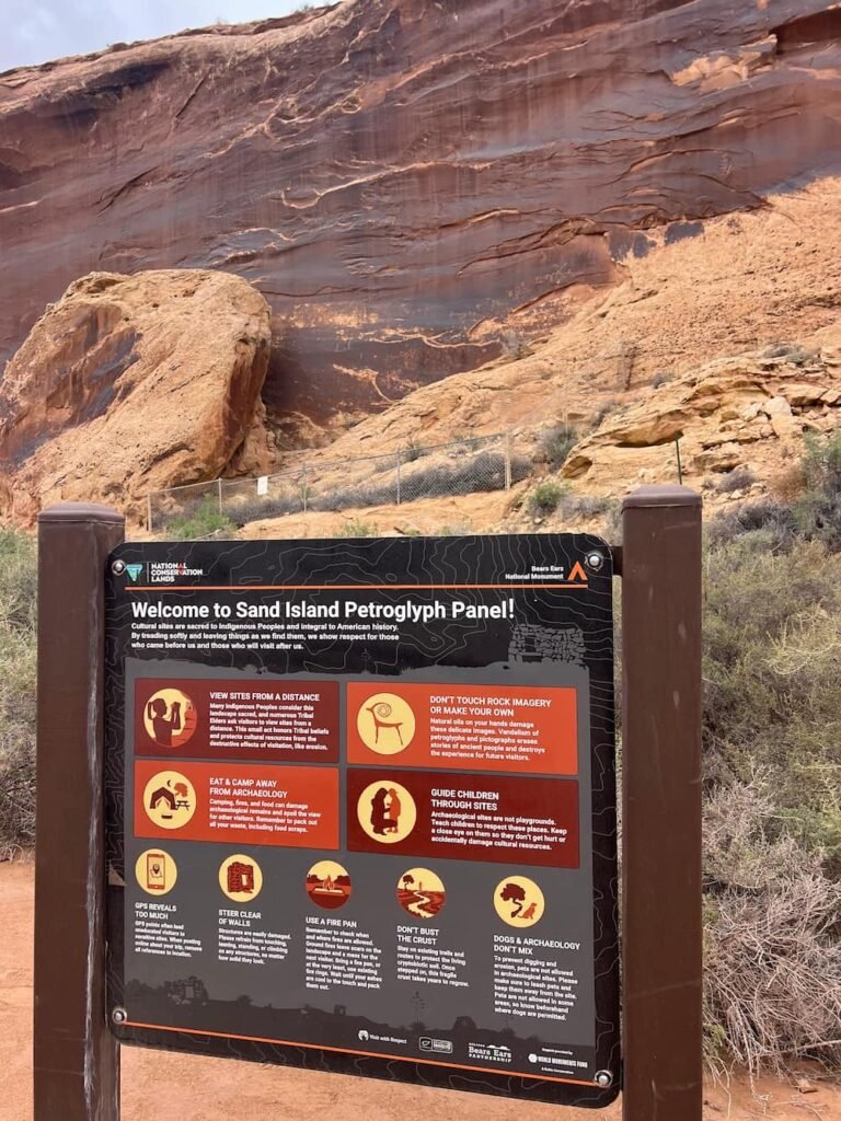
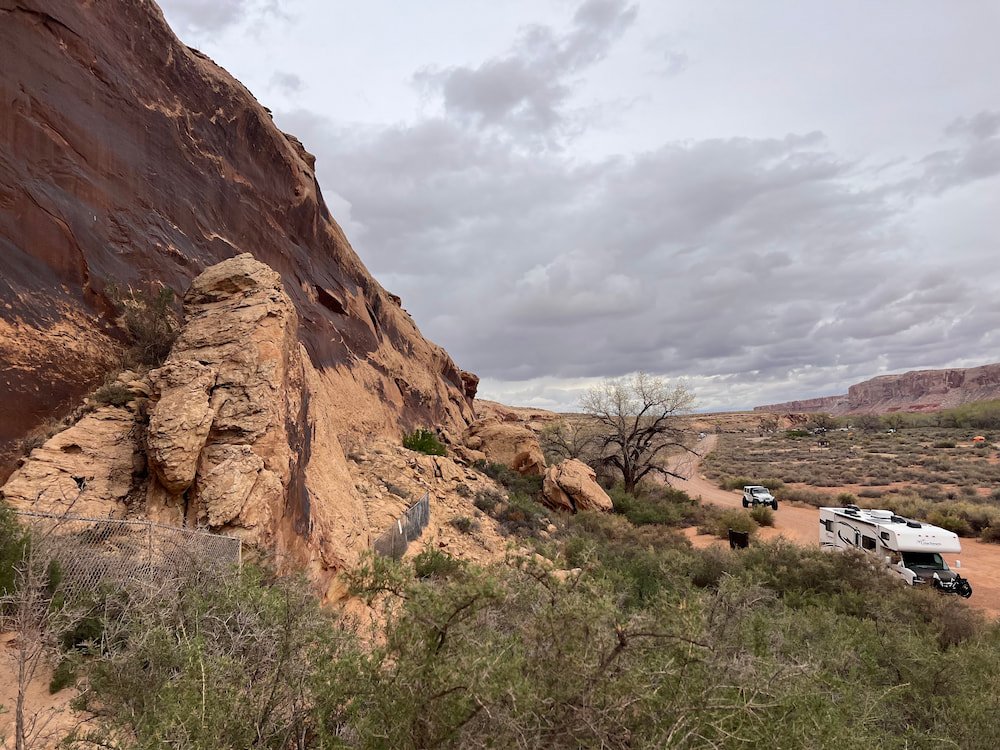
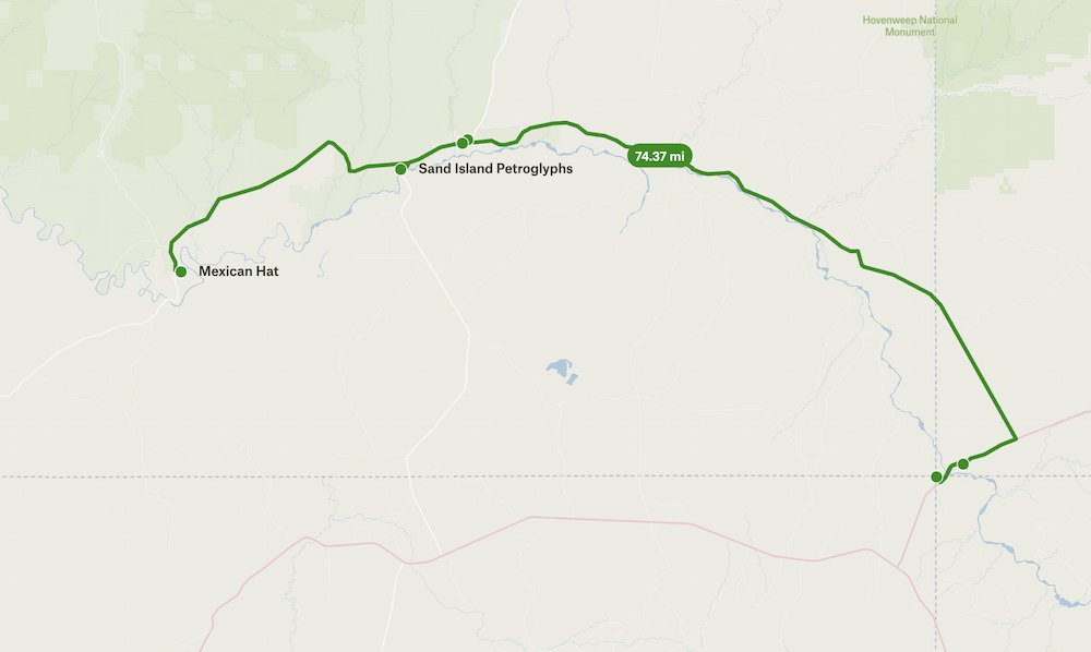
Petroglyphs at Sand Island
A brief stop after Bluff Fort Historic Site was Sand Island Petroglyphs. It’s a short drive off the road, passing a popular campground on the left hand side. The petroglyphs are extensive and amazing – there’s a panel filled with handprints, lots and lots of bighorn sheep, and even Kokopelli playing a flute! There’s also a figure that looks like it has a modern day WiFi signal on it! We aren’t sure what that figure is and what it stands for, but the symbol meant something then, as it does now!
Sand Island Petroglyphs
You could drive right up
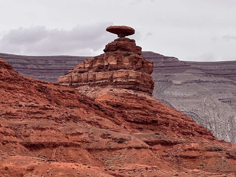
Mexican Hat (Not Called a Sombrero)
As we continued along the road in Utah, we were mesmerized by the scenery in front of us, with majestic rock formations in shades of white, grey, green and red. In some areas, the terrain was completely flat, with a rock monolith rising skywards, like a single commanding tower in the distance. It’s incredible to think how this landscape has formed over millions of years, and how some areas have created these monolithic formations, seemingly out of nowhere.
Mexican Hat
We stopped at one of the more unique and popular rock formations, called Mexican Hat (weirdly, not named ‘sombrero’). It’s a flattened pancake disk shape, perched delicately atop its stouter rock base. We decided to sleep right near it, although make sure to pay online as it’s a paid campsite (the website was listed as we drove in, and the owner will drive right up to you and yell at you if you don’t pay immediately).
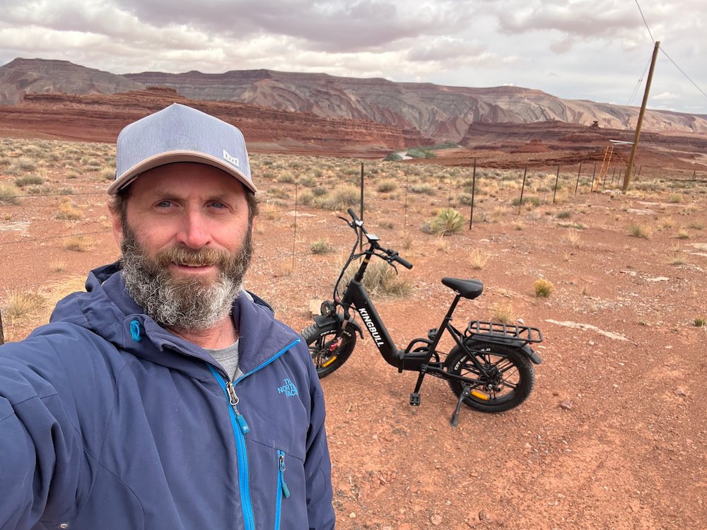
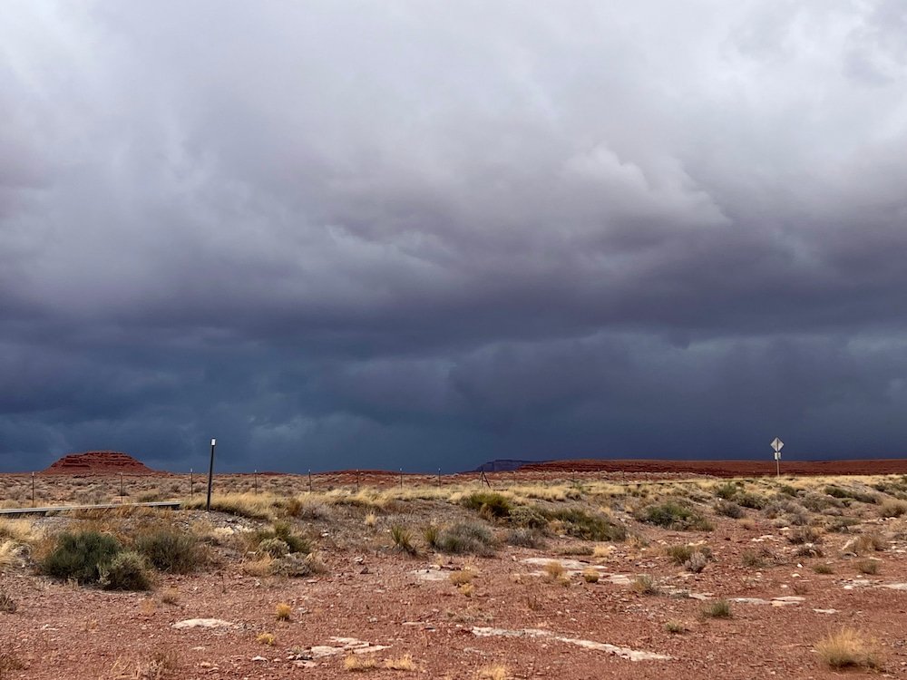
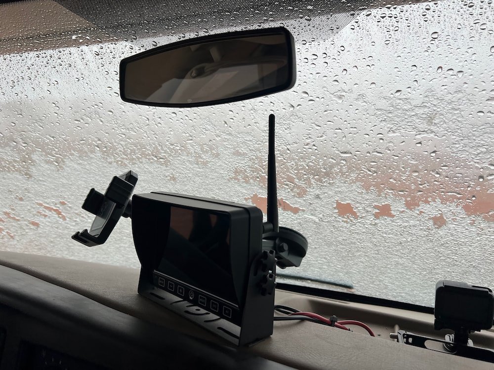
Michael rode to a much higher vantage pointThe river run through creating a ribbon of greenStorm brewingCloser to the river and the storm is getting closerHurrying back to the RV before the stormWindscreen covered in sleet
As it turned to dusk, the winds picked up, and dark clouds loomed quickly over us, indicating that a strong storm was imminent. We yelled for Sheila to quickly run inside the RV as the gales blew up piles of red dirt and it wasn’t a moment too soon – it started to rain, and the cold air quickly turned the water into sleet! What a dramatic way to end our fun-filled day.
Note
We were considering checking out some more arches nearby but after researching the road in we decided that it would be impossible (and dangerous) in the RV. Here's a video showing the Moki Dugway Scenic Byway switchbacks.
Route Map
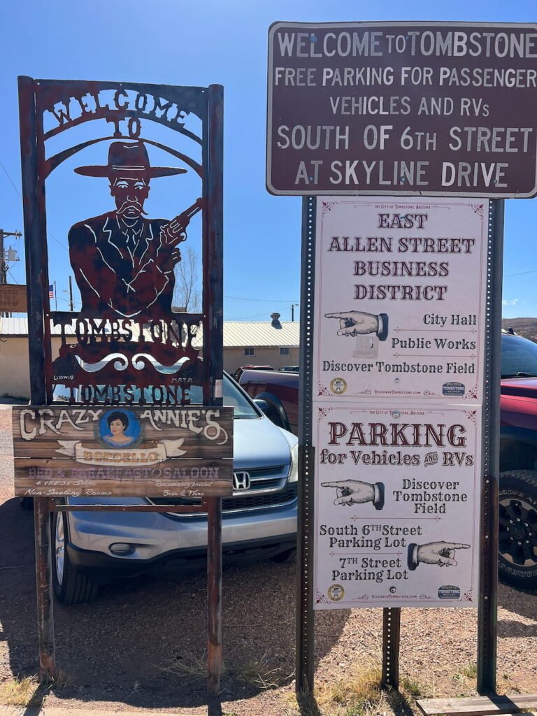
Day 26: Tombstone to Dust Storms
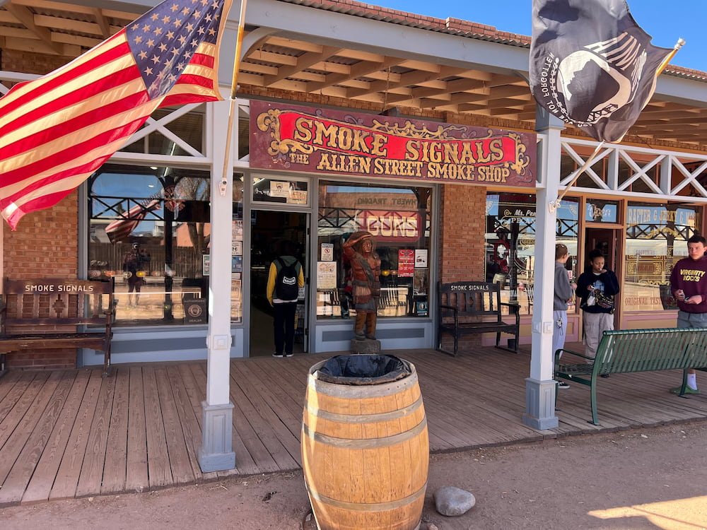
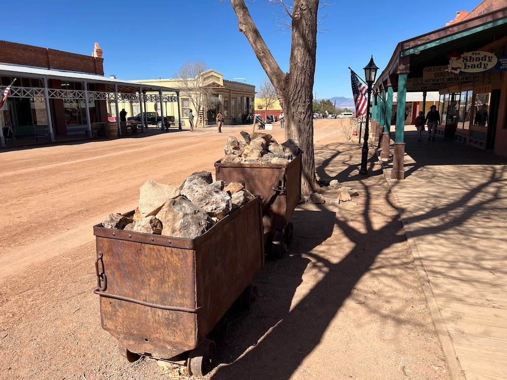
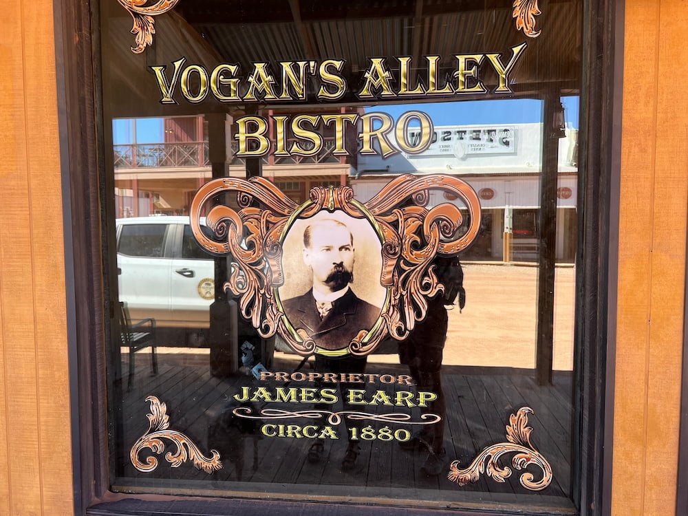
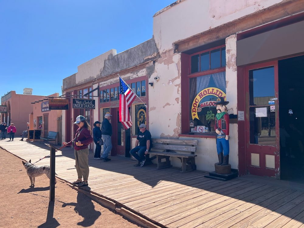
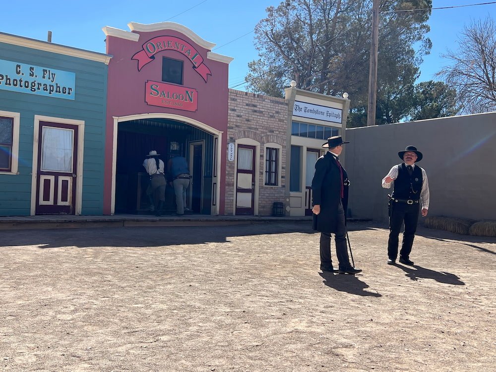
The morning was incredibly windy, quickly dashing any hopes that Lisette had of doing some yoga outside alongside the RV. Instead, we made our way back to Tombstone, where we immediately were transported back to the 1880s, when the town was in its heyday. There’s one main street to wander around, and the buildings have been restored to their former glory. Walking along the street, there are men (sadly, no women), wearing clothes from that era promoting gunfight reenactments and other shows, while a man on a horse and carriage plods slowly through the gravel dirt road.
Smoke Signals storeMain streetVogan's Alley BistroWaiting outside the shops in Tombstone
Tombstone sign
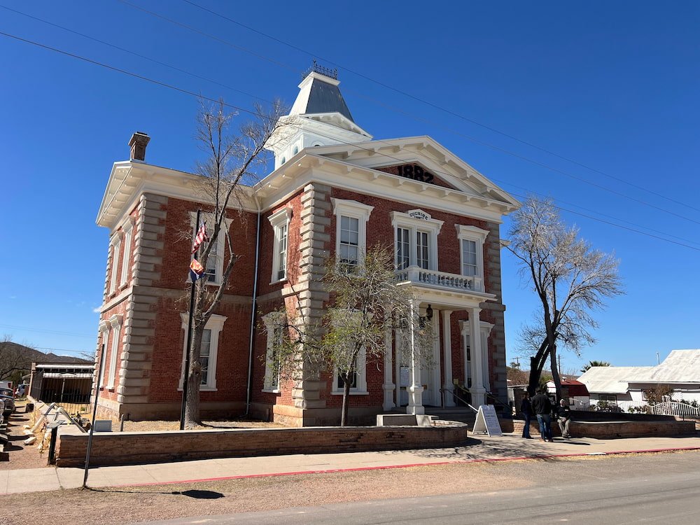
Tombstone courthouse
Gunfight at OK Corral
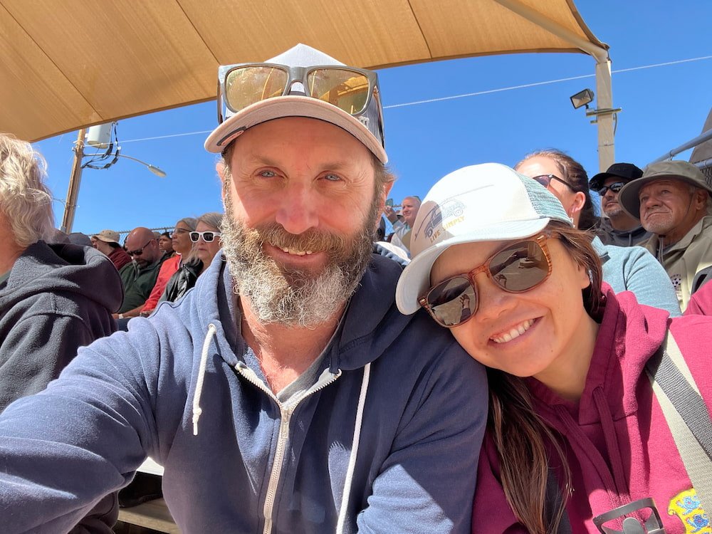
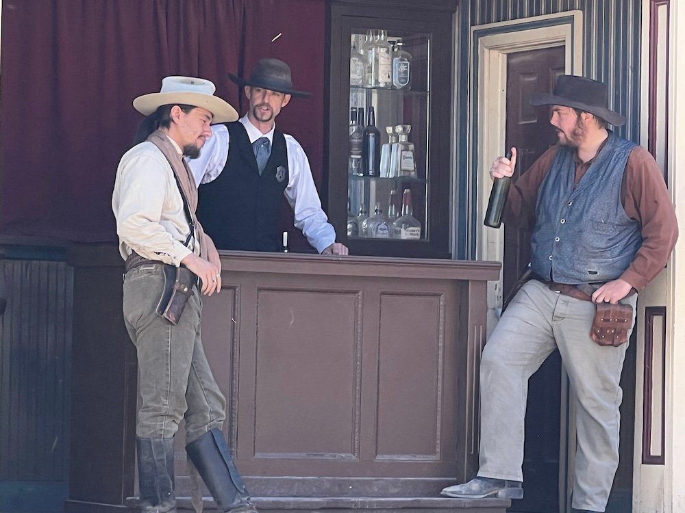
We chose OK Corral to see the gunfight reenactment, which occurred on October 26, 1881 between 8 men, which was an inevitable showdown after months of threats, romantic rivalries, stage robberies, pistol whippings and arrests. Police Chief Virgil Earp, his brothers Wyatt and Morgan Earp, and friend Doc Holliday had a showdown against several cowboys, with apparently nearly 30 shots in 30 seconds. Once the gun smoke cleared, Virgil and Morgan Earp were badly wounded, Doc Holliday suffered a superficial hip wound, and only Wyatt Earp walked away completely unscathed. The cowboys–Billy Clanton, Frank McLaury and Tom McLaury–all died, except for Ike Clanton who ran away from the fight. The gunfight reenactment is held several times daily, and it’s a bit of family fun–the audience is encouraged to boo whenever the “bad guys” walk in, and cheer loudly when the Earps and Doc Holliday come on stage. Plus the audience can take photos with the actors afterwards in their Wild West outfits.
It was crowded but we got a front row seatThe good guysThe bad guys
A free museum to visit at Tombstone is the Tombstone Epitaph, a monthly publication that covers the history and culture of the Old West. Founded in January 1880, it is the oldest continuously published newspaper in Arizona. It’s interesting to see how the printing press worked back in the day, and some of the headlines about all the outlaws, lawmen, and Wild West happenings. You can even subscribe to the publication and receive the historical editions for free.
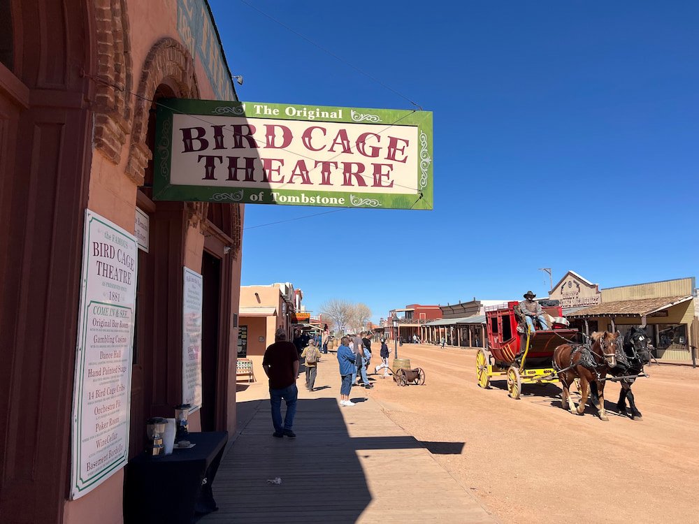
A horse-drawn carriage passes the Birdcage Theater
The Bird Cage Theatre is at the end of the street, and it was not only a theatre but a saloon, a brothel, and a gambling parlor. The walls are riddled with gunshot wounds, and 26 people have died here. There’s tours to see further in the Theatre (which we didn’t do), as well as a ghost tour in the evening (it’s known as one of the top haunted spots in the country). We spoke to one of the people working there and he said that everyone has a story, including him, of haunted encounters–there were too many for him to name, but there have been grizzly murders that make it fodder for plenty of paranormal activities.
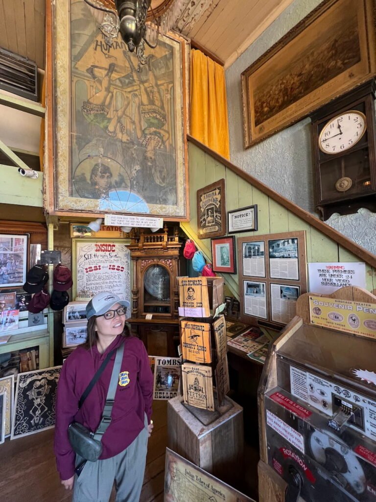
Inside the Birdcage Theater
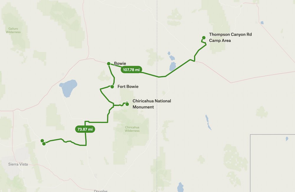
Chiricahua National Monument
Just over an hour away from Tombstone is the Chiricahua National Monument. While we were driving, unfortunately our coffee machine tipped over (again), spilling water and pushing some of our other things onto the ground. This happened because we had to suddenly stop on the road when an emergency services car came blaring past with its sirens on. We recently learned that state laws are different–while in California drivers need to move to the side of the road, in Arizona cars have to stop wherever they are.
It’s probably a given that when traveling in an RV, there will be times when things will fall or even break, no matter if it’s bolted down or not! Our first casualty was a glass butter dish, which fell out when I opened the fridge door when we were on a slope (we now make do with a plastic container).
By the time we got to Chiricahua National Monument, Michael had a throbbing headache, so Sheila and I went on a short, dog-friendly hike together. Chiricahua National Monument is home to stunning rock pinnacles that loom over the road. The Chiricahua Apaches called these pinnacles “standing up rocks”, which originated 27 million years ago when the Turkey Creek Volcano spewed ash over 3,100 square kilometers (1,200 square miles). Besides the hiking trails, there are scenic drives to not only see the rock pinnacles, but also meadows dotted with cactus, mesquite, sycamore, juniper, oak, cypress, pine, and fir trees. Chiricahua was designated an International Dark Sky Park in 2021, so while we didn’t stay here for the night, we can only imagine how epic it would be to see the skies on a perfectly clear evening
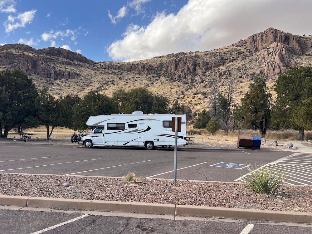
Parked at the overflow parking
The challenge with driving an RV at Chiricahua National Monument is that it’s a maximum of 24 feet to get into the Visitor Center, so oversized vehicles need to park at Faraway Ranch (called this because the daughter of the original owners thought it was so far away from everything), and dogs are not allowed on all but a few trails. Sheila and I walked from the Visitor Center back to the Ranch (as Michael had driven back to try and shake off his headache). On our hike, we saw deer! Well, Sheila didn’t actually spot it, although she was very engrossed in checking out and sniffing their green-tinged poop!
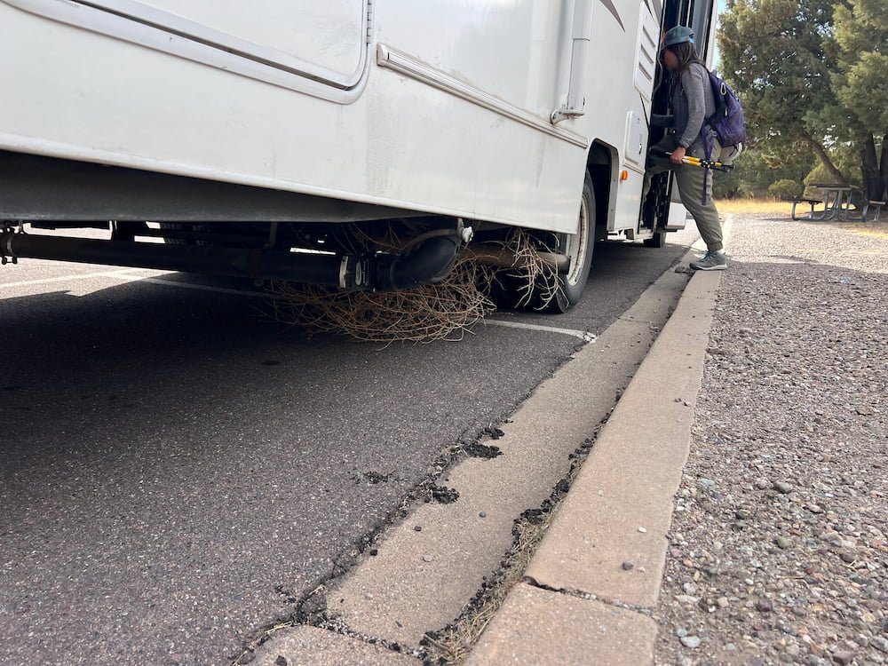
Tumbleweed stuck under the RV
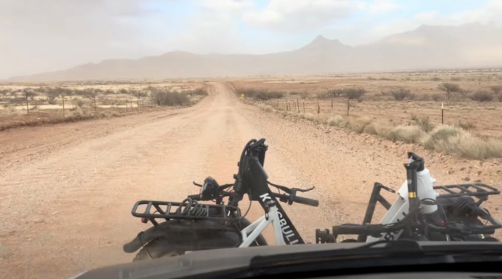
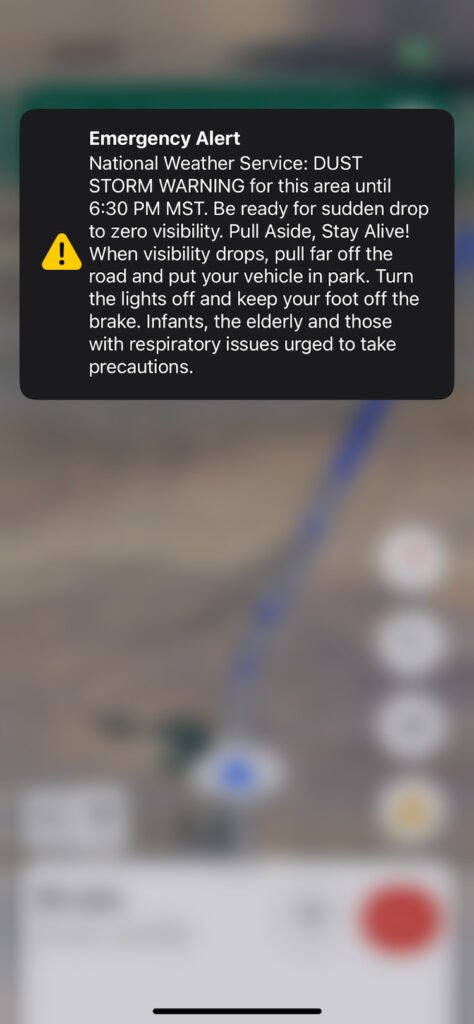
The wind was picking up as Sheila and I hiked, and it was downright icy with gale-force winds by the time we returned. Our plan was to drive on to a small town called Bowie to boondock for the night, which put us on an “unimproved” road that turned out to be the bumpiest road we’d driven on so far–corrugated parts of the road shook our vehicle violently as we drove over them, and we felt every bump as the gravel hit under our RV. The road went on for miles, made even longer as we had no choice but to drive at a snail’s pace of 10-15 miles per hour. Just ahead of (finally) arriving at Bowie, we received an emergency alert on our phones about a dust storm warning, and noticed that there were dust storm warning signs all over the road!
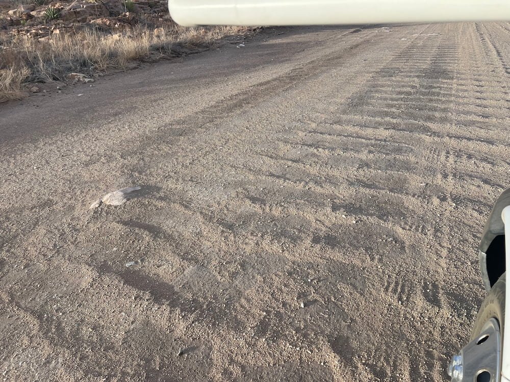
This is the dirt road we got directed toCorrugations in the road
Dust storm alert
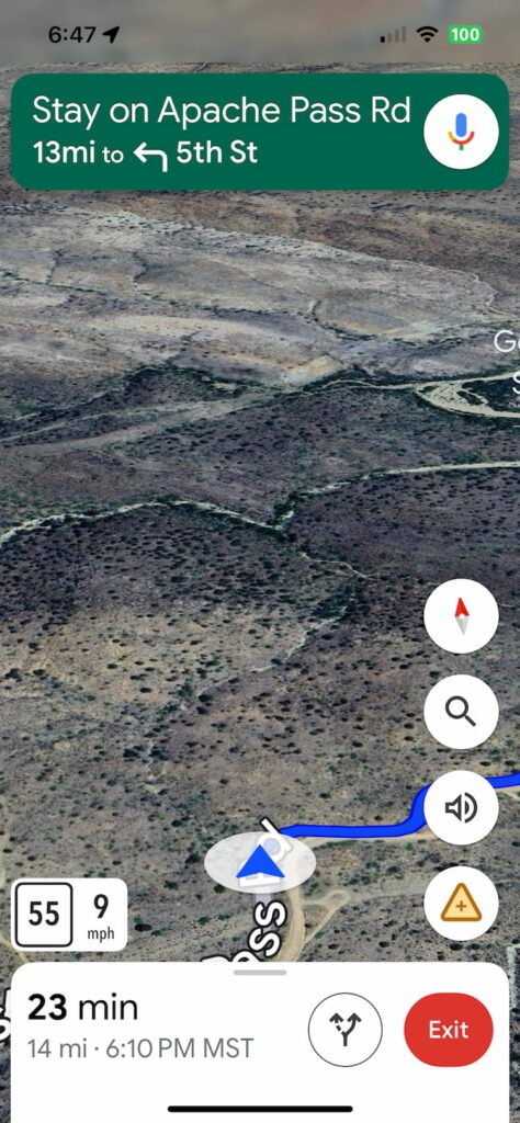
Google maps cannot be trusted at times
Rather than stay in Bowie, we decided to push on toward New Mexico, where our clocks moved forward an hour to local time. We drove through thick dust being kicked up by the wind on the highway, before arriving at a clearing off the highway where we set up for the night. Lisette had a shower in the RV and the carbon monoxide alarm went off (which we later deduced could have been because of all the dust that had blown into our RV to create a false positive). While our parking spot was on a quiet stretch, it was loud, thanks to the strong winds and rain that lashed our RV that night.
Route Map
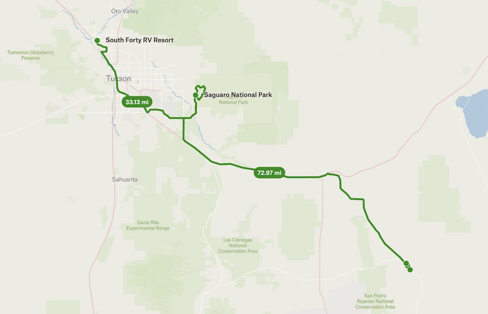
Day 25: Saguaro National Park to Tombstone
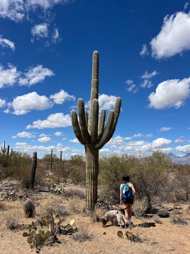
The Saguaro (correct pronunciation: suh-waa-row) cacti are the biggest cacti in the world. They grow slowly at first–an inch or so during the first 6-8 years. At 70 years old they start growing arms. They get to 12 -15 meters (40-50 feet) tall when they’re about 150 years old!
Saguaro National Park is part of the Sonoran Desert and home to these enormous cacti. It was incredible to see so many different “personalities” of cacti–some stood armless as single columns, others had multiple limbs, some were growing stumps, others had limbs drooping toward the ground, and some even looked like they had faces on them!
One of the giant cacti
Since we were here in winter, we didn’t see the cream-colored flowers that appear on the cacti in early summer, which then attract birds, bees, bats and moths to feed on their nectar. In the summer the deep-red fruit ripens, which is then used to make syrup, jelly, ceremonial wine and other delicious foods (our first cactus treat was the prickly pear cactus ice cream in Sedona).
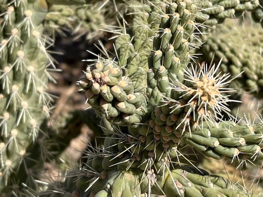
All shapes and sizesExtreme close up
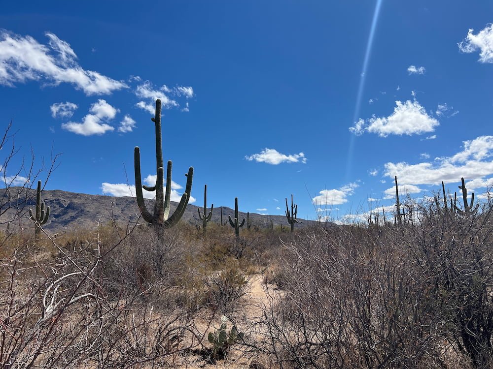
There are multiple trails at Saguaro National Park, and we took the short but cacti-packed Desert Ecology Trail, which is paved and good for leashed dogs to walk across. We had parked our RV in a different area so had cut across Cactus Forest Loop Drive to get there (the Park is a bit tight for RVs to wind through), which however did mean that we got on a trail where we brushed up against spiky plants. Probably a hike to do in pants and long socks.
Even when we left the National Park, we could still see hundreds of Saguaro cacti, lined up along the hills and ridges for miles. It’s such an extraordinary site that we enjoyed.
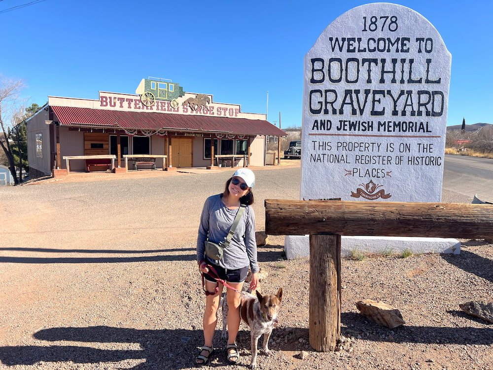
Tombstone
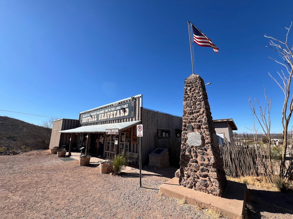
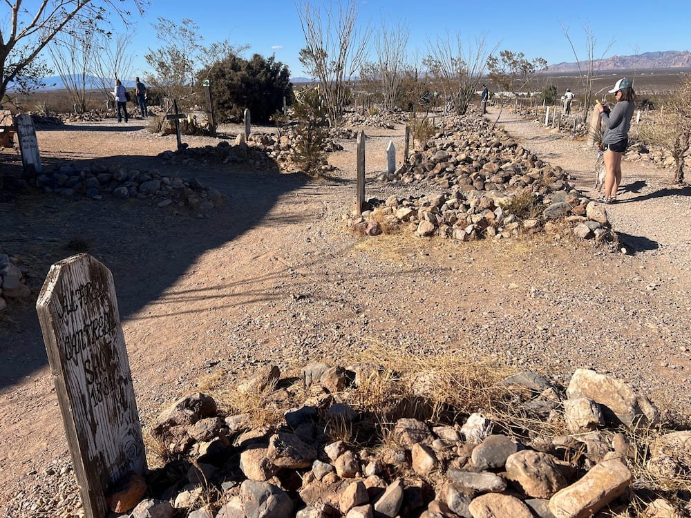
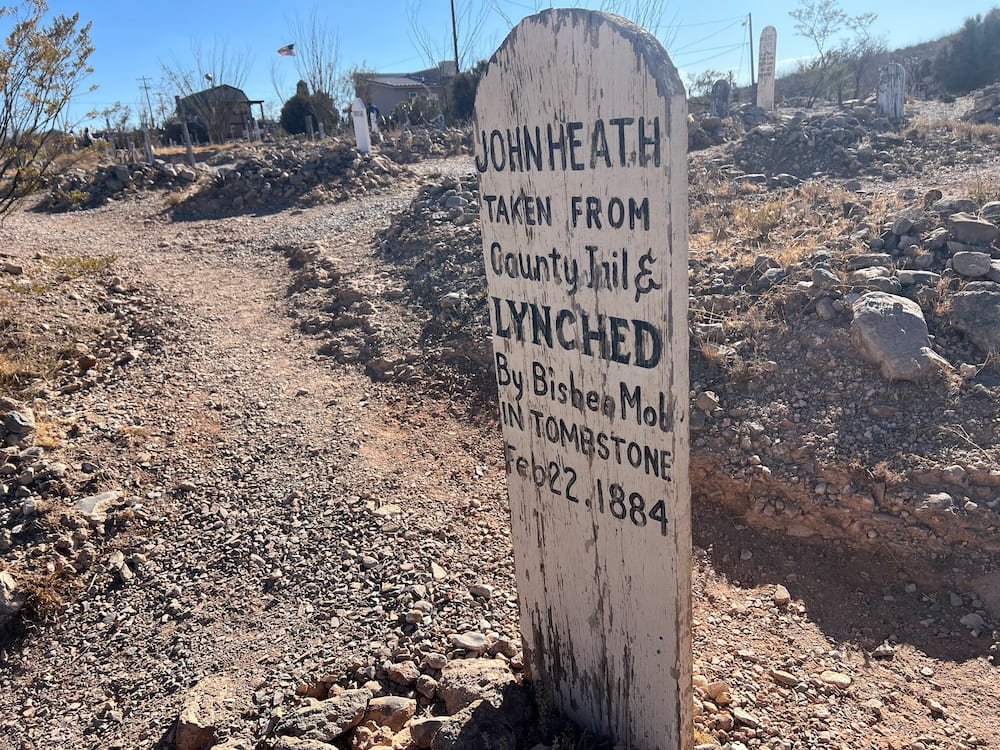
About an hour away from Saguaro National Park is the town of Tombstone, known for its history as a lawless Wild West town (and a 1990s Val Kilmer/Kurt Russell movie of the same name loosely depicting the town in its heyday). On the fringes of the town is the Boothill Graveyard, the final resting place for the town’s first pioneers and was used from 1878 to sometime around 1884. While Tombstone was known as “The Town Too Tough to Die”, there are 256 graves here, with 93 unknown or unmarked. Because of the many violent deaths of the early days, the cemetery became known as Boothill Graveyard, where outlaws are buried next to their victims. Wandering up and down the rows in the graveyard, the reasons for death are often mentioned. There is also a little pamphlet that will list the cause of death if known–including illnesses like diptheria and pneumonia, fatal shootings, beatings, stoned to death by Apaches, murdered, hanged by mistake, poisoning, suicides, injuries caused by falling from horses, and falling from a wagon and being crushed by its wheels. All terrible days to die! Boothill was neglected for many years, but has since had work to preserve the main part of the cemetery as visitors see it today.
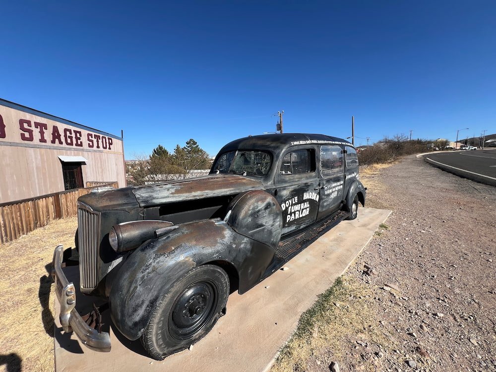
Lisette and Sheila at the entranceCool old car out the frontBoothill Graveyard monumentSome of the gravesPoor old John Heath
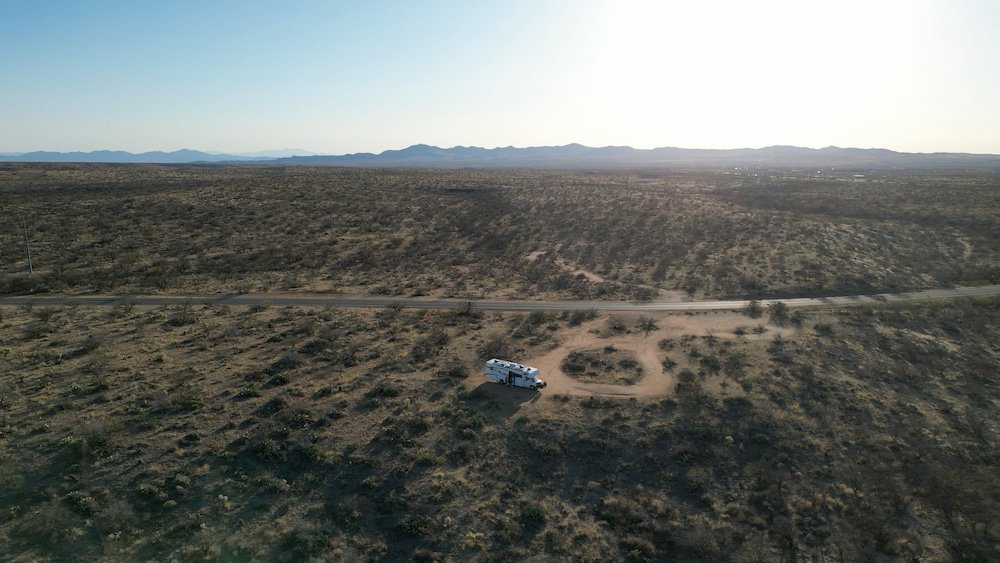
We then attempted to see the Schieffelin Monument, the final resting place of Ed Schieffelin, the founder of Tombstone who kicked off the silver mining boom in the town. Unfortunately the road is deemed too “primitive”--it’s a very bumpy gravel road to get there and a bit out of the way. Our RV immediately struggled and clanged around as soon as we started on the road, so we reversed pretty quickly! That evening, we parked on Middlemarch Road just outside Tombstone for the night, in a fairly quiet but windy spot overlooking the town below.
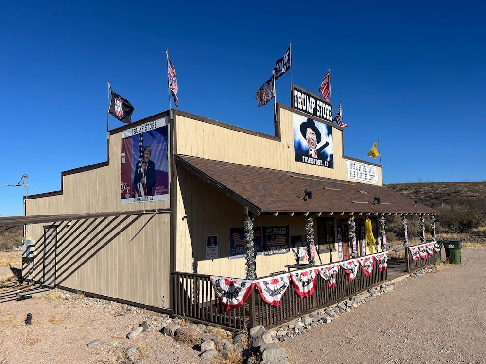
The Trump store in Tombstone
On our way to find a place to park for the night we passed the Trump store and had to take a photo (even though it was closed). We ended up parking on some BLM land not far from town.
Route Map
Day 23-24: Biosphere 2, 3rd Time Unlucky, and Tucson
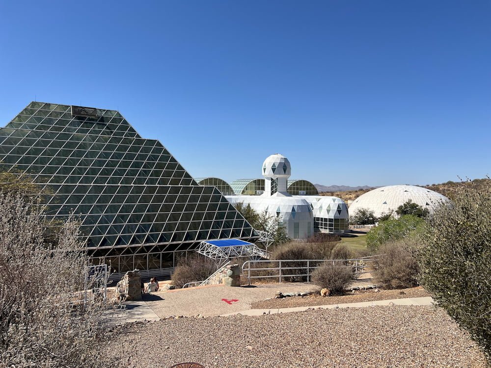
Lisette had never heard about Biosphere 2 before Michael had added it to our itinerary. Here’s the basic background about it today: It’s a large, self-contained ecological research facility in Oracle, Arizona. The facility spans 3.14 acres and has various biomes, including a rainforest, ocean, desert, mangrove wetlands, and agricultural areas. It’s now run by the University of Arizona as a research center for studying climate change, environmental science, and the impact of human activity on ecosystems.
Our campsite near Biosphere 2Biosphere 2
But the history of Biosphere 2 is just as fascinating. It was originally built in the late 1980s to study the interactions between different environments and test the feasibility of space colonization. The first mission, which was between 1991-93 and had 8 people living inside, closed off to the rest of the world. Oxygen levels inside fell dangerously low, forcing researchers to pump in extra oxygen. There was a cockroach and ant infestation. They were meant to be self-sufficient and grow their own food, but the crops didn’t produce enough, which meant that they all quickly lost a lot of weight and were always hungry. Crew members had a psychological breakdown. And after the mission was completed, former Trump advisor, Steve Bannon took offer to manage Biosphere 2, with the second mission that took place that same month sabotaged from the inside by members of the first crew. (The Guardian wrote this fantastic article that’s worth the read)!
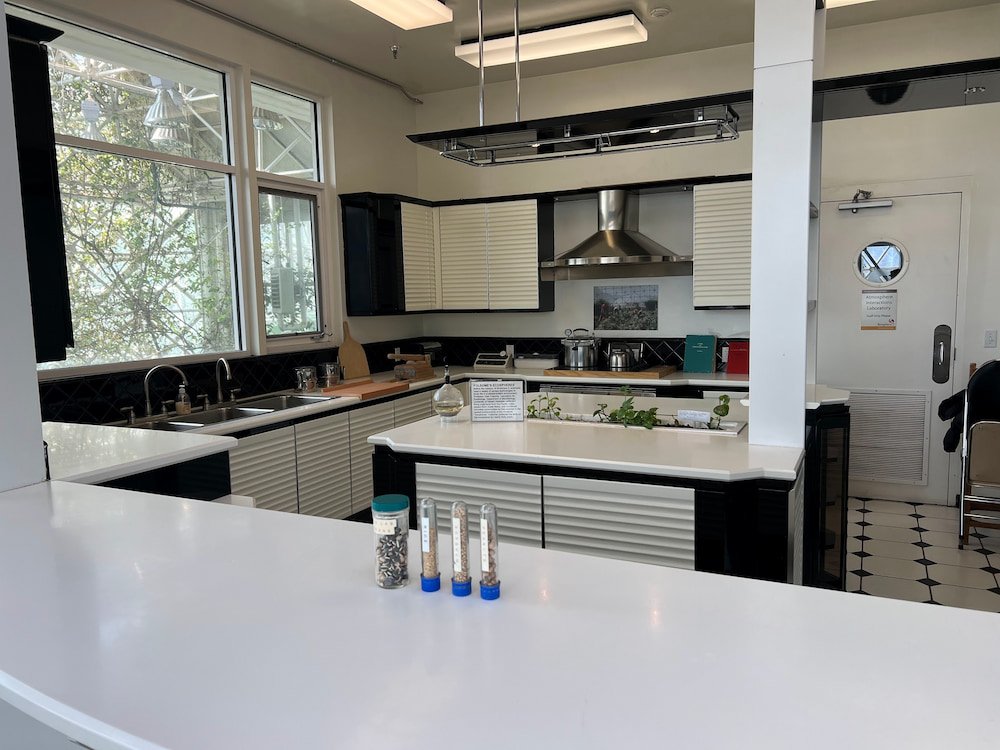
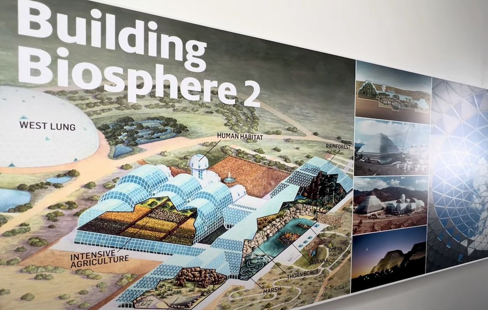
Kitchen inside Biosphere 2Map showing the complex
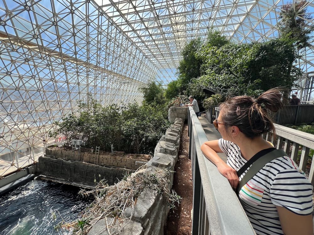
While Biosphere 2 doesn’t delve into its wild history when you visit, you can still see the original kitchen where the crew ate and their rooms. When you visit, there’s an app that you can download to do a self-guided tour (bring headphones) while you’re there, to take in all the different environments you’re seeing. For example, the LEO (The Landscape Evolution Observatory) at Biosphere 2 is the world’s largest Earth sciences experiment, designed to study how landscapes evolve over time. It consists of three identical artificial landscapes, with over 1,800 sensors monitoring water, carbon, and energy cycles for scientists to track changes in soil, topography, and biology as they evolve. By controlling climate conditions within Biosphere 2, researchers can simulate different environmental scenarios and study how climate change impacts water resources and ecosystems in arid regions, and better understand and prepare for the effects of climate change. We had a great time touring the facilities, and were impressed with the changes in climate that we noticeably felt when walking from one room to the next! It’s a stop that’s off the beaten path that’s definitely worth checking out.
Inside the Biosphere
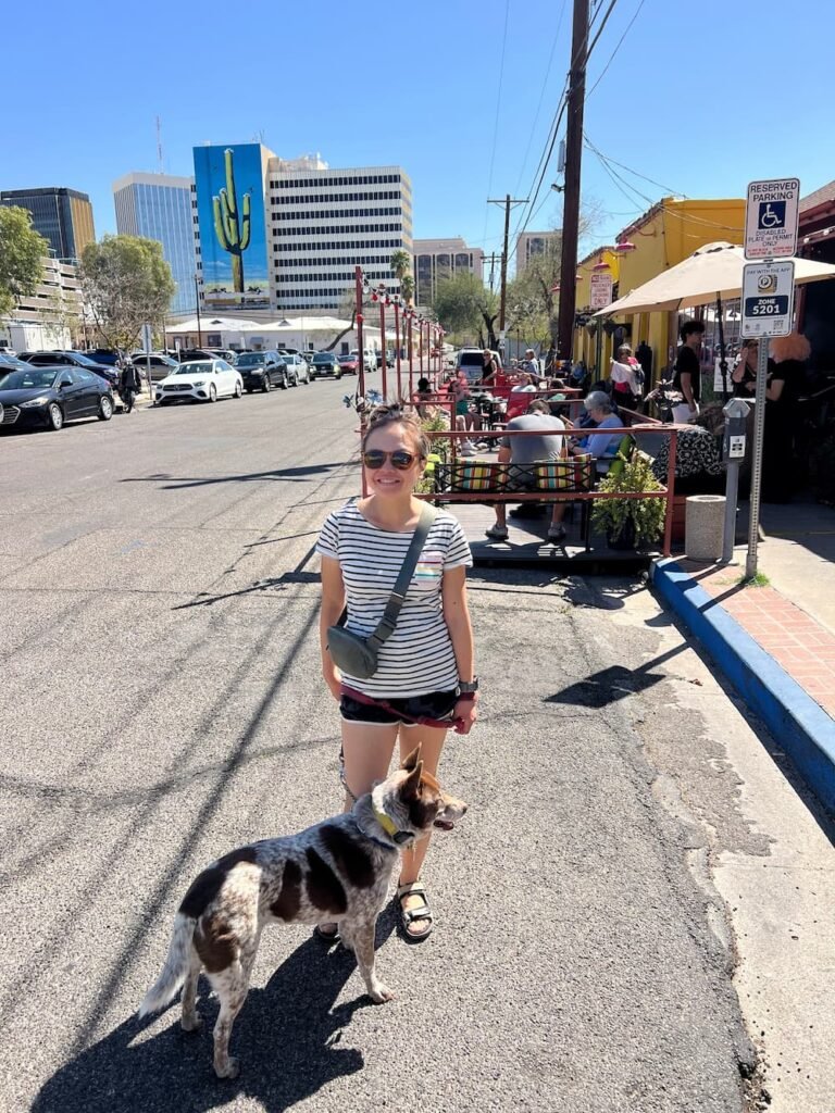
Tastes of Tucson
About 45 minutes’ drive from Biosphere 2 is the picturesque and sunny city of Tucson, which gets about 325 days of sunshine each year. It became the first city in the world to regulate light pollution specifically for space observation, back in the 1970s. UNESCO also named it as the first US Creative City of Gastronomy (the other US city with this designation is San Antonio in Texas), thanks to its deep agricultural roots going back more than 5,000 years. Today, you can still try many dishes that make use of the fruits of the prickly pear and giant saguaro cactus, mixed with dishes making use of corn that arrived from Mexico over 4,000 years ago, and international cuisine from the many immigrants that call Tucson home. After Mexico achieved independence from Spain in 1821, what is now Southern Arizona was part of Sonora, and its food culture shared the distinctive features of Sonoran-style food of northwestern Mexico. These include the use of flour tortillas, an emphasis on beef cooked over mesquite wood fires, and a blending of native and Mediterranean ingredients.
Enjoying the warm weather
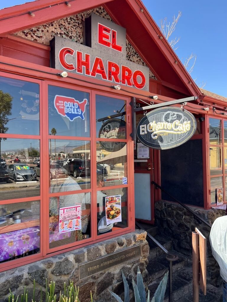
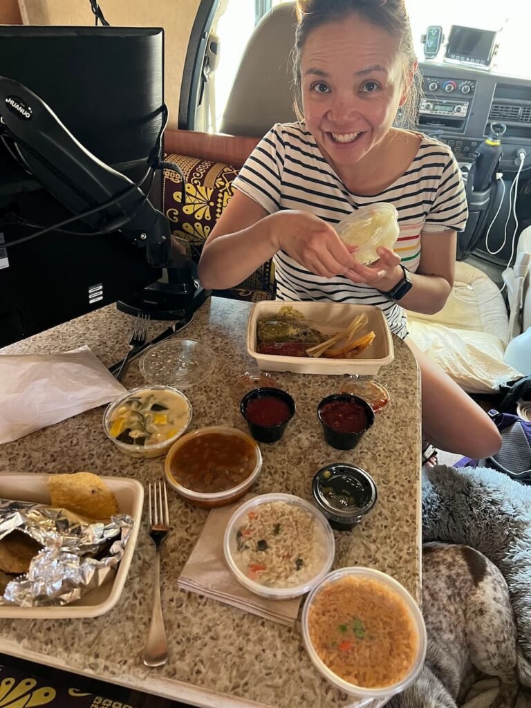
One of the most popular restaurants in Tucson is El Charro Cafe, the oldest Mexican restaurant in Tucson. Apparently it is the birthplace of Chimichanga (a deep fried burrito), which was invented by the owner when she accidentally dropped a burro into the frying pan. The menu is extensive and there are many vegetarian, plant-based and gluten-free options, with dishes including ensaladas, sopas, enchiladas, tamales, burros, tacos, chile rellenos, fajitas, margaritas, and more! Lisette was thrilled to have plant-based options on the menu and we We ordered the Hola Hemp plant-based tamales (hemp seed, organic corn, flax, nopales and quinoa, featuring arroz blanco, green tomatillo sauce and frijoles charros), and some carne seca (in Spanish “dry meat”, a popular way of drying beef in the Southwest) enchiladas to go. The portions were generous and everything we ate was absolutely scrumptious! Highly recommend it!
El Charro Cafe
El Charro meals inside the RV
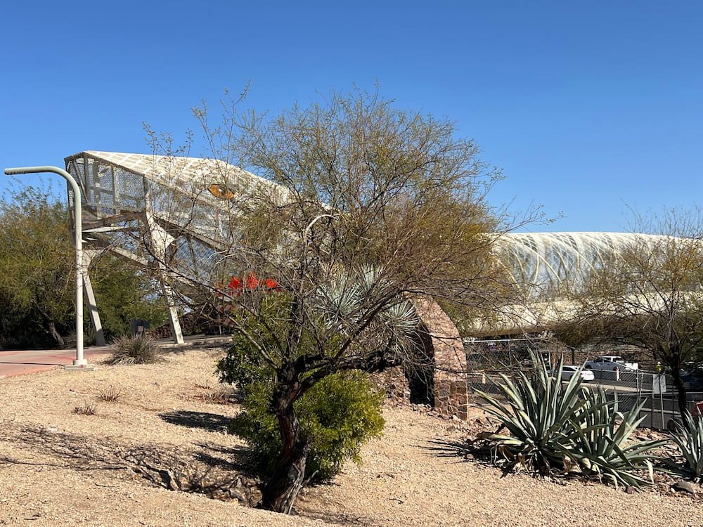
We then took our full bellies to check out the Rattlesnake Bridge, a bicycle and pedestrian bridge just east of downtown Tucson. Unfortunately the bridge was closed so we couldn’t walk across it, and it was eerily quiet when we went, despite it being the afternoon.
The rattlesnake bridge entranceInside the bridge
The US Could Have Used the Metric System
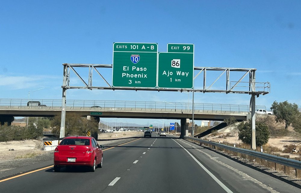
As we drove south toward our campsite for the night (yes, another Desert Diamond Casino, we stayed at one while we were in Phoenix), we noticed that on the stretch of highway the signs were in kilometers, not miles! It turns out that Interstate 19, which runs from Tucson to Nogales, is the only highway in the country to be fully marked by kilometers, was part of a failed attempt to convert the US to the metric system. In 1975, the US Congress passed the Metric Conversion Act to make the metric system the preferred method of measurement, but it was dismantled 7 years later. Too bad, because even after living in the US for so long, we still prefer metric (especially for temperature)!
Metric system on some of the signs
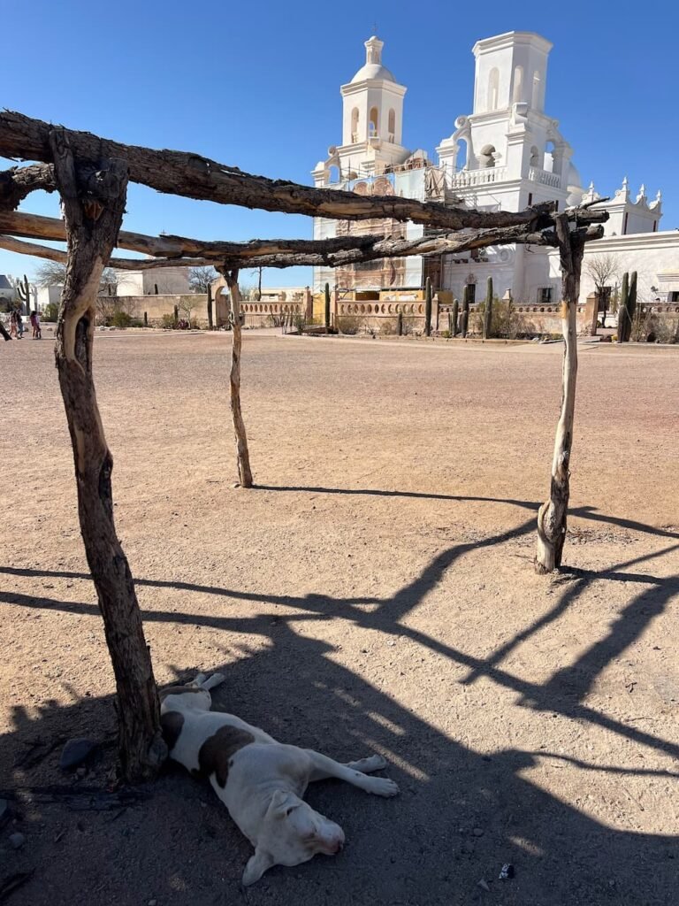
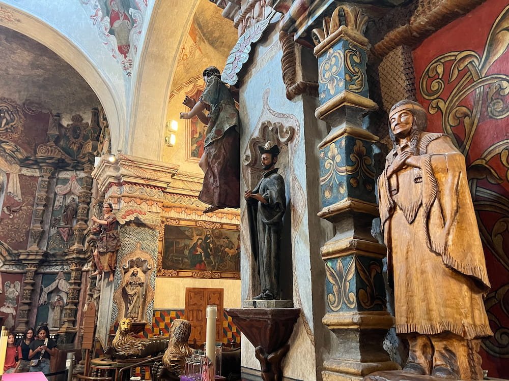
San Xavier Del Bac Mission
A dog sleeps out front of the San Xavier Del Bac Mission
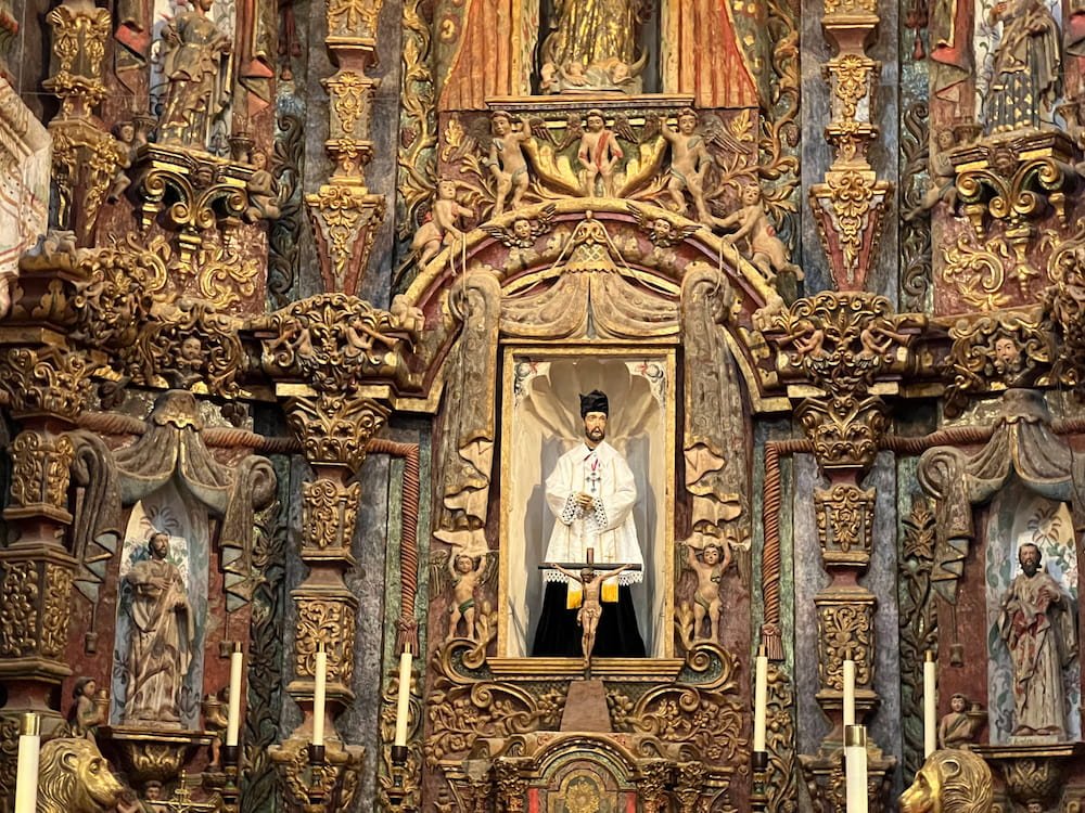
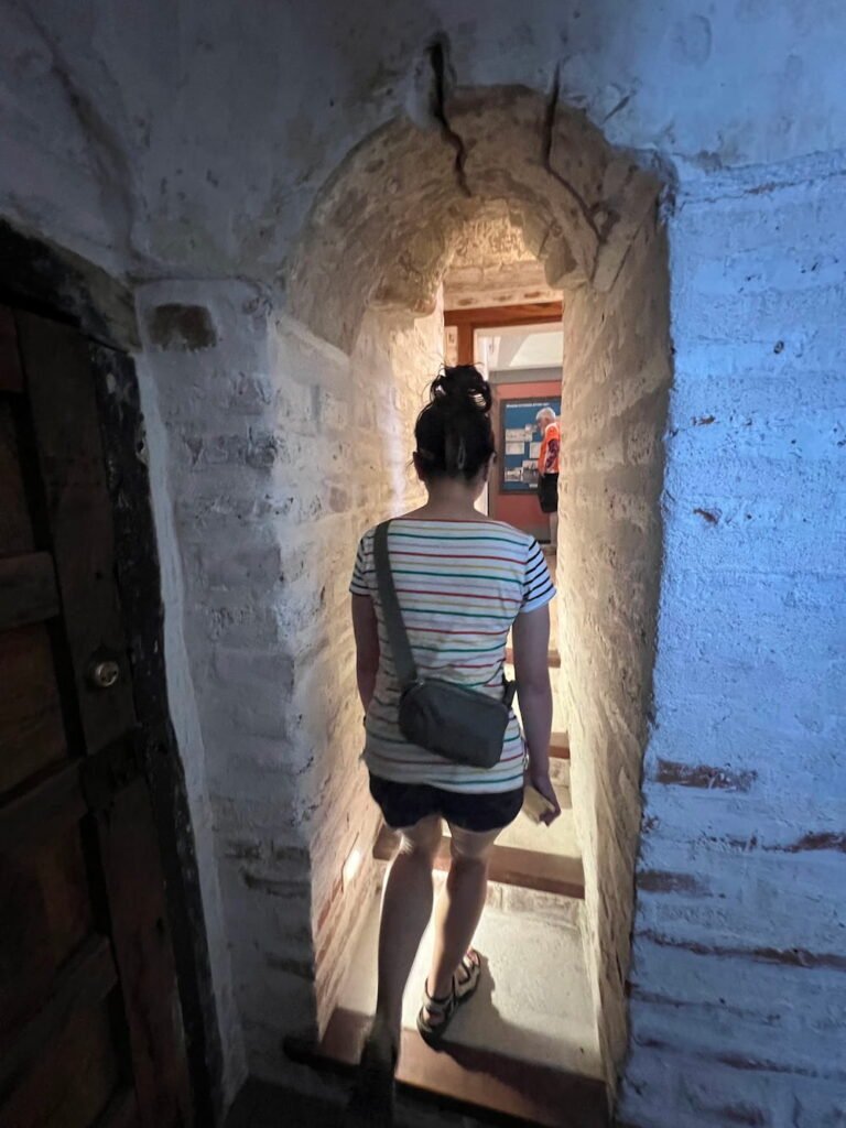
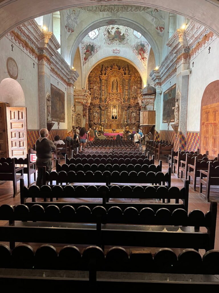
Our final stop for the day was San Xavier Del Bac Mission, a pristinely white Catholic church that was continuing to get renovations when we went. Known as the “White Dove of the Desert”, it was completed in 1797 when Southern Arizona was part of New Spain. Today, this National Historic Landmark on Tohono O’odham Tribal Lands is regarded as one of the finest examples of Spanish Colonial architecture in the US. Near the church there is a hill that you can walk up to with a grotto and a cross at the top. While we didn’t go all the way to the top, we did wander up and had a close encounter with a roadrunner!
Interesting to see a native american figure insideThe altar
Narrow passages
The ornate mission chapel
Bread and Hot Dogs
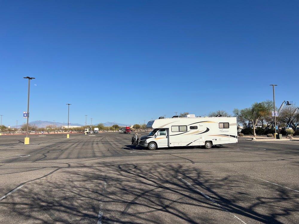
Parked in another casino parking lot
The next morning we continued to embrace the Tucson food scene, heading over to Barrio Bread, an Arizonan bakery (they have a branch in Tucson and Gilbert), which specializes in using traditional Sonoran grains and ingredients. They focus on sourdough loaves, and depending on what day of the week you go, they’ll use different grains in their other loaves for the day. We bought a regular sourdough and one with Khorasan, an ancient grain. Both were delicious–the crust is nice and crispy on the outside, while the bread inside is soft and fresh.
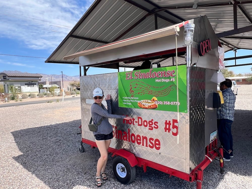
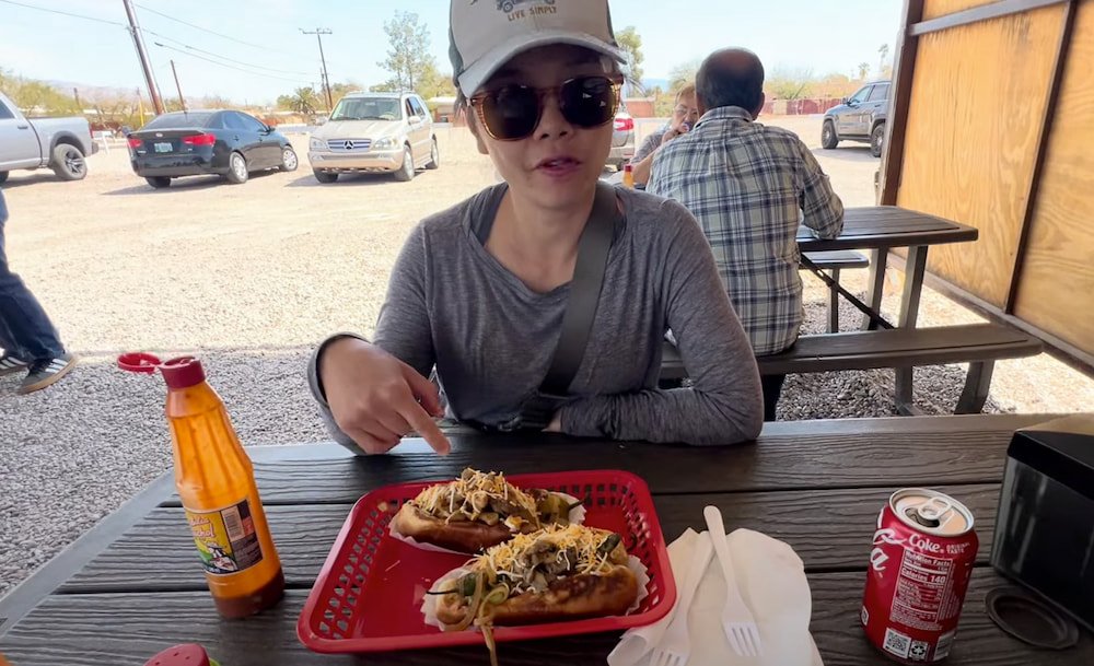
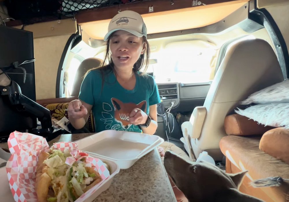
El Sinaloense Hot Dog StandThe hot dogs were excellent
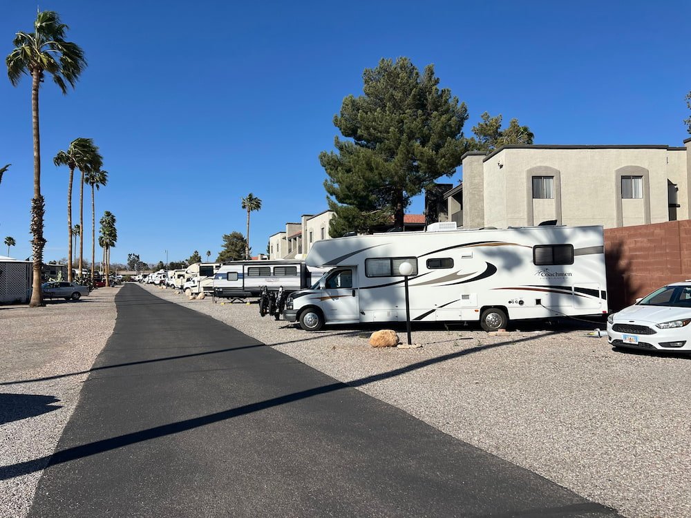
Our early lunch stop was at El Sinaloense hot dog cart, a tiny cart stationed on the side of a busy road, which is also set up with a few tables because it is extremely busy and popular! The cart is run by a man originally from Sinaloa in Mexico (hence the name), and the cart can only fit him and one other worker. A Sonoran hot dog from the area is known for being wrapped in bacon, as well as tomatoes, onions, beans, hot peppers, hot sauce and crema. You can also add more toppings, such as mushrooms, cheese, more hot sauce, etc. Lisette also was able to eat a vegetarian hot dog, and both were filling and delicious! Thanks to our leaky toilet issue, we made our way to South Forty RV Resort, where we met the mobile RV mechanic who fixed the issue. Turns out the toilet was a bit loose, hence the leakiness. We also got a few other things fixed–including getting a better water pump (the one we had was excruciatingly noisy whenever we turned the water on), and getting the leaky front section of our RV sealed. It took several hours to fix, and it certainly was a lot of work, but necessary and hopefully the issue has now been fully resolved. At the very least, it was also nice to simply chill, do laundry and other errands, and get some rest.
Our spot at the RV park
Route Map
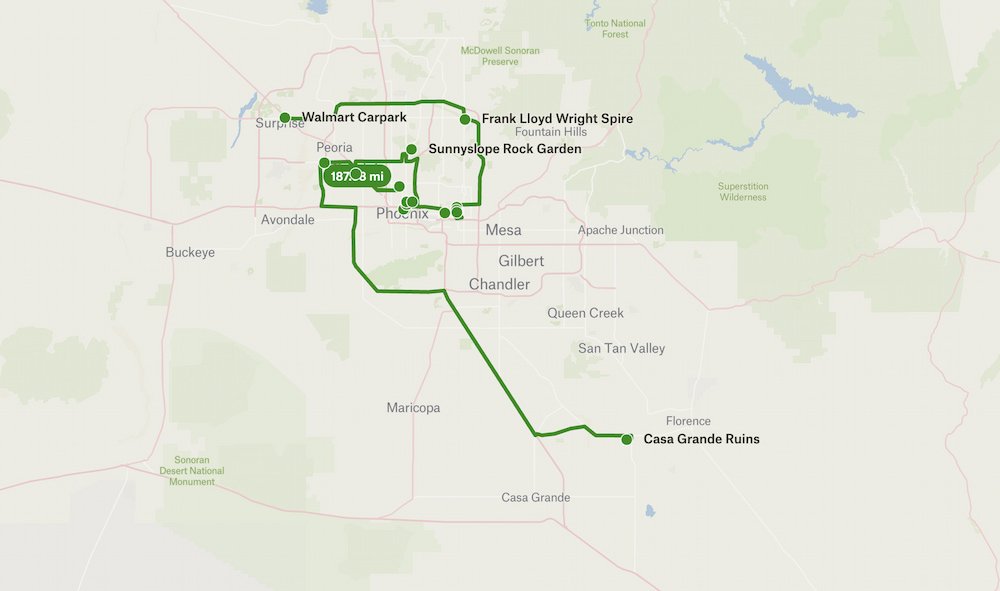
Days 21-22: Phoenix Fun
Next up: Phoenix! Lisette had been once before, but it was for a work trip for a mere day. As the capital of Arizona and apparently the fifth-most populous city in the US, we were looking forward to seeing what the city had to offer. Right next to Phoenix is the city of Scottsdale, known for its upscale spa resorts, golf courses, art and architecture.
Frank Lloyd Wright in Scottsdale
While we weren’t looking to book any spa treatments, we did learn that famous American architect and designer Frank Lloyd Wright spent a lot of time in Scottsdale. He and his last wife visited the city each year, with Taliesin West becoming his winter home and studio from 1937 until his death in 1959. Today, it’s Scottsdale’s only National Historic Landmark, with self-guided audio tours. We were interested in checking it out, but the tickets were a bit more than we wanted to spend for the day ($44), and we already had a packed schedule.
Instead, our next best option was to see Frank Lloyd Wright’s turquoise spire, a 125-foot tower that was part of a proposed design for Arizona’s new State Capitol. At the time, the design was rejected for being too modern, but it was resurrected years later. Today, the turquoise and copper tones of the tower (representative of the Arizona landscape) sits on the corner of Frank Lloyd Wright Boulevard and Scottsdale Road, making it a prominent attraction–but unfortunately in a location where we could only do a drive-by view of it as we continued driving on.
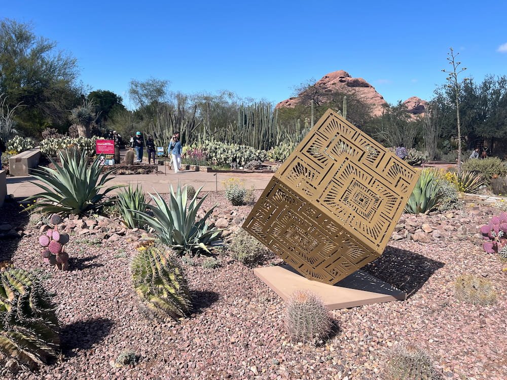
The Desert Botanical Garden
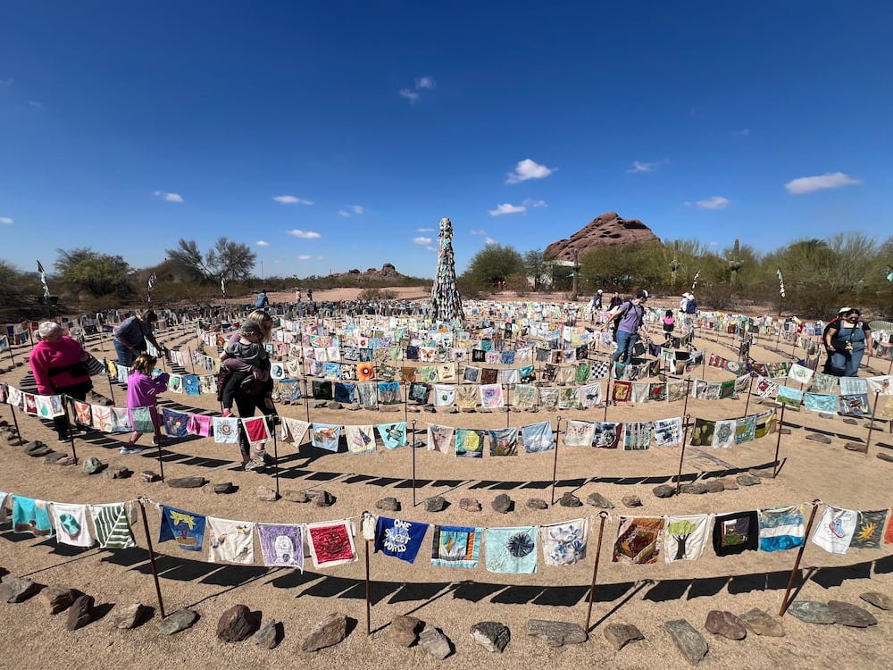
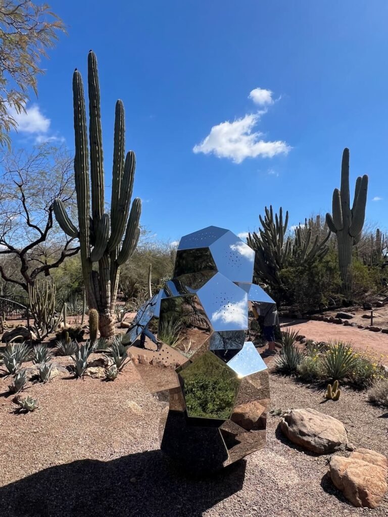
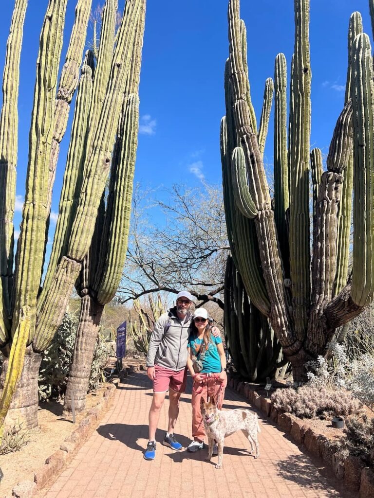
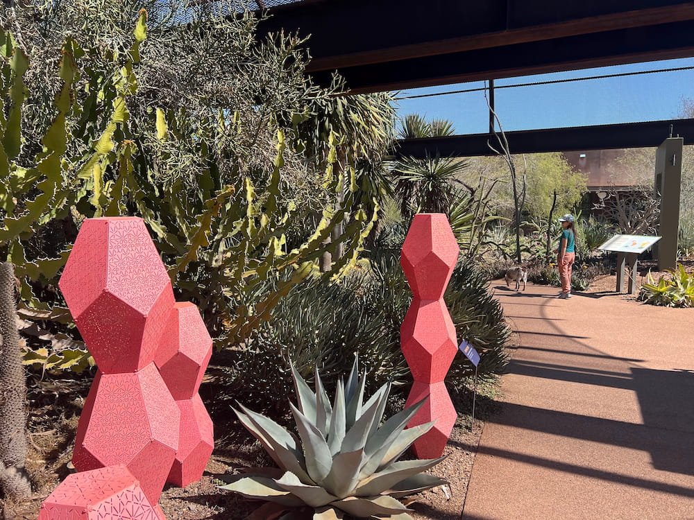
We love quirky and unique designs–whether that’s for art, architecture or natural wonders–so we enjoyed spending time at the Desert Botanical Garden in Phoenix. On select Saturday mornings, the Garden hosts “Dog Days at the Garden” so that leashed dogs can also explore the trails, and it just so happened that the Saturday we were there it was one of these mornings. Dogs need to enter by 11am, and we made it with about 15 minutes to spare.
Art at the botanical gardensToward 2050 with thousands of flags
Cool mirror art
Look at the size of those cacti
More art in the gardens
There are a lot of different paved, looped trails at the Desert Botanical Garden, including a Sonoran Desert Nature Trail, Plants & People of the Sonoran Desert Trail, and Desert Discovery Trail, and much more. The only section that was off-limits for dogs was the butterfly exhibit. All of the trails are short and easy–they’re no longer than half a kilometer (one-third of a mile) each. We loved looking at and learning about the astonishing variety of cacti (including barrel, octopus and even “old man” varieties), agave plants, yucca, aloe, and much more. The Saguaro cacti, which are mostly found in the Sonoran Desert that spans parts of Arizona, California and northwestern Mexico, are fascinating as their “ribs” can contract and expand to help them survive the harsh desert climate. Its flowers are also the state plant of Arizona. We also learned that other cacti have spikes to help act as shade and absorb water better–fun facts!
Besides seeing the myriad of plants, there were also hummingbirds and other birds taking advantage of the garden, a section focused on a bountiful garden of herbs and plants that can grow in the dry climate, and a section that provided information on how Native Americans lived off the land. Even if you’re not a green thumb (which Lisette definitely is not), we thought it was a fun place to visit for a couple of hours or so. It was also absolutely wonderful to bask in the warmth of the Phoenix sun wearing t-shirts–what a radical difference from the day before, when we were bundled up in beanies, gloves and our warmest winter clothing!
Parked and ready to wanderDesert oasis
Other Quirky Phoenix Highlights on Day One
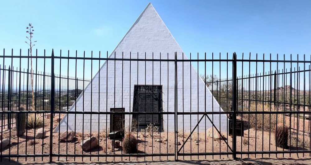
Given our appreciation for the unique and unusual, we like checking Atlas Obscura for a few suggestions on places to visit when we’re in a town or city. For us, this meant checking out the nearby tomb of the first Arizona governor, George W. P. Hunt, who was nicknamed “The Walrus” thanks to his wide girth and impressive moustache. A freemason, he is buried in a white pyramid alongside his family at the top of a hill with a lovely view overlooking the city.
Governor Hunt's tomb
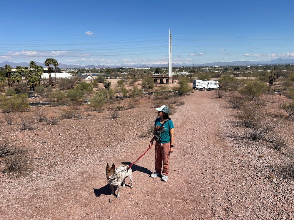
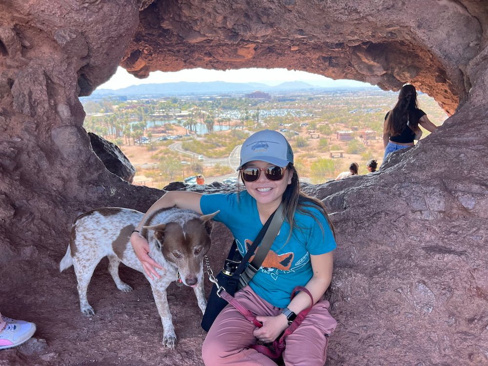
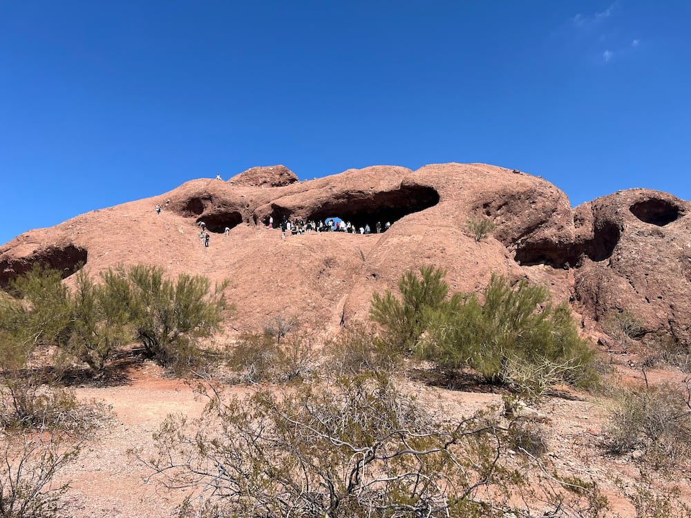
A short walking distance from the tomb is another curious attraction, called Hole-in-the-Rock–which is quite literally that. It’s an easy hike to get up, and visitors are then greeted by a big gap in the rock where there’s a nice breeze, and where people can clamber through and see a view of the city in the distance. There’s not much more to this rock (sure, you can walk up and around it), and it was busy with people ogling to capture their windswept moments with the hole in the rock behind them.
At hole in the rockHole in the rock
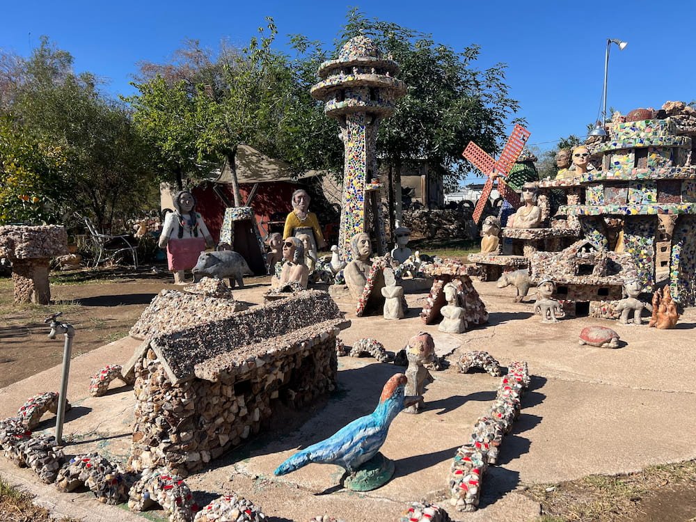
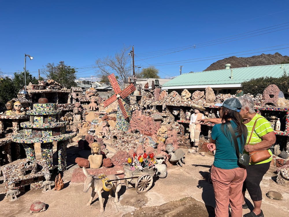
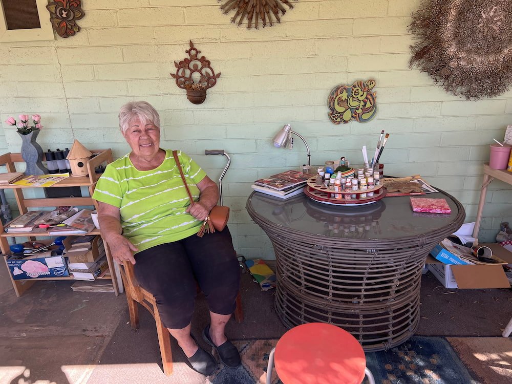
Atlas Obscura seems to be a big fan of odd structures constructed over years by one person, and we were intrigued by the description of the Sunnyslope Rock Garden, which was built by one man who collected bits of dirt, sands, broken crockery, scrap metal, and other materials from about 1951 until his death in 1977. We’d read in some reviews that the rock garden can only be viewed from the fence outside, but as we pulled up, Marion, who owns the property and lives onsite, was going out and she gladly welcomed us in to give us a private tour.
Sunnyslope rock gardenMarion was quite the story tellerMarion's chairMarion
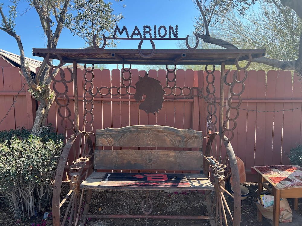
Marion grew up in New York but visited her parents decades ago in Arizona, and she saw the Rock Garden during one trip and immediately fell in love with it. Here, we saw mini windmills adorned with mosaics, and figures of birds, people, dogs, and many others. Marion is also an artist and will do some touch ups to the sculptures, and she’s even made her own mark on the property, with a seat between a couple of carriage wheels and a silhouette of a horse, in front of which bears her name. While the house is in a residential area a bit out of the way from everything else (and it didn’t seem to be in the nicest neighborhood), it was well worth the visit and special tour for us.
First Christian Church by Frank Lloyd Wright
While we didn’t tour Taliesin West, we did stop by another Frank Lloyd Wright creation–the First Christian Church, which has a spire that rises 23.4 meters (77 feet), supported by triangular pillars. The church was closed, but we could make out stained glass inside that sparkled in the light.
For lunch, we went to the Fry Bread House, a James Beard award-winning restaurant established by Cecelia Miller, a Tohono O’odham woman and native of Arizona, that’s run by her family to this day. Fry bread (also known as Indian fry bread), is a dish by the indigenous people that’s a type of flatbread that’s fried and leavened. It’s the size of a pizza but soft and pillowy in texture, and can be eaten on its own, or topped with savory or sweet fillings. We ordered the vegetarian fried bread taco, which had refried beans, green chili strips, onions, lettuce, sour cream, and cheese atop the fry bread instead of a taco. Of course the portion was huge, so while Michael and I thought it was delicious and enjoyed trying the fry bread, we were relieved to share it (although everyone else at the restaurant seemed to be ordering their own)!
Lisette about to dig into the fry bread
We’d been planning to go to a Thai restaurant for dinner, but we were stuffed from the fry bread, and when we arrived at the Walmart we’d planned to park at for the night, we quickly changed our minds as it seemed to be rather sketchy. Our plan B was going across town to the Desert Diamond Casino in Glendale. We both checked out the casino and when Lisette came back to the RV first, she noticed that there seemed to be a leak at the base of the toilet bowl, and yes, it was leaking pee onto the floor inside. While confused and slightly perturbed, she cleaned it up and hoped that it wasn’t anything to worry about.
Day Two: Downtown, David Bowie and Driverless Cars
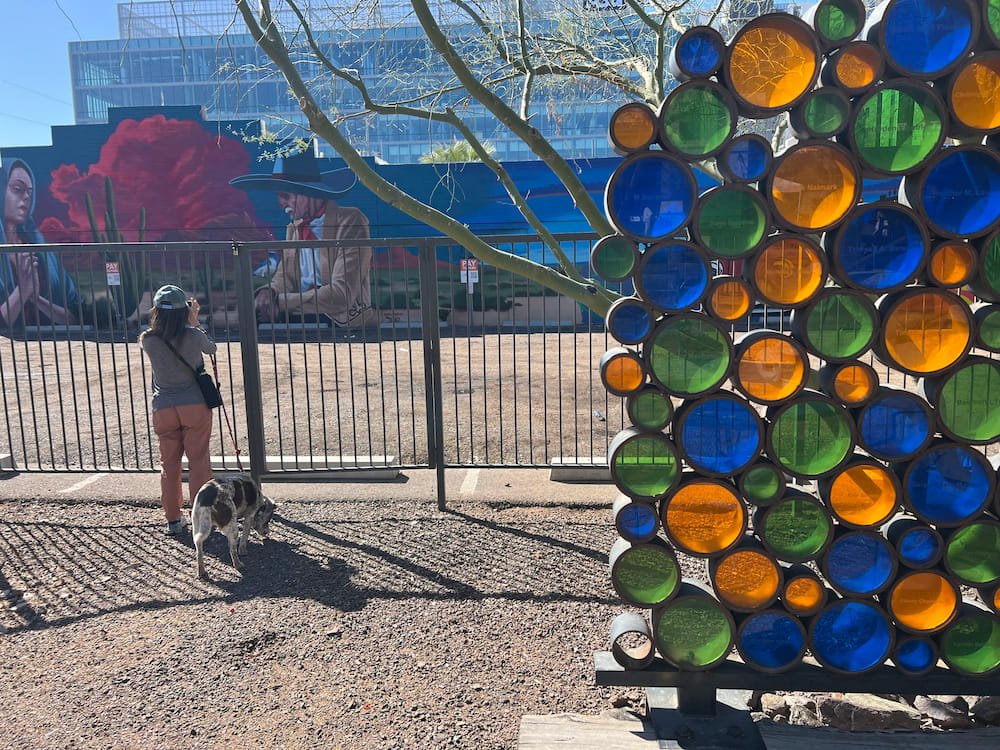
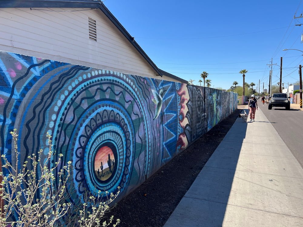
The next morning, we drove back to Phoenix to check out the murals downtown, mostly focused on Roosevelt Row. Parking in a city can always be a challenge–but it’s even harder in an RV. On the first Fridays of each month, there’s an art walk where the streets come alive at night, with street vendors, live music, and of course the opportunity to further appreciate the art further with food and drink in hand.
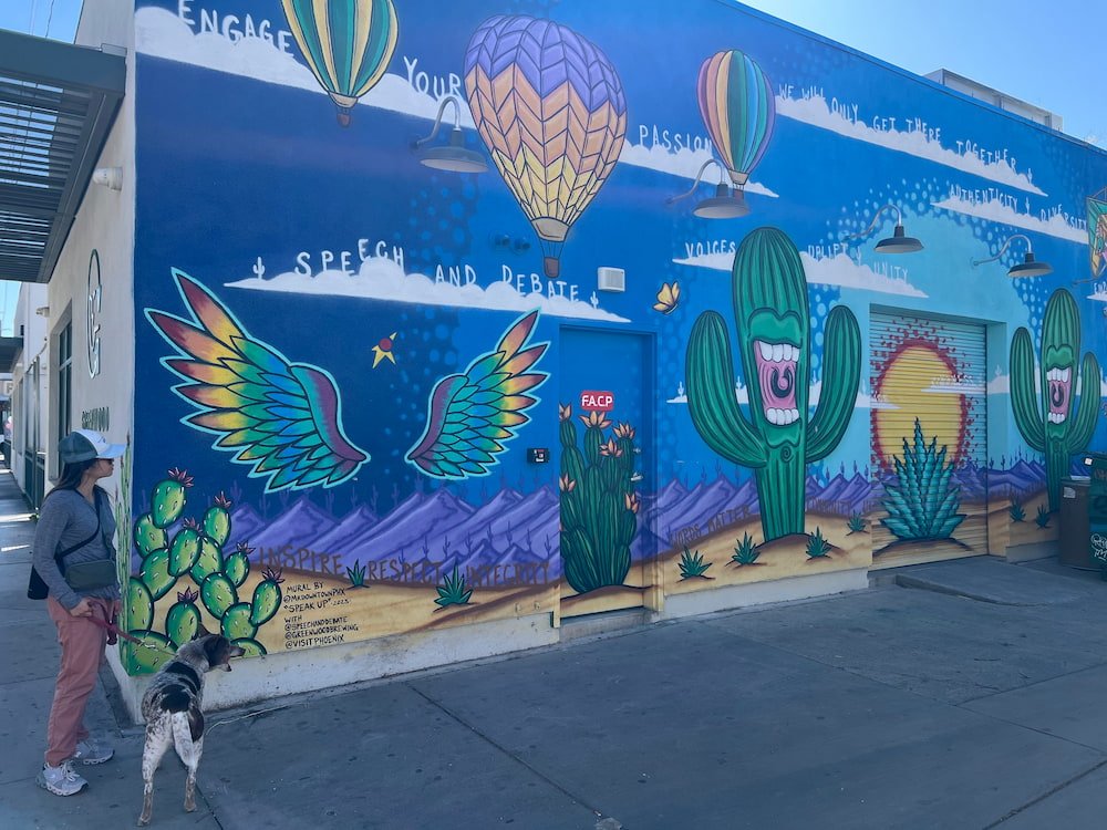
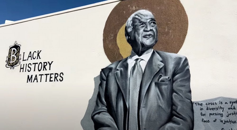
So many murals and art piecesThere's always wingsAngry birdEven the buildings were pieces of artBlack history mural
This sign cracked us up
While it was probably much quieter when we were there, we loved looking at the murals in the light of day, including images paying homage to Black History, Native American culture, and others making their own statements. We also had coffees at Futuro, a specialty coffee shop that also serves tea and pastries, and is part of a collective that includes a hair salon, a restaurant and an art gallery. The coffee on their menu–such as lechera (with sweetened condensed milk and piloncillo, basically a Mexican brown sugar), transported us back to our last trip to Mexico, and made us think about how we’d love to return!
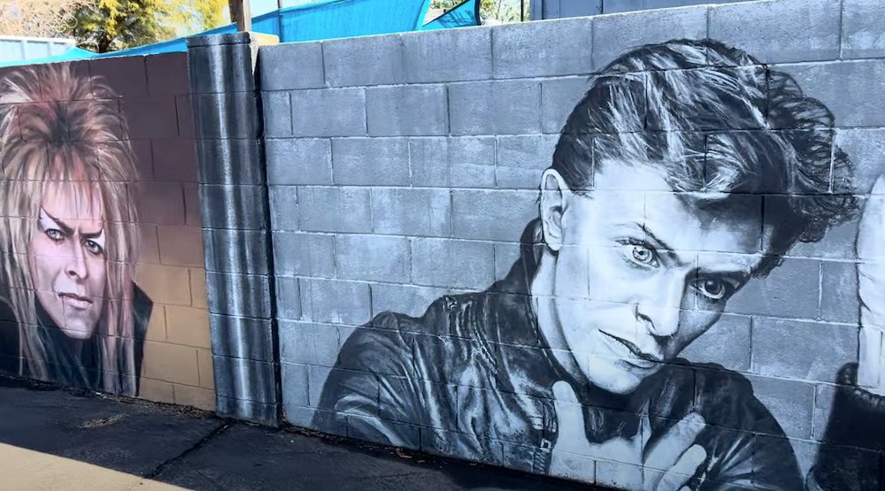
Our coffee that took forever to makePart of the David Bowie mural
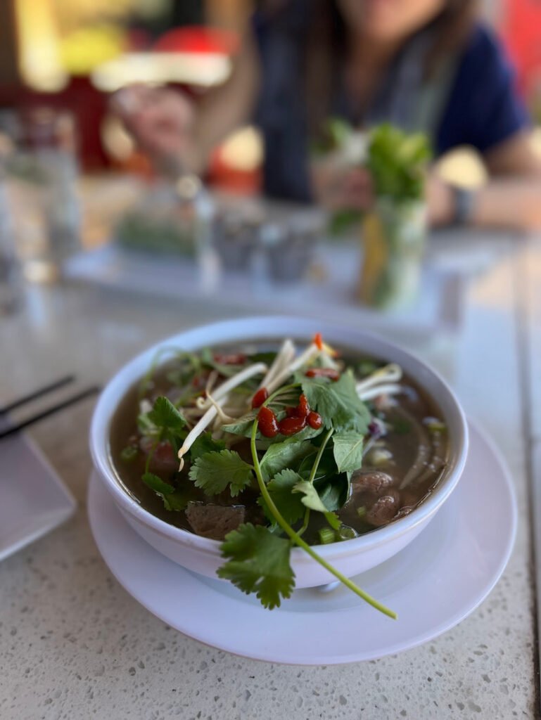
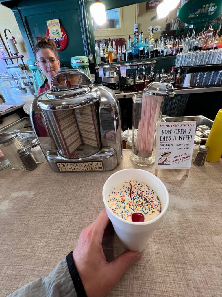
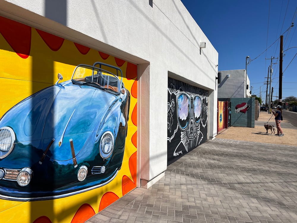
Coffees in hand, we left downtown to check out multiple murals of David Bowie in an alley showing his different alter egos, before heading further north to MacAlpine's Diner & Soda Fountain, one of the few remaining original soda fountains in the United States. It opened back in the 1930s and it’s like stepping back in time. While we had lunch at Rice Paper Vietnamese Restaurant across the road (lots of unique and delicious varieties of rice paper rolls, and pho noodle soup was half price when we went!), Michael got his malt milkshake fix at MacAlpine’s, which was delicious. Besides classical American fare like burgers, ice cream sodas, banana split and other meals, MacAlpine’s is also renowned for its fresh pie slices, so go there hungry!
Michael's pho
Malt shake from McAlpine's
Our final mural fix was the Oak Street Alley Murals, which span a few blocks of captivating murals including Frida Kahlo, birds, sci-fi scenes and many others in the Coronado neighborhood. We were just a bit too early, but there’s an annual festival around mid March each year that brings the community together to meet the artists, and also conduct workshops.
Oak street was wonderfulEven garages were painted
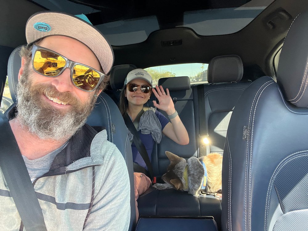
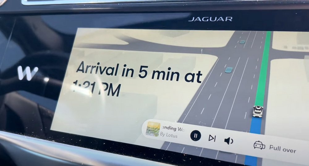
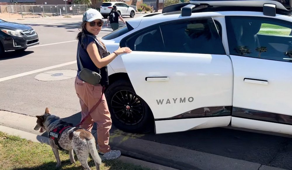
By then, we were far away from our RV, so we ordered a Waymo–a driverless car–to bring us back. Despite living in San Francisco where the autonomous vehicle pilots took place, we’d never ordered one while we were there, but Phoenix is the only other city where this is available. I guess we didn’t try it in SF because we had a car, and if we weren’t getting around in that, it was because it was more convenient to ride public transport. So this was the first time for all of us, including Sheila! It was a very comfortable ride, with the Waymo easily navigating the streets, changing lanes, and showing us where we were on the screen. While driverless cars have been available in San Francisco for a couple of years or so now, it is still surreal to have these available in our lifetime, but we can appreciate the benefit of it in terms of making it easier for everyone to get around, and minimize accidents, road rage and other traffic issues.
In the WaymoGreat updates on the screenOur ride is complete
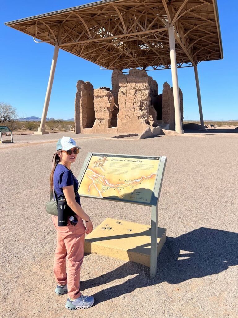
After our adventures wrapped up in Phoenix, that same afternoon,we continued on to Casa Grande Ruins, a national monument not far from the city. The ruins stand out from miles away, as it almost looks like a UFO in the distance, as the ruins are sheltered by a roof structure to protect it from the elements.
The Casa Grande Ruins consists of the ruins of several structures, which were built by the ancestral Sonoran Desert People's farming community around 1350 AD. While there’s extensive evidence of irrigation, its purpose is still a bit of a mystery. There’s also an exhibition at the site, which goes into more detail about this fascinating place.
Casa Grande ruins
As we parked for the evening, we noticed that our toilet was leaking pee inside.. Again… And this time, Lisette mentioned to Michael that she'd noticed this the evening prior. It seemed to only happen when our RV was parked on an incline sloping downward, which could indicate a seal issue at the base of the toilet bowl. Unfortunately since neither of us are experts and we didn’t want to make a toilet issue worse, this meant yet another search and call to find a mobile RV mechanic–our third time within a month on the road. While we’d expected to encounter issues, there’s definitely a lot that we’re uncovering in such a short amount of time. It made us wonder about the condition of the RV and the extent we’d have more issues as we went along…
We parked that night in a fairly isolated area, which was helpful for two reasons. Firstly, Lisette was the first to christen our portable camping toilet (we ordered this one), which we’ve brought along for doing number twos. We agreed ahead of the trip that we’d only use the RV toilet for pee, because we didn’t want to clear out any other matter from our black water tank (it’s gross enough, thanks). The portable camping toilet is if we don’t have access to a public restroom. The verdict? Easy to use, and very useful!
Secondly, being in a spot away from the city and people, we had an incredible sunset to ourselves, as well as a beautiful sunrise with the bright pink, orange and yellow colors accentuating the sky. It’s these moments that we’re grateful to have the opportunity to savor and enjoy!
Route Map
Day 20: Arizona, oh you mean Ari-snow-na!
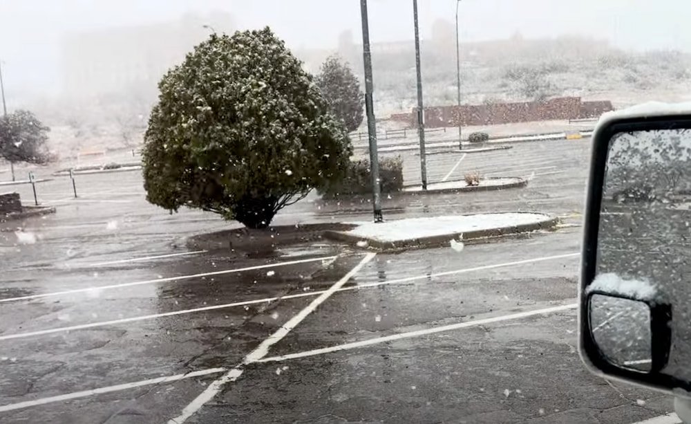
The morning was freezing and raining, but imagine our surprise when the rain started to turn into sleet, and then snow! Our second time seeing snow on this trip, and both times it’s in Arizona–a state where you’re more likely to conjure up images of sunny skies and hot desert temperatures!
More snow to wake up to
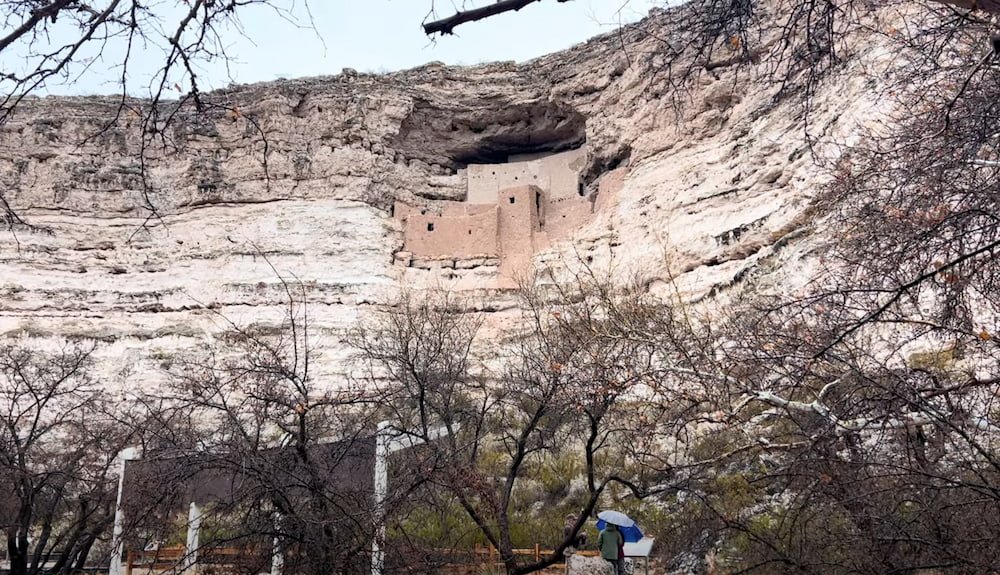
We walked outside briefly with Sheila (a dog’s gotta go do her business, after all). There was a converted school bus that had stayed overnight as well in the parking lot, and it turned out that there was a family traveling in it, including 2 little kids that were having a blast throwing snowballs and playing in the snow as the dad filmed the experience–very cute. Once the snow had subsided somewhat around lunchtime (turning back into rain), we made our way to Montezuma Castle National Monument, one of the first national parks designated in the US by Theodore Roosevelt.
Aztec in Name, But From the the Southern Sinagua People
Montezuma Castle (and nearby Tuzigoot–if you pay for entrance to Montezuma then Tuzigoot is also included), gives visitors a glimpse into the lives of the Southern Sinagua farmers who flourished in the Verde Valley hundreds of years ago. The indigenous people built this five-story, 20-room dwelling sometime between the years 1100 and 1300, which is entrenched into a cliff recess about 30 meters (100 feet) above the valley. Early American settlers marveled at the structure, assuming it was Aztec in origin, hence the name. Even though the dwellings were built using soft limestone, because it was protected from the elements it has lasted for over 700 years to be one of the best preserved prehistoric structures in the Southwest United States. Not far from Montezuma Castle is Castle A, a five-story apartment building with about 45 rooms.
Montezuma Castle
Nobody knows why the Southern Sinagua migrated away from their pueblos by the early 1400s, abandoning the castle that they spent so much effort in constructing. Theories range from overpopulation, resource depletion, disease, conflicts, or something else altogether. Whatever happened, many Southern Sinagua likely migrated northward to pueblo villages, while others may have stayed in the Verde Valley.
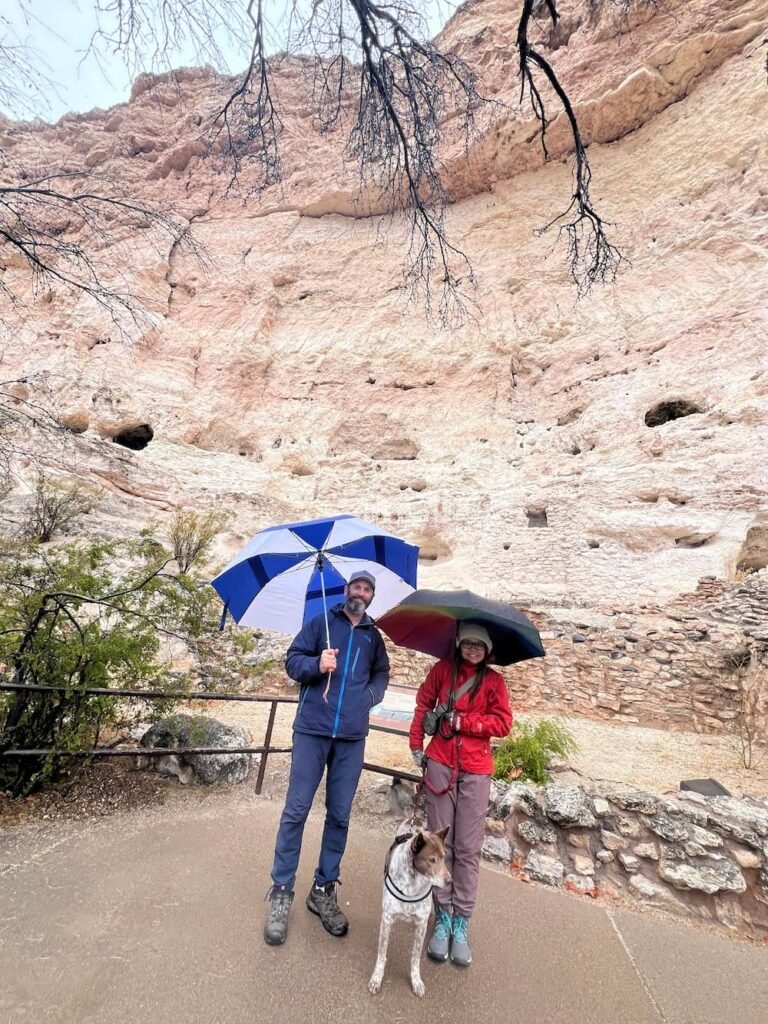
Rain didn't stop us
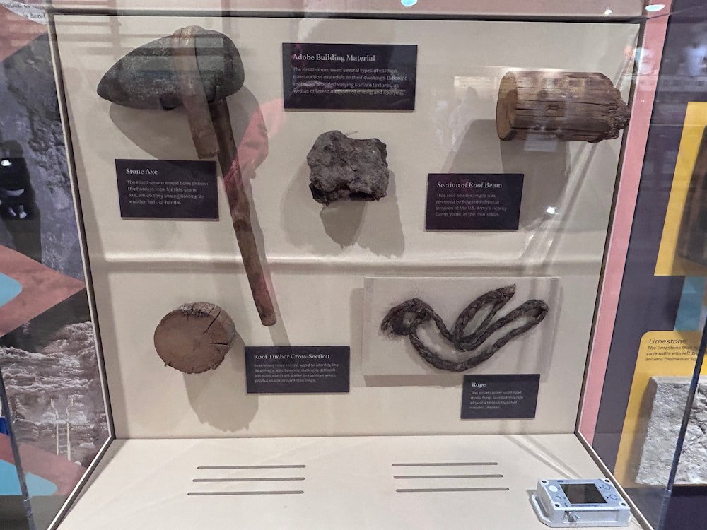
In the visitor center, there’s an interesting exhibit that provides more insights into how the Southern Sinagua people lived. At the time, they had an abundance of resources: including water from the river and streams, and sufficient game–including deer, antelope, rabbit, bear, muskrat and duck. They also mined a salt deposit a few miles away. They also were artisans, crafting stone tools like axes, knives and hammers, as well as manos and metates for grinding corn. Other crafts included bone awls and needles, woven cotton garments, ornaments, as well as specialized, reddish-brown pottery that was likely used for cooking and storage.
One of the displays in the visitors center
Because it had been raining, when we got back to our RV we realized that the window by the kitchen was leaking, bringing trickles of water onto the countertop. Sigh… it’s fixable with some sealant, but we’d prefer not to have too many consecutive issues!
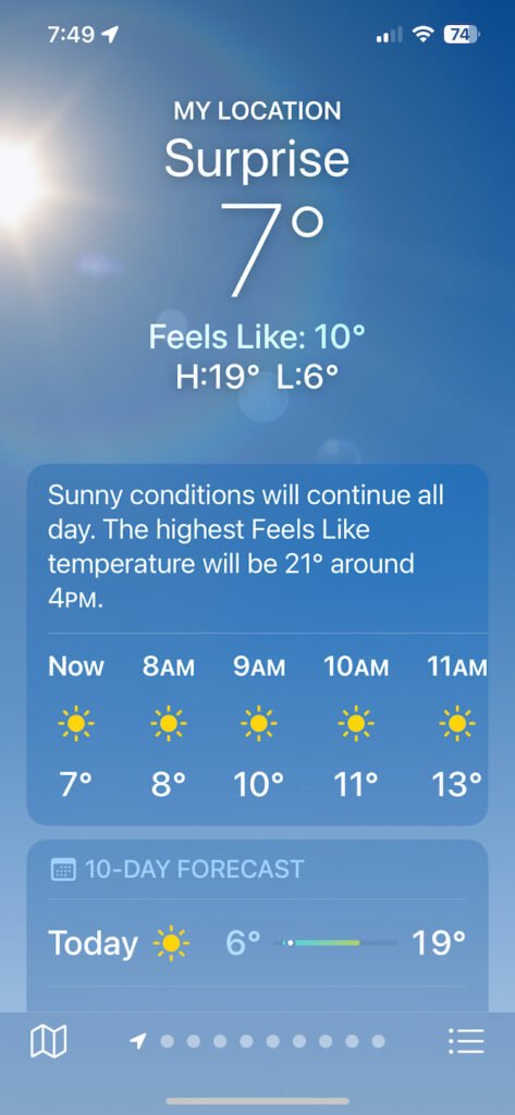
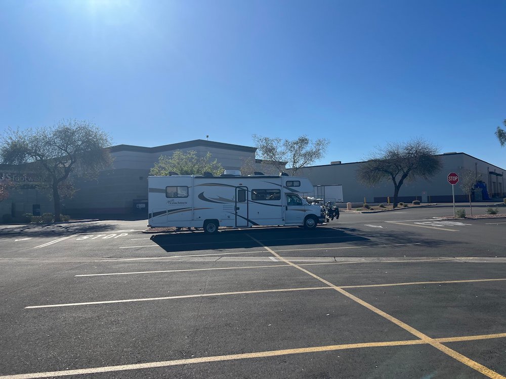
Fortunately the rain subsided as we drove toward Phoenix, where the snow capped hills gradually gave way to commanding cacti lining the highways as we got closer. It was still cold and we stopped at a town called Surprise (Surprise!!), where we bought some groceries and slept in a nearby parking lot for the night–only to find that it was not far from a railway line, which kept us awake again. Who knew that besides getting quite a bit of snow, that Arizona has an abundance of railway traffic?
Weather in Surprise was surprisingly better
Our camping spot outside Walmart in Surprise
Route Map
Days 17-19: Scenic Sedona
After being surprised by seeing elk and snow during the mornings that we stayed in the Grand Canyon, when we woke up this morning we were greeted by sights of the snow and ice melting from the previous day’s snowfall. Upon leaving the Grand Canyon, we saw increasingly longer queues of cars looking to get into the park–we guess now that the weather was nicer and the season was starting, it’d get busier.
Red rocks in the distance
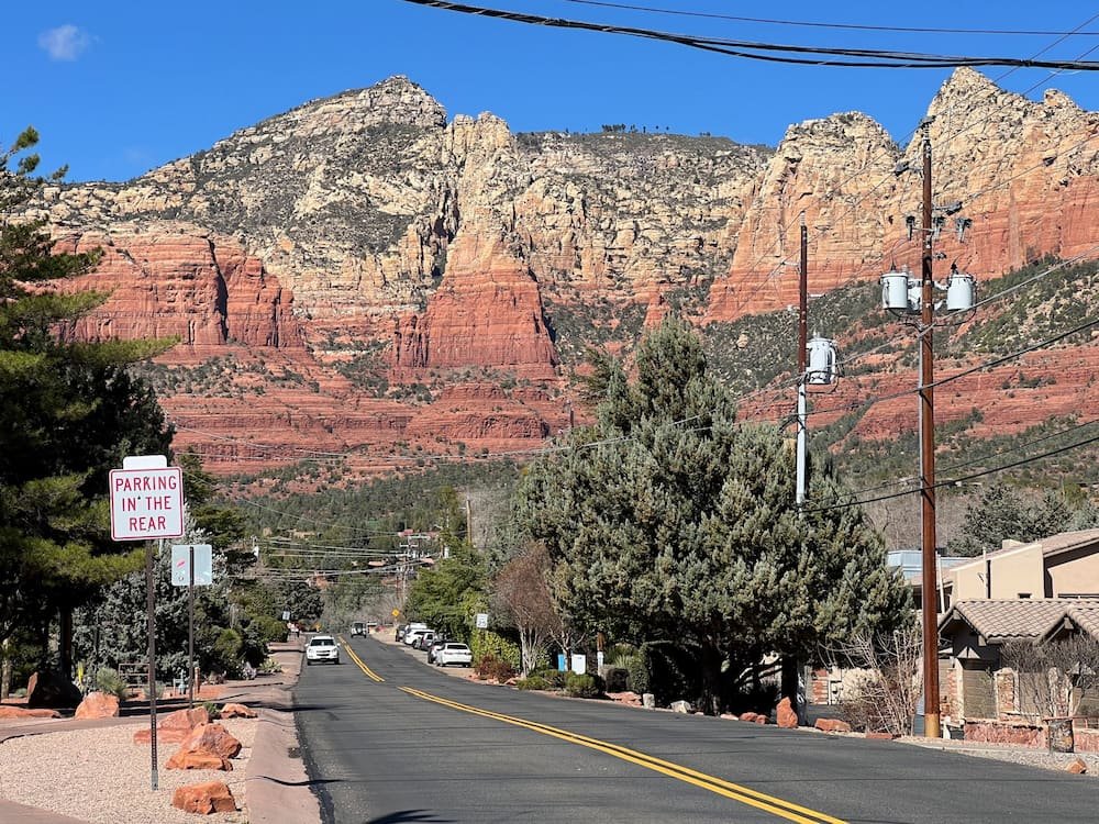
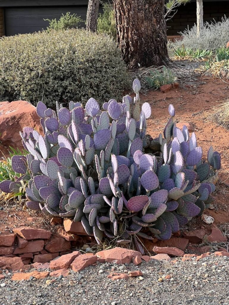
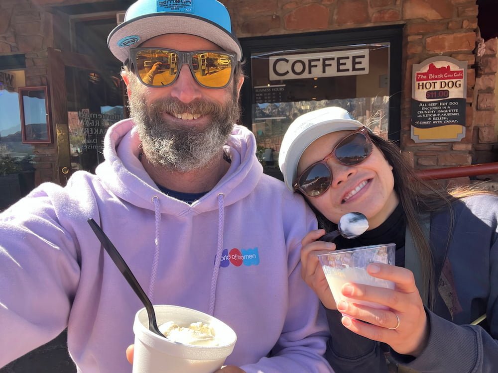
As we drove to Sedona, the weather became increasingly warmer, and we were in awe of the scenery–strikingly vibrant red rocks rose high above the earth to surround the desert town, making for dramatic views in all directions. We walked along North Route 89A (one of the main roads), which is full of restaurants, cafes, and shops. One of our favorite cacti is bright purple–a type of prickly pear. It turns out that prickly pears are also used extensively in food and drink–they can be eaten as is or made from syrups that go into margaritas, jam and candy, or mixed with coconut water for a refreshing drink. At the Black Cow Cafe on this main street, we tried it as an ice cream flavor, which tasted a bit like a sweet, mild melon.
Purple prickly pear
Yummy ice cream
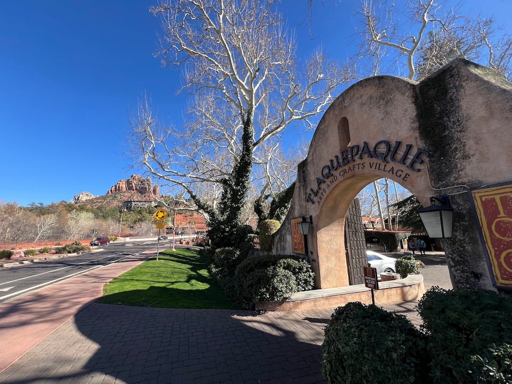
As we kept walking south on the route, we arrived at Tlaquepaque Arts and Shopping Village (pronounced T-la-keh-pah-keh), which is modeled after a traditional Mexican village, with stucco walls, cobblestone paths, decorative arches, and lovely fountains. It’s filled with art galleries and boutique shops, and while we weren’t planning to buy anything, we enjoyed walking around and appreciating the architecture.
Tlaquepaque Arts and Crafts VillageCenter for the New Age
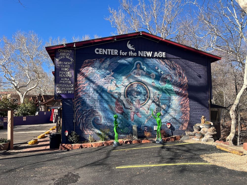
Amid the red rocks of Sedona, many people believe that there are vortices–swirling centers of energy that are helpful for healing, meditation, and self-exploration. A vortex is meant to be a mysterious cosmic force that is both sacred and powerful. Because of this, it’s no surprise that Sedona is a very mystical, new age-focused town, with lots of stores focused on yoga, meditation and spiritual tours among the rocks.
The teal arches?
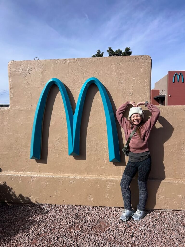
In the evening, we checked out the McDonald’s in Sedona, which is unique because it is the only one with teal colored arches (rather than the usual bright yellow) to stand out against the red rocks! Like McDonald’s or loathe them, we do appreciate how they localize their fast food chains across many cities around the world, creating their own tourist attractions.
Always difficult to find parking
We realized that unfortunately Sedona is not an easy place to navigate or park if you have an RV or oversized vehicle. There aren’t many places to stay for the night, and the windy roads can be tough to drive around. There are very few RV parks (and the ones that exist are super expensive compared to the average price we’ve seen or stayed out in other places), unless you drive well away from Sedona to stay in another town. We were feeling a bit anxious as the sun started to set, as most of the offices at RV parks close from 5pm, and we didn’t have many options. We took a chance by parking outside of a gym that was open 24/7, trying to stay low key by parking on the fringes of the lot.
Devil’s Bridge Trail, RV Pipe Fail
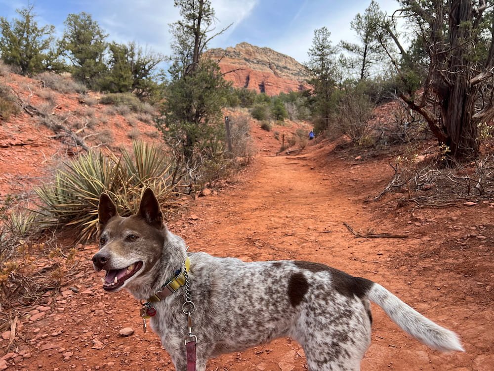
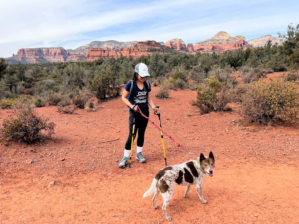
We were relieved to find that we slept in the gym parking lot with no incident, and we were free to hike the next morning in Sedona. There are over 50 hiking trails in Sedona, and the great thing is that they’re pretty much all dog friendly!
Happy Sheila ready to hike
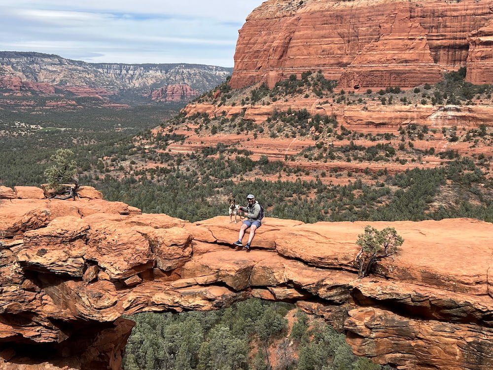
We chose Devil’s Bridge Trail, because we wanted a somewhat moderate hike, and it also rewards hikers at the end with a perfect photo moment on the “devil’s bridge”, which is a natural sandstone arch and the largest one in Sedona. Parking around the hiking trails is not easy for RVs, but we were fortunate to find a spot on the side of the road not far to the start of the trail.
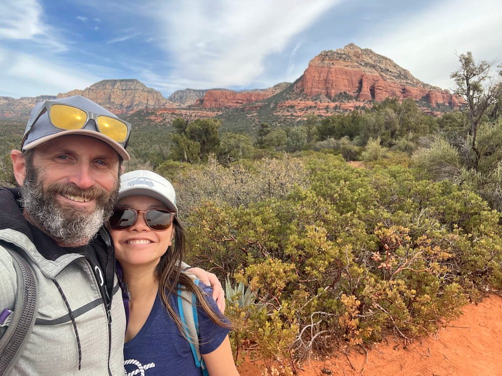
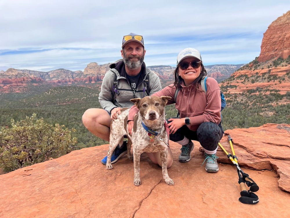
Ready to hit the trailSedona selfie
The hike we chose is about 2.9 kms long (1.8 miles) and starts off easy, as it’s fairly flat and the entire hike is paved with clear markers (plus it’s a popular trek, so there were quite a lot of other people doing the hike that we could follow). Along the way, there are plenty of places to take in the majestic landscape around you. As we neared the arch, the climb became more challenging, where we had to scamper up rocks as the elevation reached a top of 1,402 meters (4,600 feet), with a 121 meter (400 foot climb) in altitude.
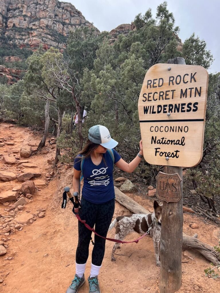
Red Rock Secret Mountain Wilderness
Family snaps are hard to come by
Once we got to the end, we got to that spectacular view, and a short line of folks who wanted to run across the bridge and take that impressive photo with the sheer drop below. Sheila was in her element on the hike, enjoying the opportunity to sniff and scramble up and down the rocks with us–and she was the center of attention when Michael and Sheila got their turn to take a picture on the arch, with a few people commenting that their dog would not be so brave!
Michael and Sheila on the natural rock bridge
We enjoyed the hike so much that we decided to scope out where we could go the following day. We drove along one of the roads, which had what were certainly very expensive adobe-style houses amid the landscape. At one point, we realized that we needed to do a 3-point turn in someone’s driveway to get back onto the main road–only to hear a loud scrape as our RV bottomed out, followed by water gushing along the curb! Uh-oh… was this our grey water (from the kitchen and shower), or our black water (from our toilet)... or both that had spilled out onto the streets?
The broken pipe
We hurriedly drove back to the gym parking lot where we’d spent the previous night to diagnose what happened, and it was clear that a part of our pipe had snapped, and fortunately it was likely the one connecting to our grey water. No choice but to search online and call a mobile RV mechanic for the second time on this trip–and fortunately we were able to find someone who could help us in the morning at an RV park south of Sedona in a town called Cottonwood, where we drove toward and slept for the night.
All Day RV Pipe Repairs
The RV repair guy arrived after 8am, and determined that our grey water pipe had snapped, but that because the pipes were already sagging too low to the ground, it was only a matter of time before this would happen. He needed to come back around 1.30pm to finish off the repairs, so in the meantime we stayed at Rio Verde RV Park, a small RV park with a couple of hiking trails and clean facilities. Time for a hot shower and getting errands done! The manager, Mandy, is lovely and based on our experience, we’d recommend it to anyone looking to stay at an RV park near Sedona.
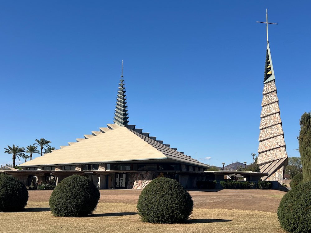
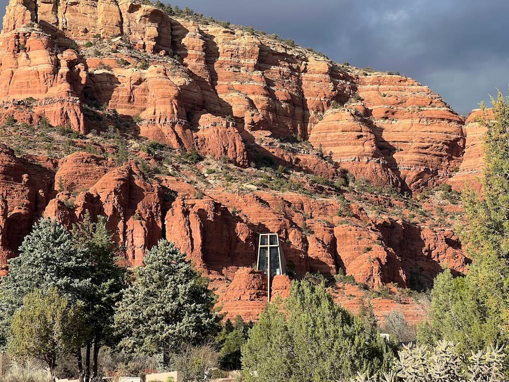
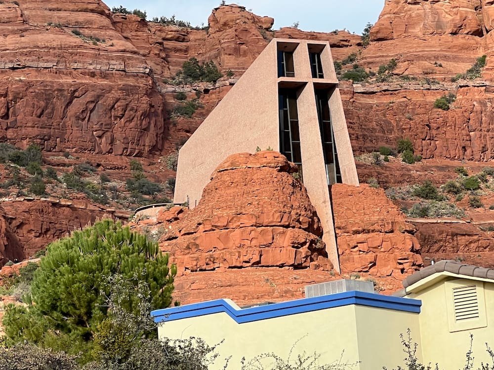
We didn’t end up leaving the RV park until after 3.30pm, but this was just enough time to head back north to see the Chapel of the Holy Cross before it closed at 5pm. The Chapel is a Catholic church perched high atop a red rock with the most spectacular views all around–and perhaps some of the best vistas of any church we’ve been to in the world. Built from 1954 to 1956 within the Coconino National Forest, the church cuts a striking figure from the outside, with the chapel (with a large cross) embedded into the rock. It’s a short uphill hike to the church, with a grotto along the path, and signs greeting visitors in multiple languages.
The Chapel blending into the rocksUnique design of the ChapelThe Chapel seems to split two rocks
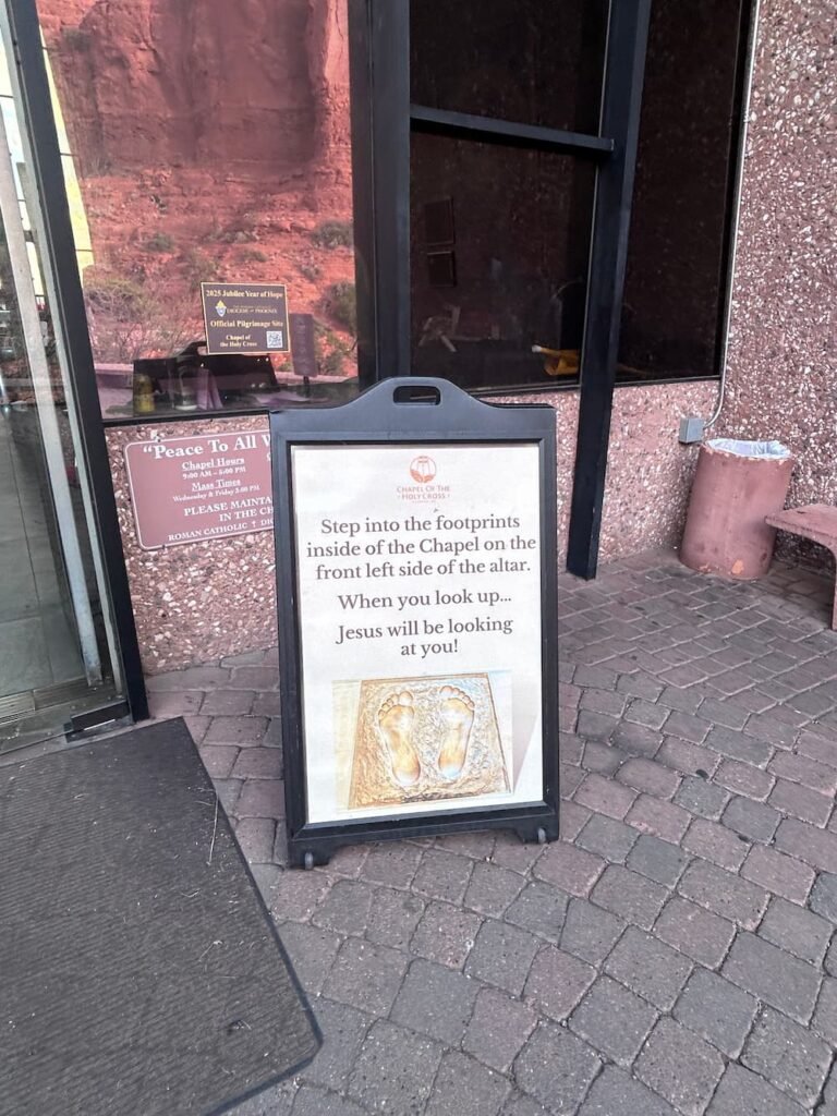
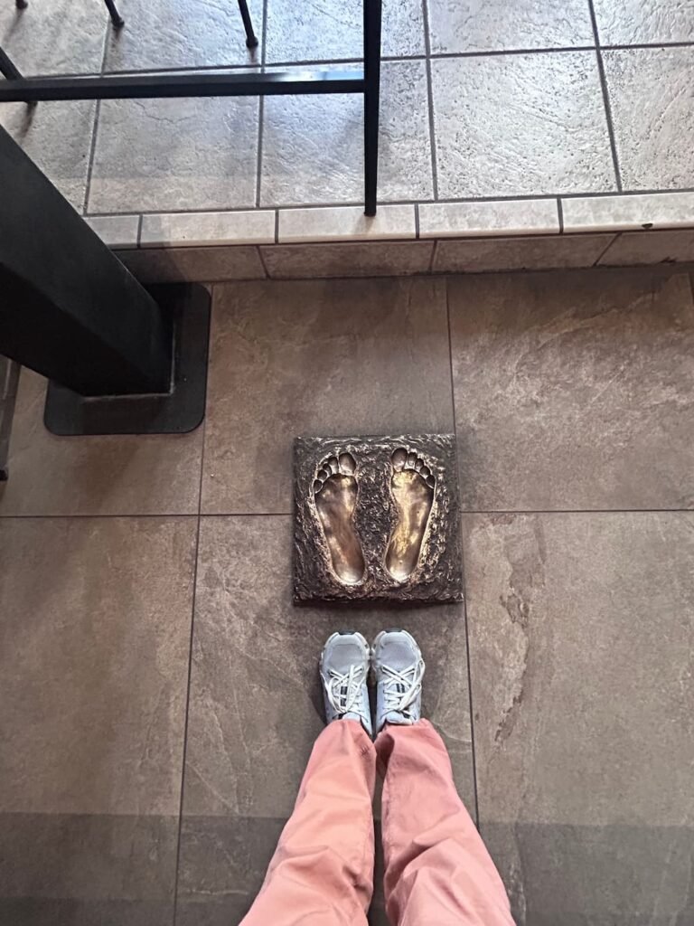
Upon entering the church, there are towering floor-to-ceiling windows at the front to welcome all the sunlight through, and two sets of pews running parallel to each other facing the altar. At the front on the left hand side, there are footprints on the ground, where you can place your feet and look straight up–and see Jesus on the crucifix, and his eyes looking right at you. Lisette tried it and maybe it’s her Catholic upbringing, but she found the stare to be very intimidating! There’s also a gift shop downstairs near the entrance, but we didn’t go in as it was already closing for the day.
Step into the footprints sign
The feet to stand on
Looking up at Christ on the cross
We left Sedona as we knew that there weren’t any RV camping options, and arrived at the town of Camp Verde, where we stayed at Cliff Castle Casino Hotel for the evening. After our experience at Red Rock Casino, we realized that casinos are fantastic options for sleeping for the night–they are generally safe and quiet, are open 24/7, have clean amenities that we can use, and as a bonus, we can sign up to try our luck to make a bit of money to help fund our trip, even if it’s only by a small amount. Initially when we pulled in we had security walk toward us because we couldn’t park in the general lot (and we thought we were going to get kicked out), but it turns out that there was a dedicated, separate lot for RVs and oversized vehicles–and we got a shuttle pick us up once we parked to drive us directly to the casino entrance.
Dinner at Johnny Rockets
We ended up enjoying our time at this casino. We had dinner at Johnny Rockets, an old school American diner, which was great as it had vegan options for Lisette, including an Impossible Burger hamburger and a vegan milkshake. There was also a bowling alley next door, which we were tempted to do but didn’t (it was packed)! We ended up winning $74 (and at one point cashed out a whopping 4 cents!), before calling it a night.
Route Map
Days 15-16: The Grand, Grand Canyon
The Grand Canyon is easily Arizona’s most distinguishable landmark. At 277 miles long, as much as 18 miles wide and a full mile deep, it’s the second largest canyon in the world (the largest is Yarlung Tsangpo Grand Canyon in Tibet). The Grand Canyon’s walls contain rock layers that are up to 1.8 billion years old.
Trail map
We stayed exclusively at the South Rim in the Grand Canyon, which is open year-round and is the busiest and most frequented area by visitors, as it’s also the most accessible and has the most amenities such as accommodation, tours, transportation, etc. The North Rim is more remote–due to its higher elevation it’s a lot cooler and only open between around mid-May to mid-October. Meanwhile, Michael and I visited the West Rim years ago, which has a lot of activities that are outside of that Park on Hualapai Tribal Land, including the Skywalk (a horseshoe-shaped glass bridge cantilevered 70 feet over the Grand Canyon), riding rapids, soaring in a zipline, and learning about tribal culture in Eagle Point’s authentic village. We were fortunate years ago to take a helicopter ride into the canyon when we went to the West Rim (as well as a small plane ride to/from Vegas to get there that also flew over Hoover Dam, which was a splurge, but definitely a fun and memorable experience!
Our First Morning Surprise: Elk!
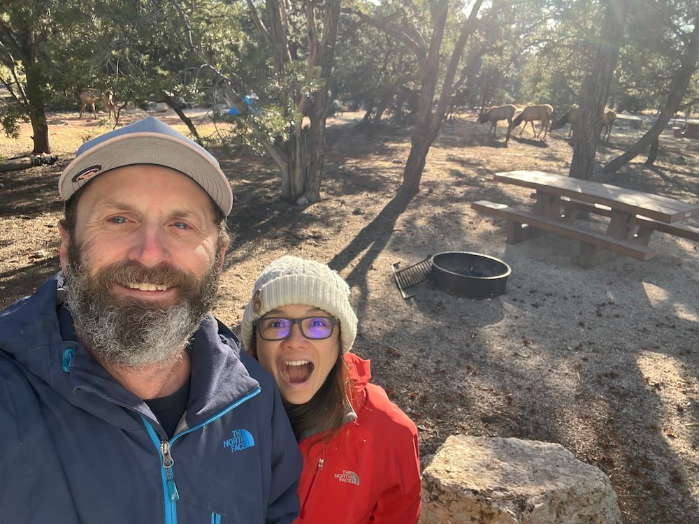
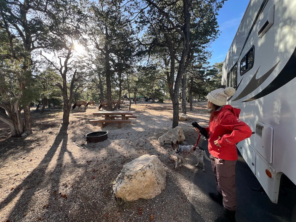
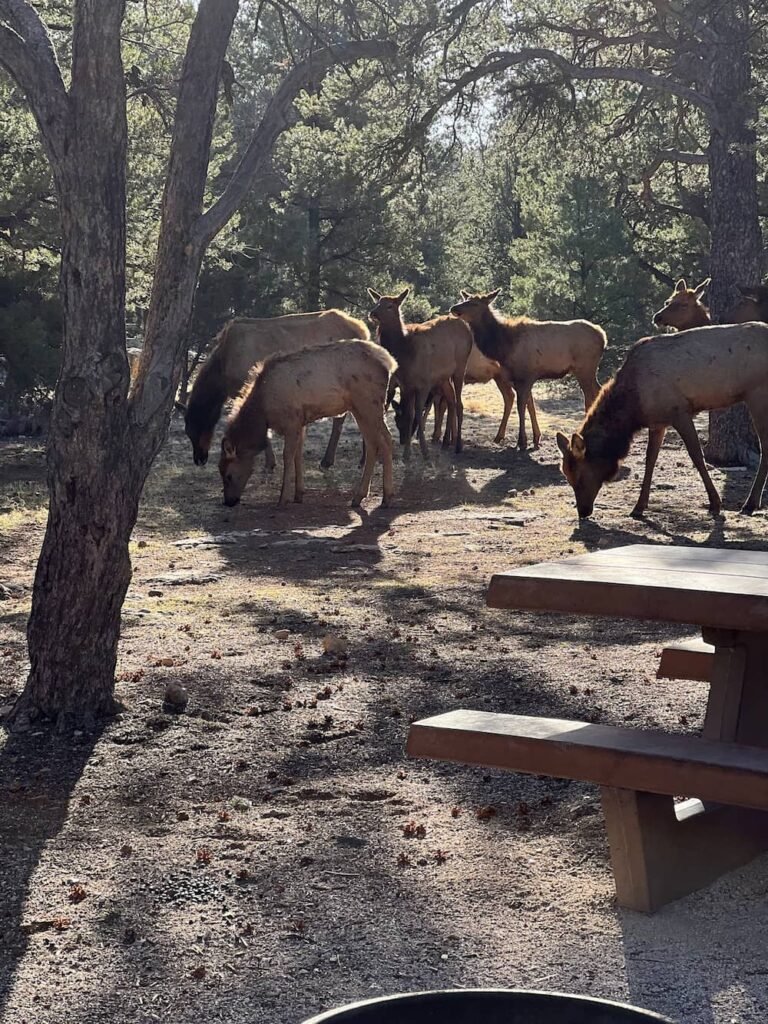
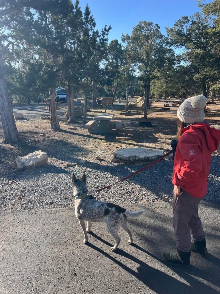
But we digress… Going back to our first full day in the Grand Canyon, we had the incredible surprise of stepping outside of our RV to find about a dozen elk wandering around in our campsite! They were all very relaxed and not the least bit intimidated by the RVs, tents, and people milling about, and ambled along to leisurely munch on leaves. Sheila appeared to be way more curious about the elk (a new animal for her to spot), and she didn’t seem to know what to make out of the experience!
Stoked to be so closeThey were right beside our RV
Curious elk
Sheila staring one of the elk down
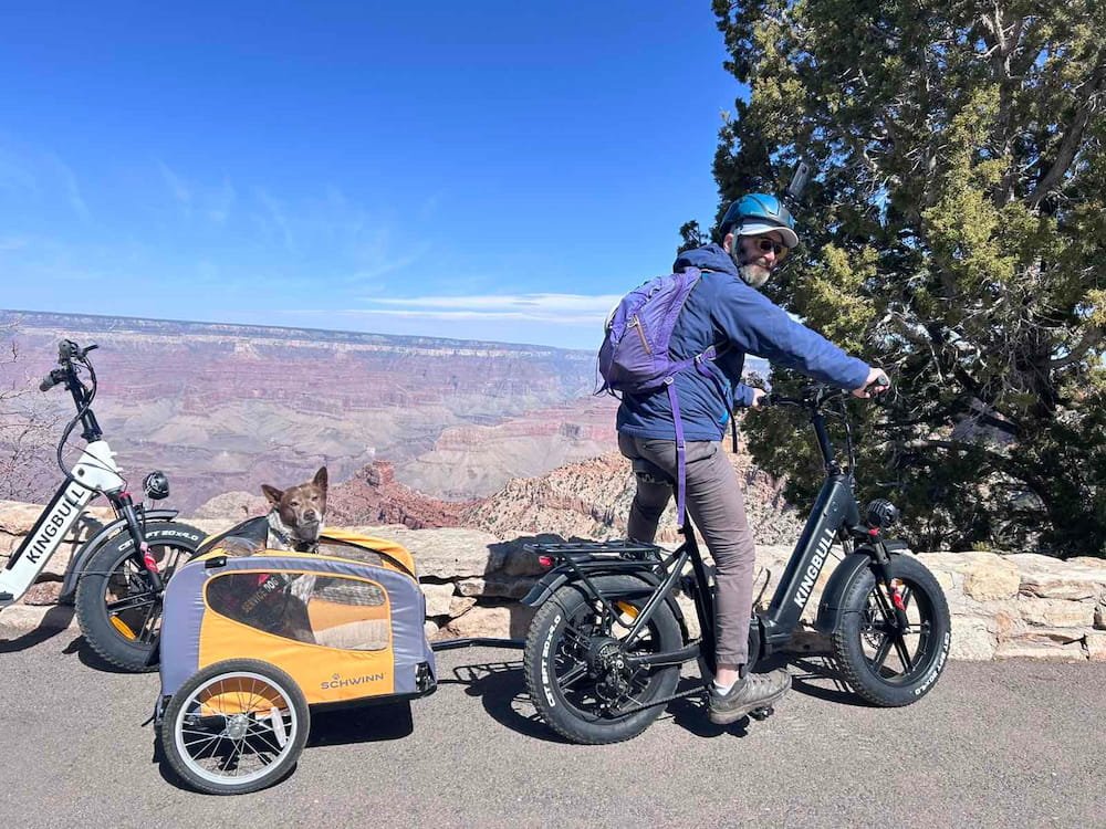
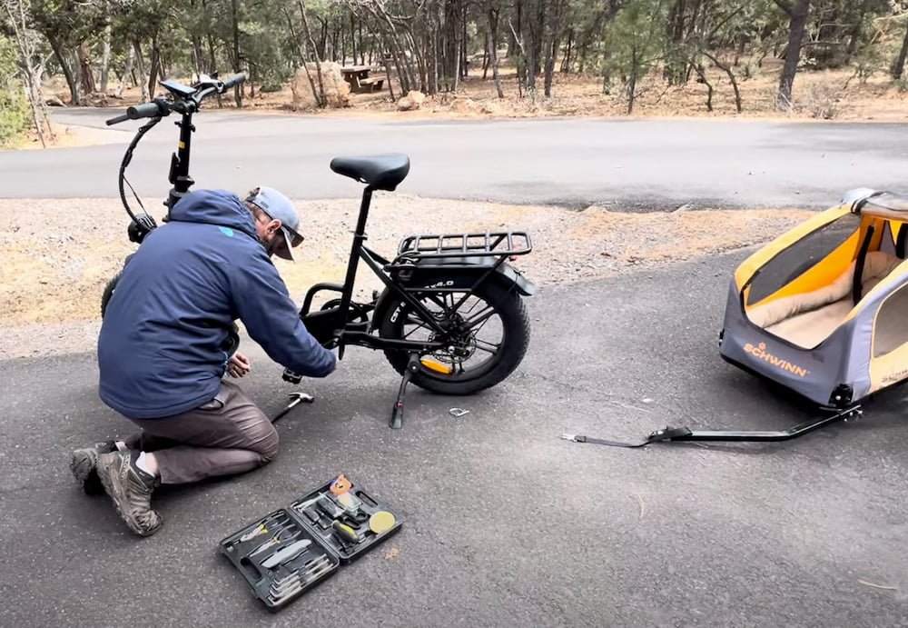
We were also happy to learn that there are dedicated bike trails around the South Rim, so we strapped Sheila back into her dog trailer to ride toward Yaki Point, which is the only scenic viewpoint that isn’t accessible by cars. We were enjoying our ride along the scenic trail, catching more in-depth glimpses at times of the canyon and the gorges below. Unfortunately, it wasn’t long before Michael’s pedal fell off, so we headed back to our campsite to fix it. It seems that it hadn’t been properly pushed in, which meant that the tread on the pedal had worn out, so Michael ended up finding some MacGyver-like ways to bash it back in.
Stopping to take in the view of the Grand CanyonMichael fixing the broken pedal
After making a filling Mediterranean chickpea salad for lunch, we were off to ride again, this time with a warm and content belly full of food… Only for Michael’s battery on his eBikes to stall! By this time, an icy and strong wind had started to blow, so we aimed to get back to our campsite as quickly as possible. We say “aimed” because we swapped eBike batteries since Michael had the additional weight of riding with Sheila’s dog trailer attached, and we made good time until Lisette had to ride the last bit uphill to the campsite, and her little legs struggled to push the pedals uphill–a jogger probably would have easily overtaken her at that stage!!
As the temperatures dropped in the evening, it was the perfect time to make a comforting meal. Lisette loves to cook–she’ll spend time each week reading through new recipes from food bloggers via social media or from their newsletters, will happily devote time to meal prep to make sure that random ingredients are used up, will eat food while reading about food, and is always eager to try new recipes. Tonight we used up some of the red lentils that had traveled with us from home to make this hearty Mediterranean lentil stew, which was a success! Lisette substituted soy sauce for the broth, and added one of our favorite hot sauces, Cholula, instead of using the fiery harissa. While Lisette does miss having her oven, it’s been wonderful to have a perfectly operating kitchen while we’re on the road.
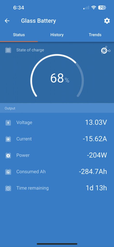
Feels like -9C
Our lowest battery level since fixing the solar system
Due to the snow covering our solar panels and the lack of direct sunlight, our batteries dropped quite a bit when it was snowing. Luckily we have a big enough battery bank to survive an extended time without sunlight.
Earlier that day, we’d met a family from London who were traveling around for about a year around the US, also spending a lot of time checking out many of the country’s national parks. The parents were homeschooling their two girls, and had previously also had a caravan to spend 18 months exploring Australia. This time, they had an epic expedition vehicle, which they’d customized and shipped from the UK (coincidentally it was the same one we spotted at Walnut Canyon - see the pic here).
For us, this current trip in an RV is a test to see how we’d handle it, but we’d love to have an expedition vehicle in the future to continue exploring countries across Africa, the Middle East and Central Asia. We were able to check out their expedition vehicle in detail and get a lot of tips and insights for us to reference for later. It’s wonderful to folks along the way who are like-minded in wanting to explore the world. Nobody ever lives wanting to have spent more time behind a computer working, that’s for sure!
Our Second Morning Surprise: Snow!
Remember earlier when we mentioned that our first surprise on our first full day in the Grand Canyon was seeing elk mill about our campsite? On the second day, our immediate surprise was waking up to see snow outside! The temperature had dropped dramatically the afternoon prior, and as we fell asleep we’d heard the sound of the wind and what sounded like rain pattering on our RV. Well…we thought it was rain, but it was snow, which Lisette noticed as she lifted the blinds to take her daily morning photo. She started a habit of taking a photo each morning of the view outside the window on her side of the bed, with the goal of stitching it up at the end of this trip (don’t tell Michael though–the photos are all in vertical mode, which he’s going to hate as someone that insists on horizontal snapshots!). This morning was probably the prettiest morning image of the trip so far!
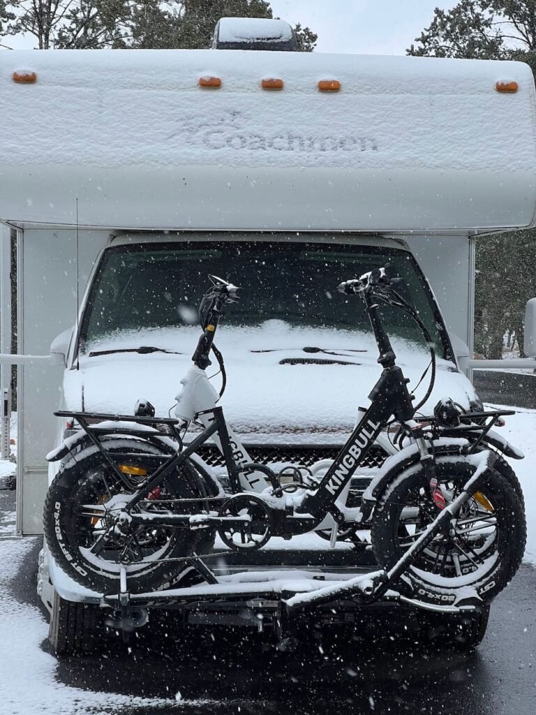
Snow outside the RV
The RV getting covered in snow as it falls
Given the cold, snowy day, it seemed like the perfect morning to make pancakes. Lisette has been making pancakes for years using this recipe, but alas, in her haste to finish cooking she blasted the heat too high on the stove, so quite a few pancakes looked cooked on the outside, but were still raw in the middle. Now we know how to work this stove for future cooking endeavors!
Pancakes for breakfast
We used a big chunk of the day to do errands, including spending money to have nice hot showers and doing laundry. It cost $2.50 for a 5 minute hot shower, but after having many consecutive days of the quick “splash and dash” showers in the tiny space in our RV, a 5 minute hot shower just letting the water run in a more generous space felt simply luxurious! It also cost $2.50 for the washing machine and dryer respectively, but these are the errands that simply need to be done while on the road once in a while. In the late afternoon we checked out the Yavapai Museum of Geology, a free museum to learn more about the formation and composition of the canyon, which is also perched to have a spectacular view of the canyon itself. Heading back to our campsite, we took care to walk carefully that evening as the snow turned to slippery ice in sections of the road.