Lisette woke up the next morning around 5.30am and took Sheila for an early sunset walk around the perimeter of the RV park, as other travelers also started their day. After breakfast, we realized that our black water tank was leaking… not a good sign. We had fortunately booked to stay at an RV park that night, going back on ourselves to return to the town of Pahrump that offered full hookups, so we could dump our black and grey water that evening.
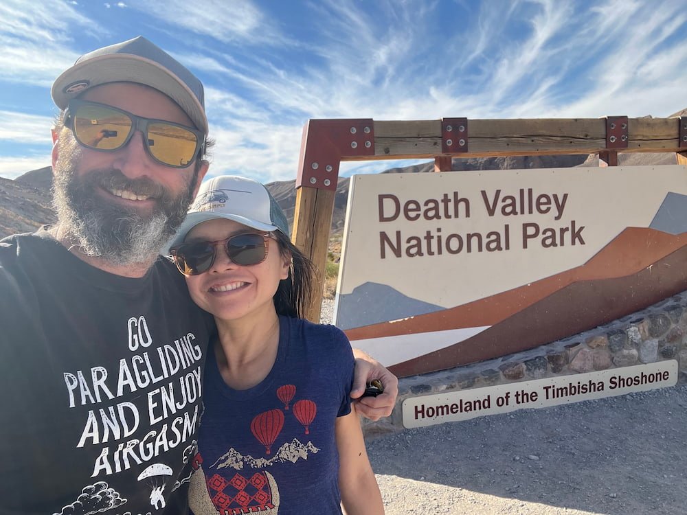
Death Valley was surprisingly hot for this time of year–it hit a top of 28 degrees Celsius (82 degrees Fahrenheit)! One of the first things that we were greeted by when we drove in was an incredible oasis, surrounded by lush palm trees, with Spanish-style buildings adorned with red tiled roofs that looked more appropriate for Los Angeles than the hottest, driest and lowest point in the country. It turned out that this was what was originally called the Furnace Creek Inn, designed by prominent Los Angeles architect Albert C. Martin and landscape architect Daniel Hull. Now called The Inn at Death Valley, it underwent a $100 million-dollar renovation and is a luxury hotel and resort, with 66 rooms, a spring-fed pool, and an additional 22 private, one-bedroom casitas for guests.
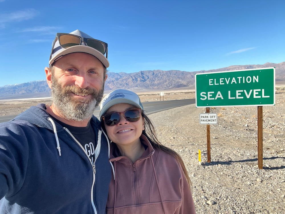
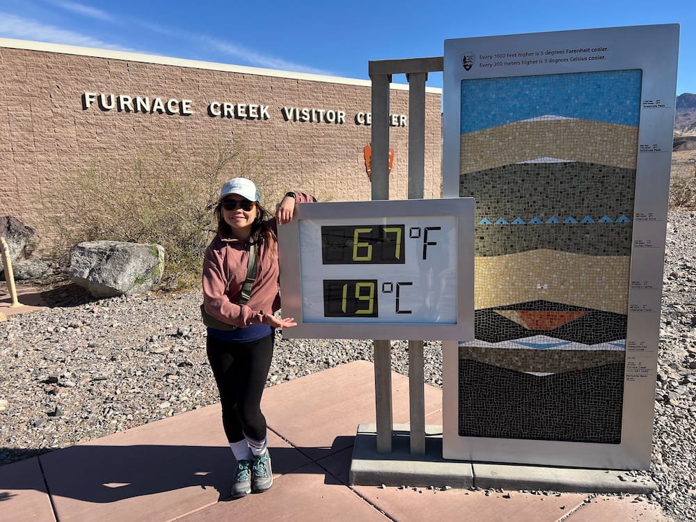
Not far from The Inn, we saw a sign that said that we were already at sea level elevation (and we would dip well beyond this during our stay). Heading over to the Visitor Center (which included a photo by the digital thermometer with the current temperature–although coming in February it didn’t reach the boiling heat that people tend to take photos next to), the rangers were very helpful in helping us plan our day’s itinerary. It turns out that as our RV is longer than 25 feet we had to miss Dante’s View and Artist’s Palette, which are along very windy roads to get there.
Our One-Day Itinerary at Death Valley
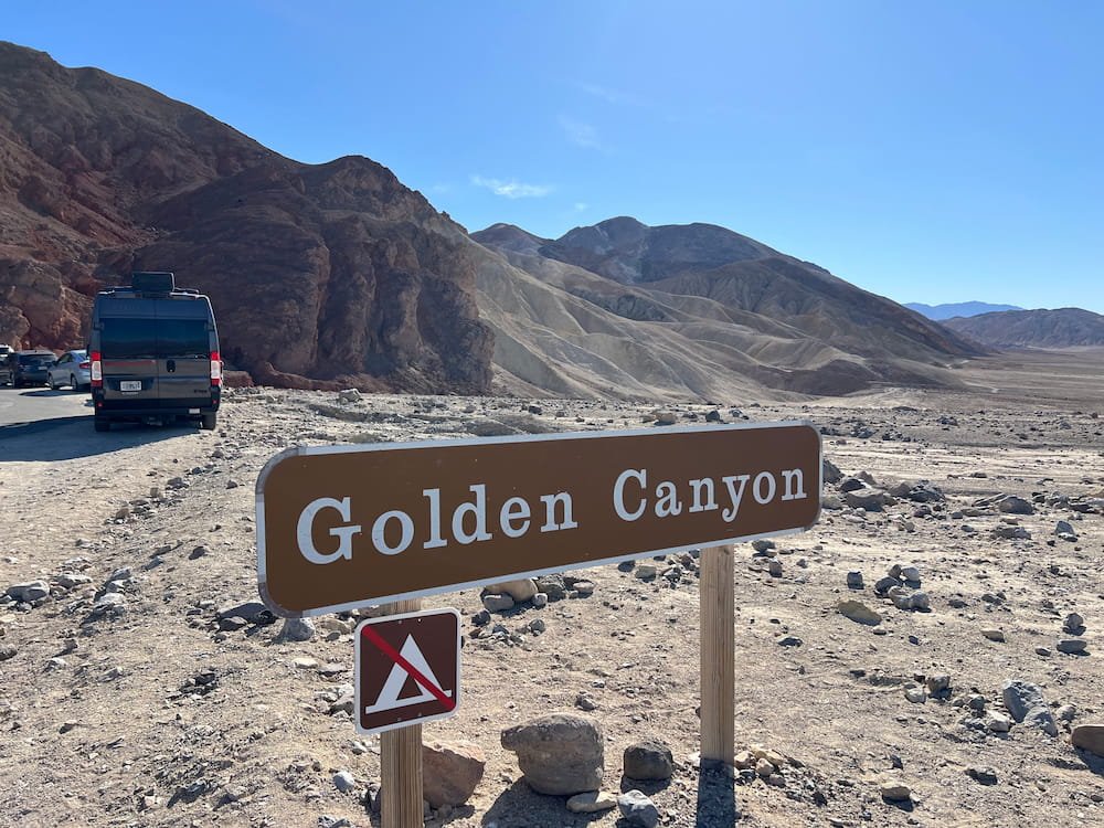
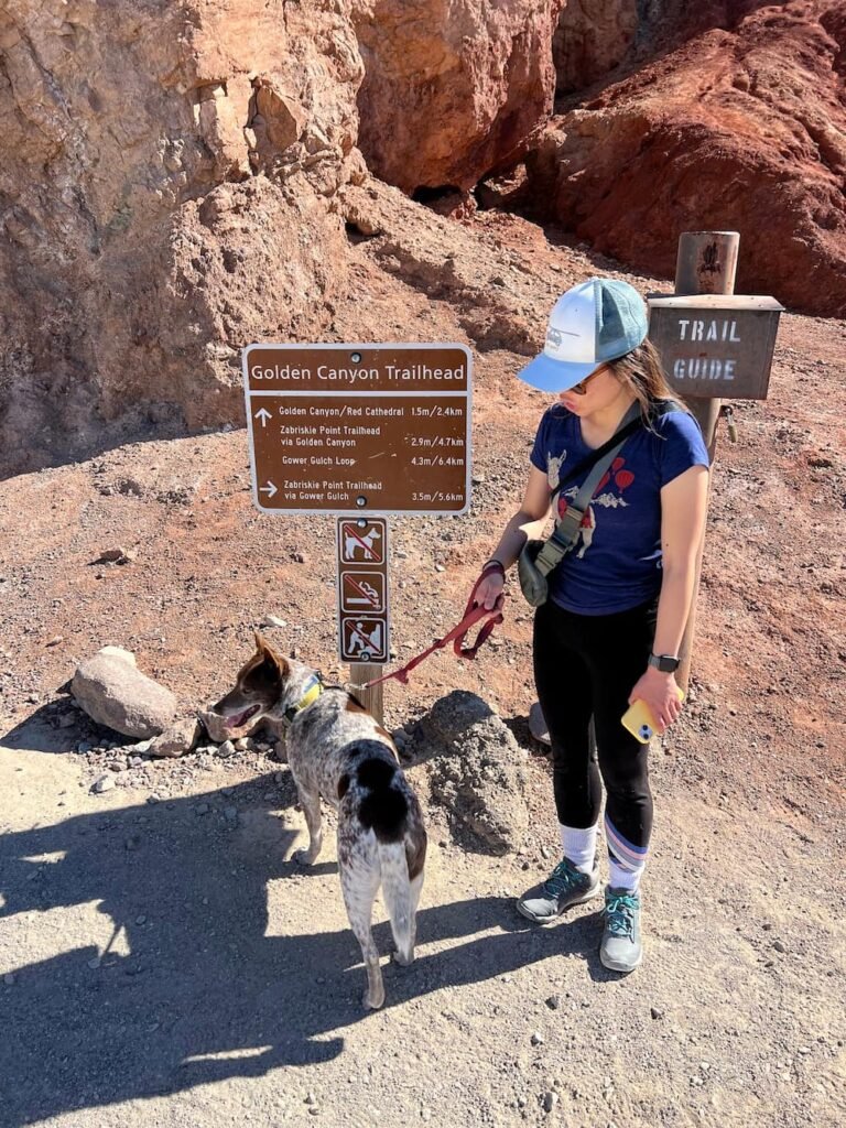
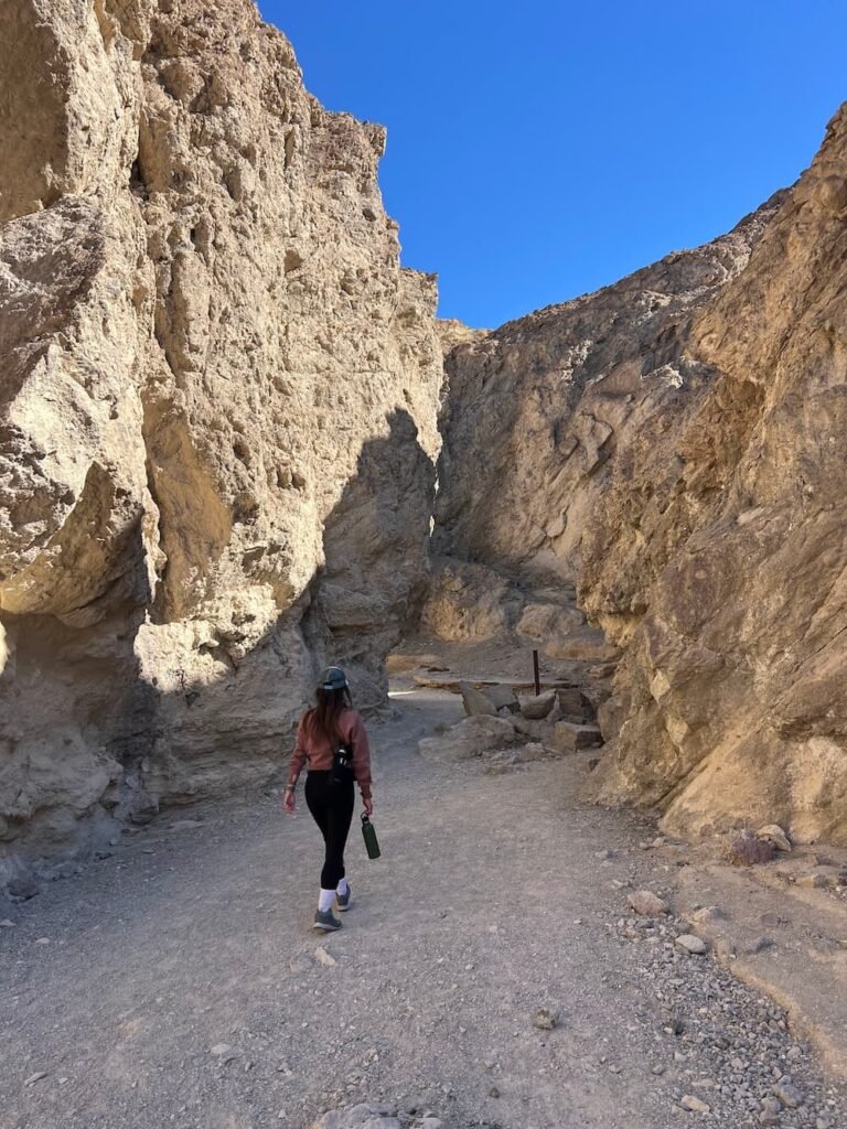
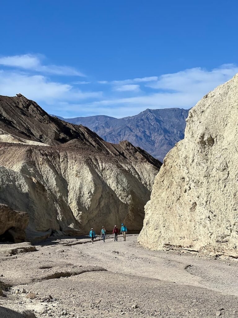
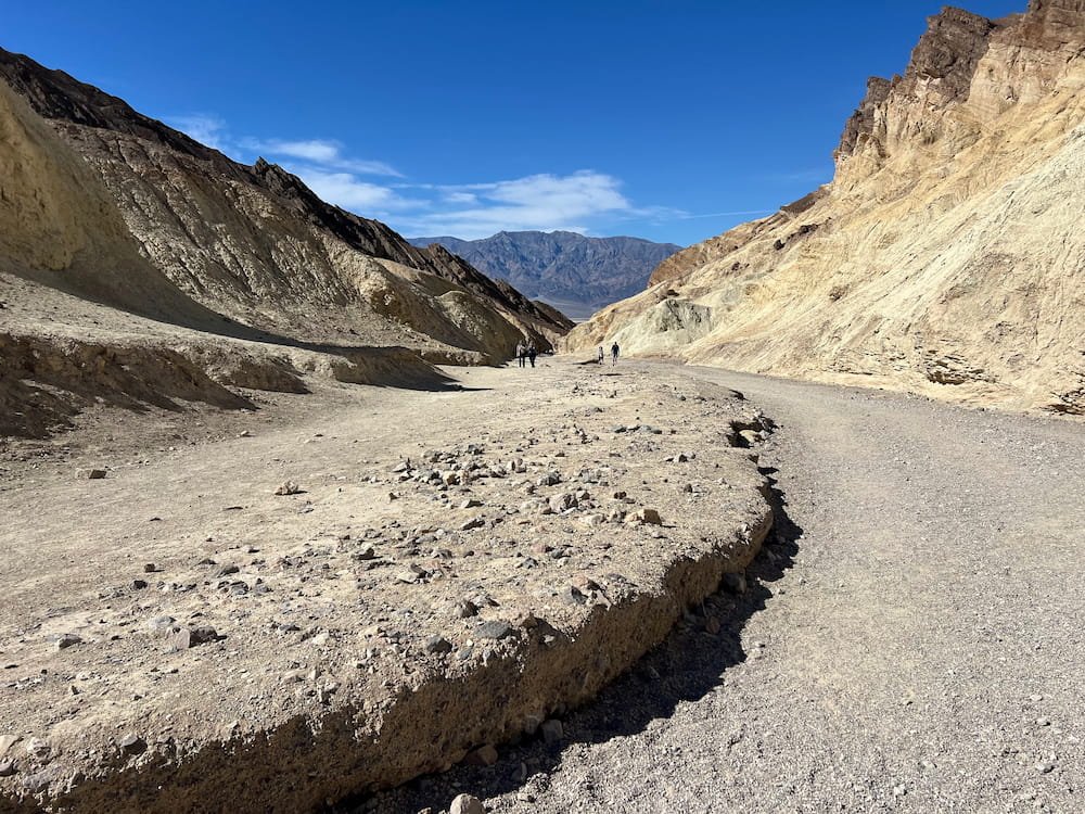
Golden Canyon Trail
However, we had a full and awesome day – first going on a lovely hike at Golden Canyon Trailhead, where we were greeted by a maze of golden colored hills and narrow canyons. The section we did was an easy stroll, although we didn’t do the entire loop, which is 12.6 km (7.8 miles) and apparently becomes more challenging as you go further. We didn’t do the full loop, but decided to turn back toward where we’d entered after a mile or so.

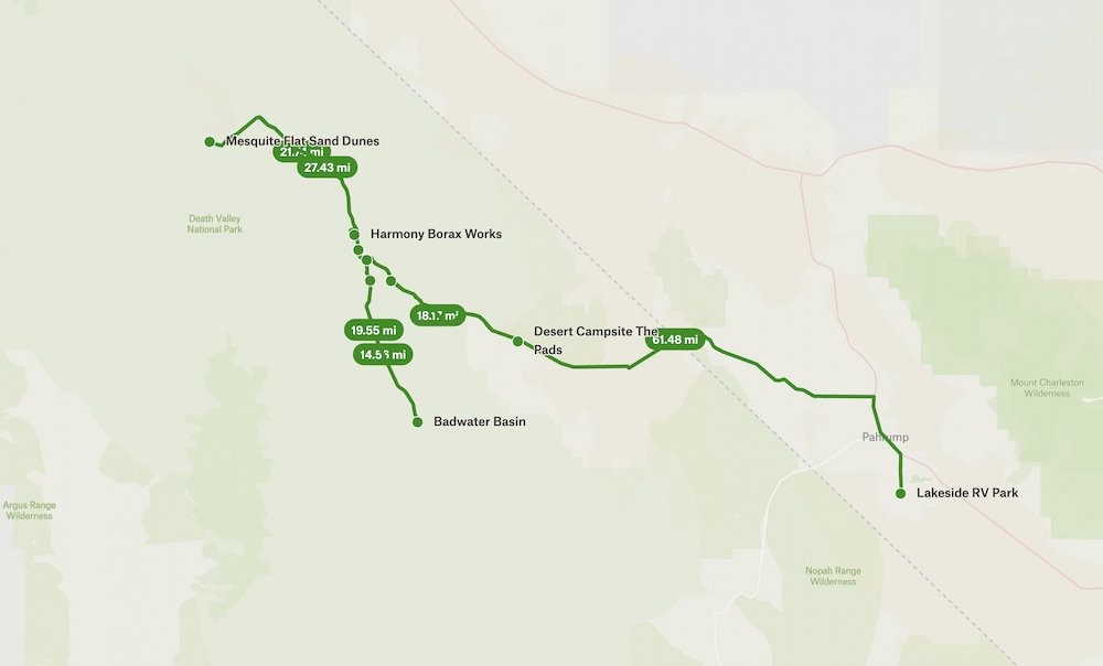
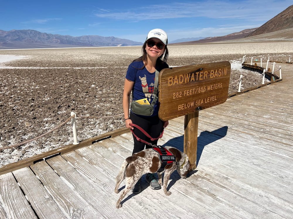
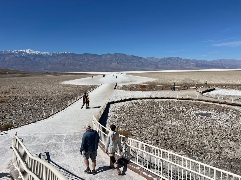
Badwater Basin
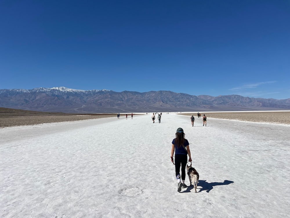
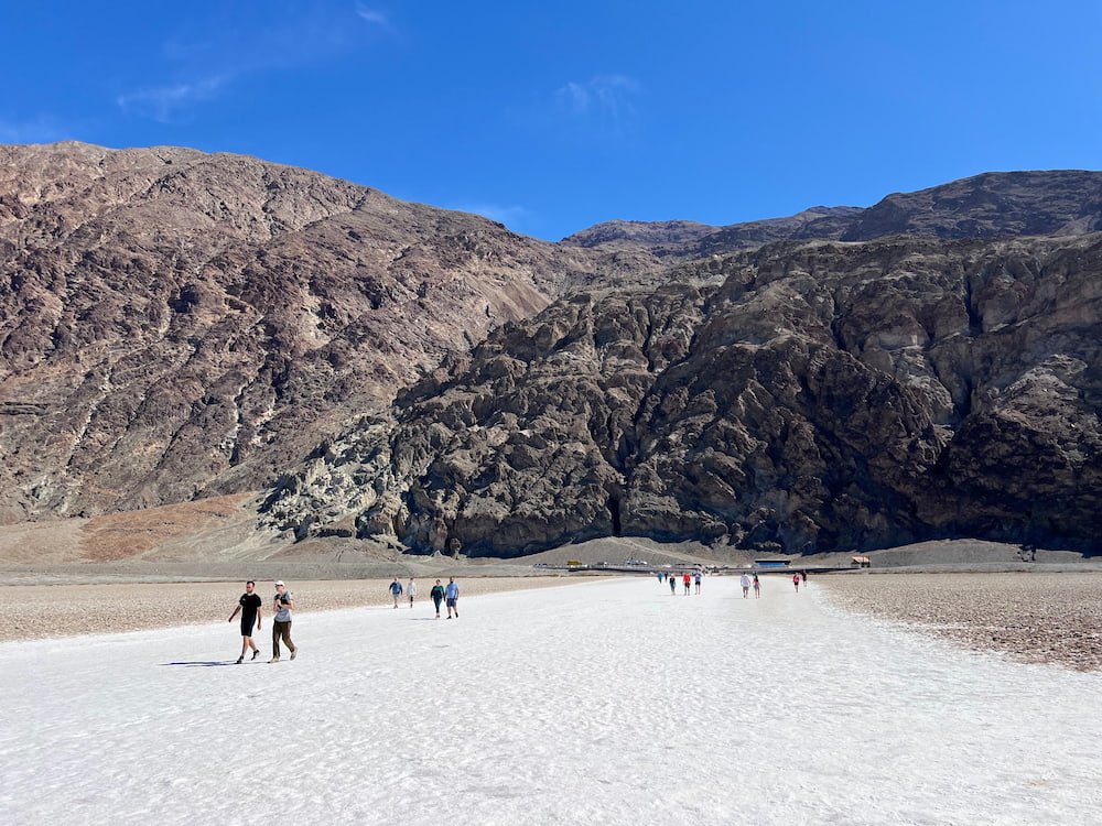
Badwater Basin is the lowest point in North America, at 86 meters (282 feet) below sea level. The salt flats cover 518 square kilometers (200 square miles), and are made up of mostly sodium chloride (table salt), as well as calcite, gypsum and borax. It is blindingly white and from a distance looks like people are walking along snow. Michael noticed someone lick the ground to taste it, but we definitely wouldn’t recommend it!
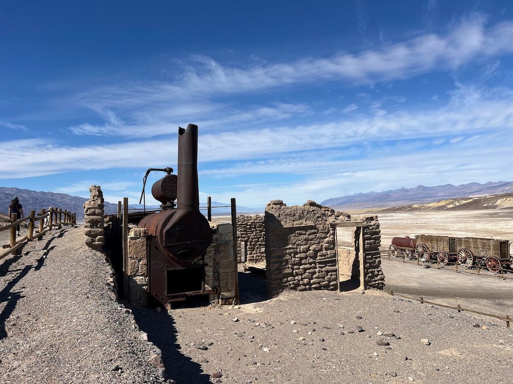
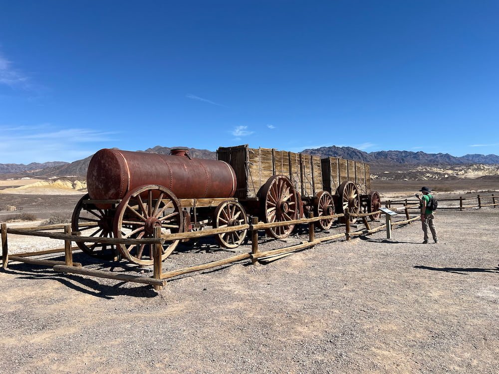
Harmony Borax Works
After borax deposits were discovered in Death Valley in 1881, borax mining operations were set up in the area. One place to see the remains of the plant and associated town is Harmony Borax Works, which was famous for its use of mule teams and double wagons to haul borax along the Mojave desert. You can still see the rusty old wagons stationed here today.
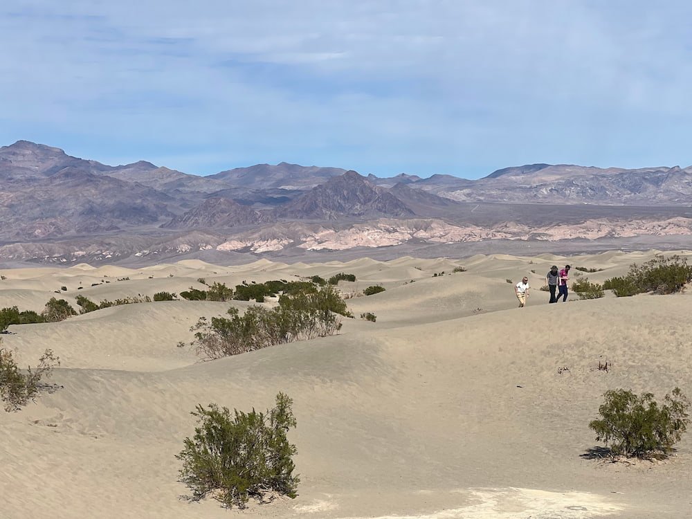
Mesquite Flat Sand Dunes
Next up was the Mesquite Flat Sand Dunes, one of the rare places where there are actually sand dunes in Death Valley. The place is named after the mesquite trees that grow all around this area. Since we were there in winter, the mesquite trees looked rather dry and lifeless, but apparently once spring arrives the trees are full of bright green leaves and yellow flowers, with flour from the bean pods used to make a traditional food of the Timbisha Shoshone native people. We didn’t stay there for long as the sand felt hot to touch and we didn’t want Sheila to get uncomfortable walking on it.

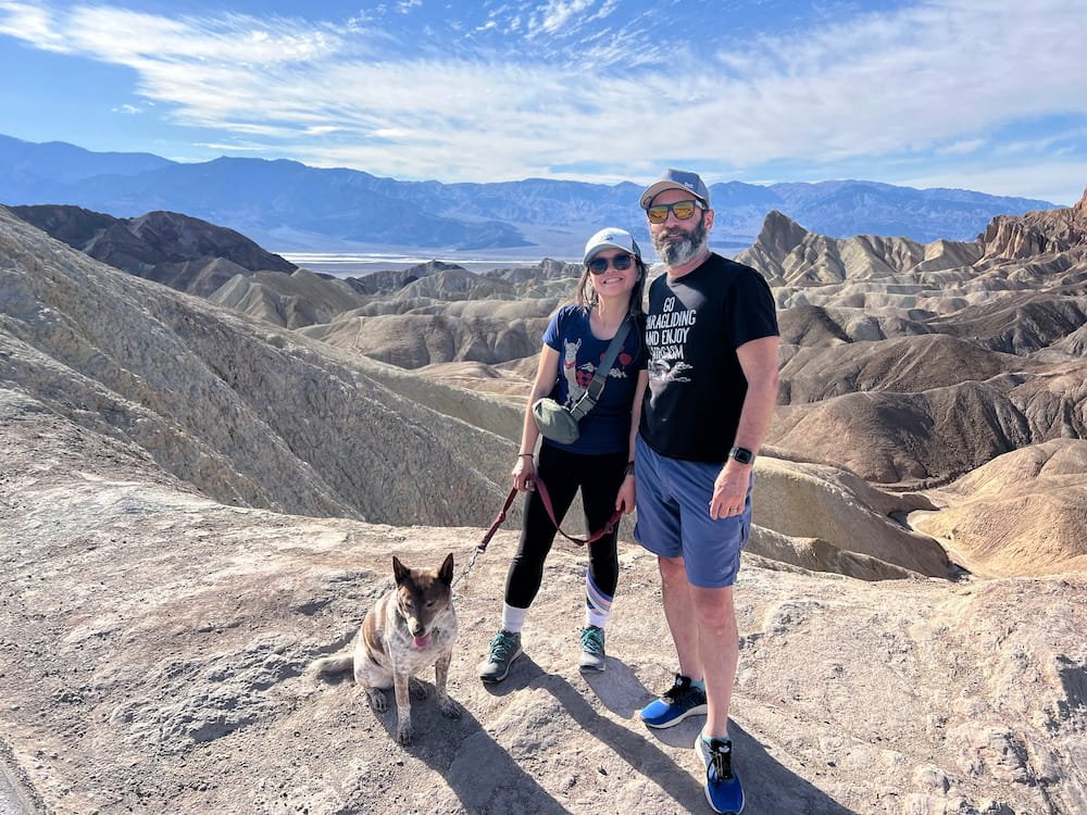
Zabriskie Point
ur final main stop was walking up to Zabriskie Point, a popular spot to see an absolutely stunning view of the Death Valley badlands below. It was a bit of a full circle trip as Zabriskie Point also connects to the Golden Canyon Trailhead, where we were at the beginning of the day.

First Time Staying at an RV Park
We drove back to Pahrump and pulled up in our spot at the Lakeside RV Park, the first time we used an RV park during our trip so far. It looked like there were quite a few folks here for extended stays, as evidenced by the homely decorations outside their RVs, fences they’ve erected around their lots, etc. This was the closest we’ve stayed next to our neighbors for the night, as in an RV park you are essentially side-by-side in a parking space.
Now here comes the tricky part–we had to dump our grey and black water tanks, which we hadn’t done yet on this trip. Lisette was too proud (and shy) to ask our neighbor for advice, so she got a quick tutorial by watching a couple of YouTube videos. It was messy–she ended up spilling black water in our parking spot because as soon as she unscrewed the black water lid, sewer water started gushing out immediately, indicating that our black water tank was indeed past the point of full before we opened it. She also had the pipe connections fitted the wrong way, so as the pipe needed to drain into the sewer, it splashed the sewer water out onto the ground rather than going down the drain. GROSS. To make things even better, it also turns out that we had valves on both sides of the RV, so after thinking we’d drained everything, we had to do it again because it hadn’t finished emptying. And then we realized that the sensors didn’t seem to be working, because the grey and black water tanks were still showing up as somewhat full despite us flushing them, and seeing clean water go through. So we’ll have to also clean off our muddy, sewer stained shoes in the light of day tomorrow!

BUT it was a learning experience, and an important one as we are still in the early days of our RV life. We hope that the sensors will clear themselves up, and we’ll have to do further reading/research and purchase some cleaners that could potentially have the sensors be accurate again. Based on initial reading and research though, the sensors to show the water levels are notoriously finicky, so we’ll likely have to simply gauge based on experience when it’ll be time to dump our tanks. At least our clean water is now hooked up to the city water, so we don’t need to be worried about using up our water tonight. And we can have a longer shower that’s not just a splash and dash!
Route Map