After a peaceful nights' sleep with no light pollution to bother us, Lisette went to take her daily "what's outside her bedroom window" photo first thing in the morning, only to lift the blinds and be greeted by a tree! We couldn't help laughing at the unexpected sight. It turns out we'd sidled up next to it when we parked overnight. In the light of day, we also found the skeletal backbone of what was likely a cow nearby, a bright calcium white. Oh, and a bullet shell from someone who had hunted in the area, as well as too much litter from folks who came and didn't clean after themselves, ergh.
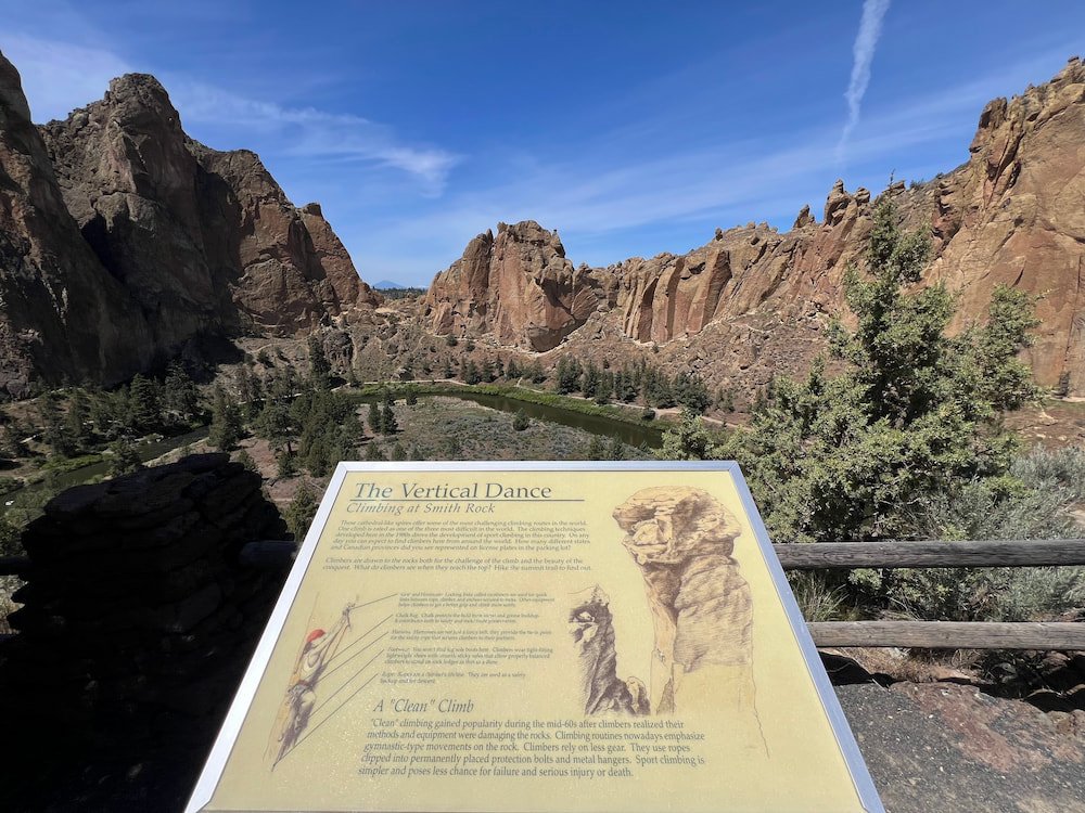
Our next destination was Smith Rock State Park, located in the Central Oregon high desert area, which is a mecca for rock climbers. It's apparently considered the birthplace of modern American sport climbing, with hundreds of routes also available for traditional climbing, multi-pitch climbing, and bouldering. While we've encountered a few places now that are great for outdoor rock climbing, we're both incredibly rusty, haven't got all our gear (most importantly: rope), and Lisette hasn't had any experience in belaying outdoors. So, we had a bit of FOMO seeing all the climbers, and checking out all the wicked routes they were doing!

Definitely A Hard Hike
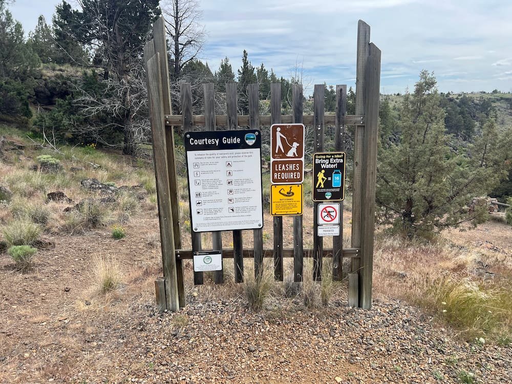
Fortunately, Smith Rock State Park isn't just centered around climbing, with options for hiking, running, mountain biking, birdwatching and fishing. We chose to hike the Misery Ridge and Summit Trail Loop, a somewhat strenuous 6.2 mile trail (just under 10 kms, although we ended up walking a bit further than this). We chose this hike as Misery Ridge is particularly popular, where we could see the various rock climbing routes up close, as well as marvel at the scenery from at the top of the rock as well as through the crooked river canyon.
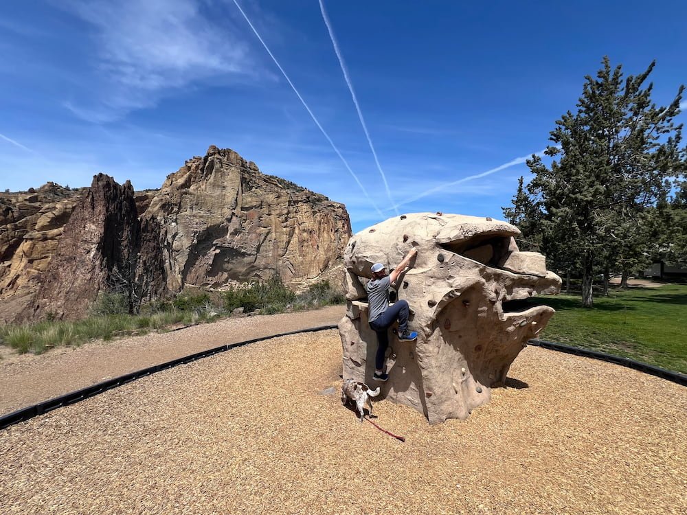
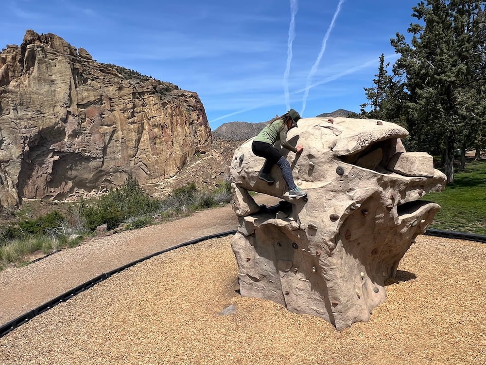
From the parking lot, we went around the park, first stopping to check out a manmade structure for folks to practice or play around with some rock climbing holds. The trail then went down into the canyon, arriving at the base of the rock face (where we immediately saw rock climbers).
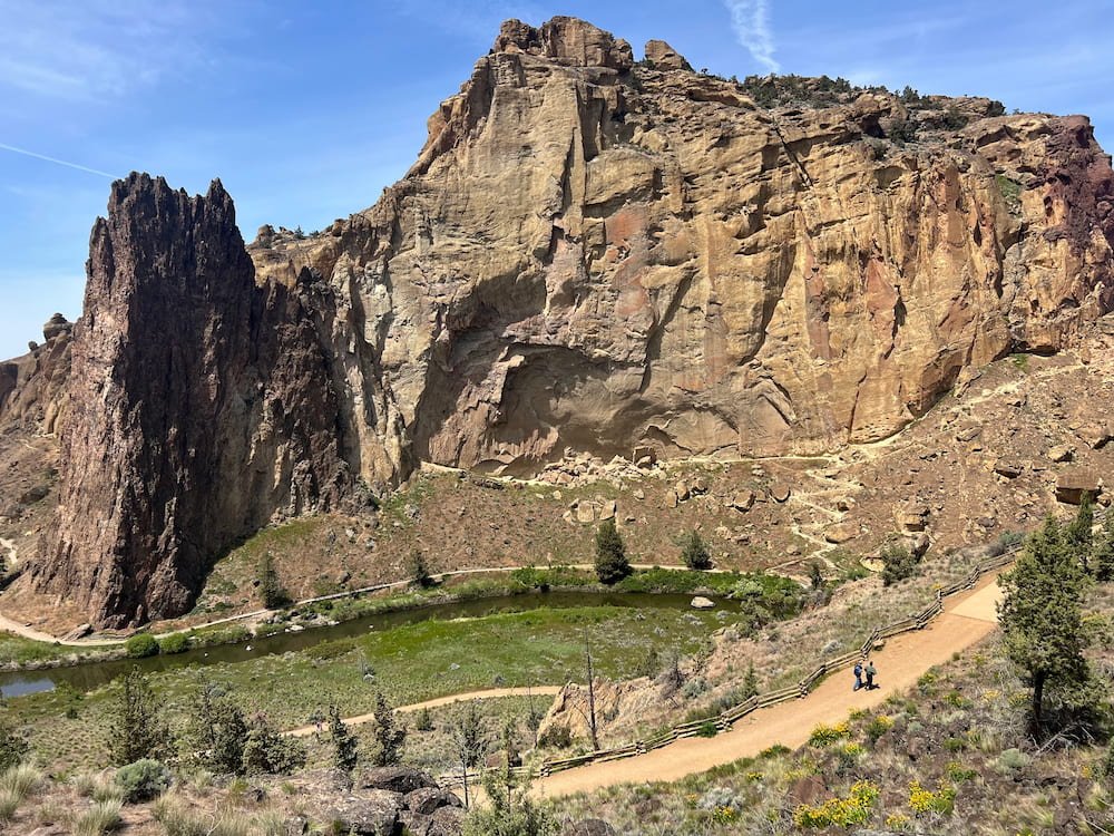
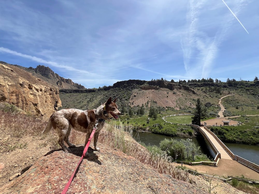

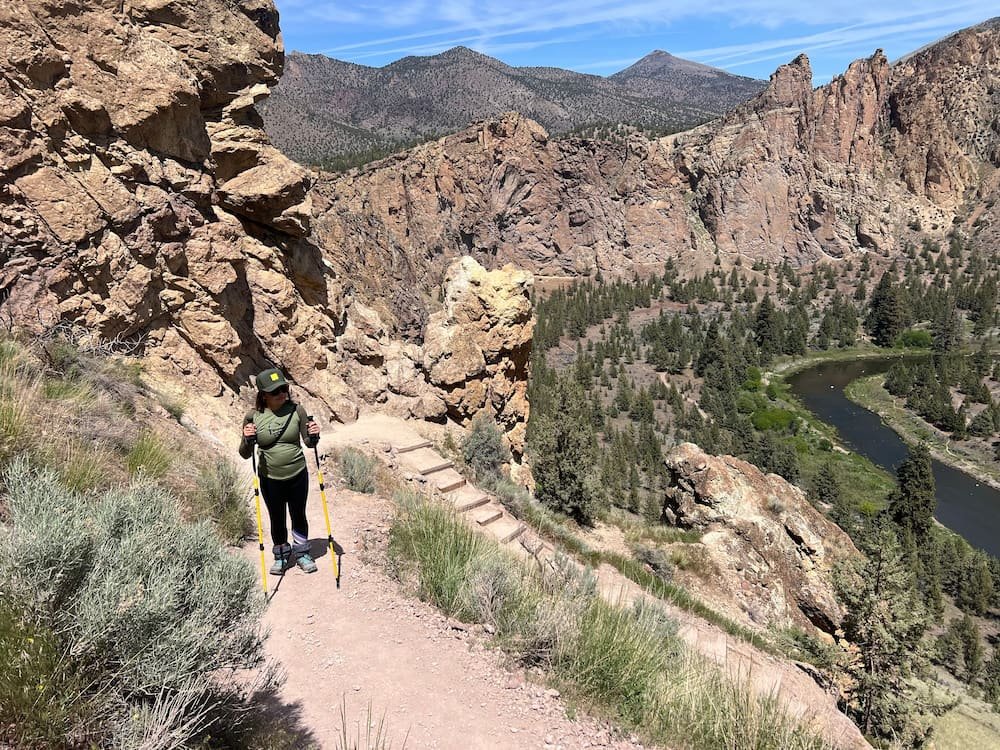
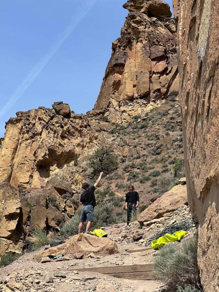
It turns out our starting point was the challenging Summit Trail, where we were basically on an outdoor StairMaster, continuously trekked upwards along switchbacks to get to the top of the Smith Rock. The steep ascent made us breathless--but fortunately so did the incredible view even before we made it to the top! It was pretty cool to see the switchbacks below us from where we'd just come from, and the river, canyons, and other hikes across the water.
The Best Views of Smith Rock
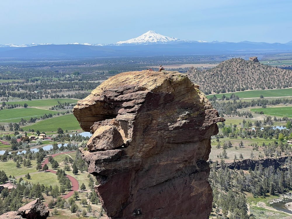
Once we got to the summit, we saw people enjoying the view, sitting around and eating. But the most impressive folks we saw chilling and eating were the guys that were perched at the top of Monkey Face, a sheer rock pillar that they'd obviously had to climb with its cracks and overhanging arêtes! What a well-earned and stunning view they must have also had once they got to the top.


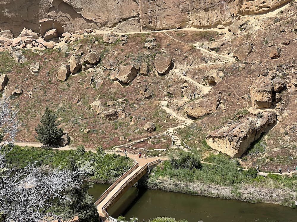
As we started to descend the trail on the other side, we encountered people heading in the opposite direction, who had started on the other side. In hindsight, it would probably have been easier to do the trail in that order, as they would have had the steep switch backs to go down. Plus the descend turned out to be harder for us versus them going up, as the trail was incredibly gravelly, which resulted in our shoes sliding down the trail, and us having to catch ourselves before we slid down too far! Lisette is not a fan of hiking downhill at the best of times, so fortunately she brought her hiking poles as it would have been a nightmare to get down without them.
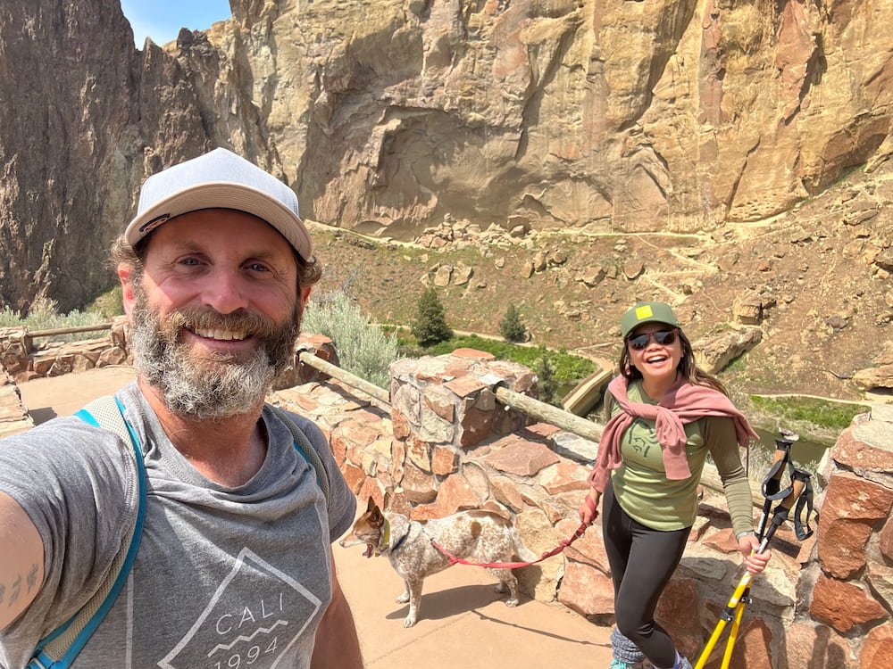
Along the way, we encountered more rock climbers who definitely center their world around setting the next route! When we arrived alongside the river, we saw a beautiful deer across the water! Sheila had been an absolute trooper on this hike, and she got to dip her feet in the cool water and explore the river before we continued on. We also saw different species of birds, including a black bird with blue accents on its tail (likely the Steller's Jay), and many others. There are also bald eagles here!
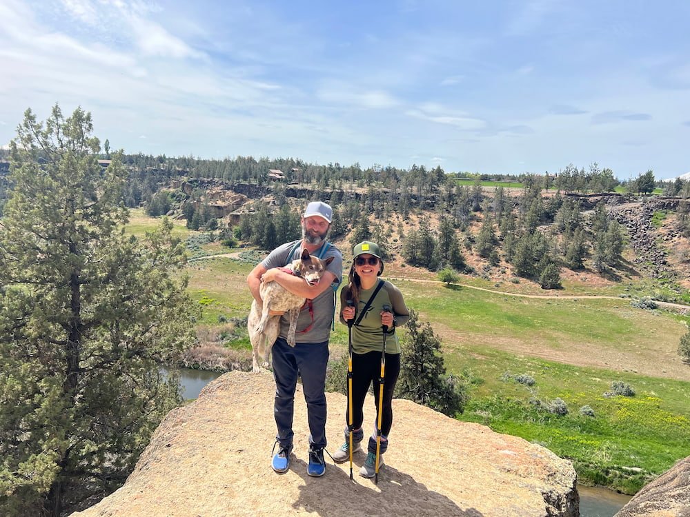

As we made our way back, we walked across a couple of pretty bridges, and had to trek back up again out of the canyon (fortunately not as steep and no more switchbacks!), before arriving back at the RV. We were hot and tired, but felt a huge sense of accomplishment for completing this hike!
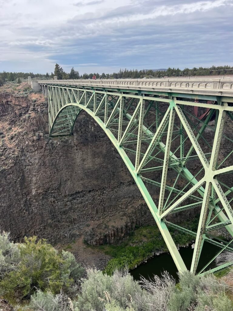
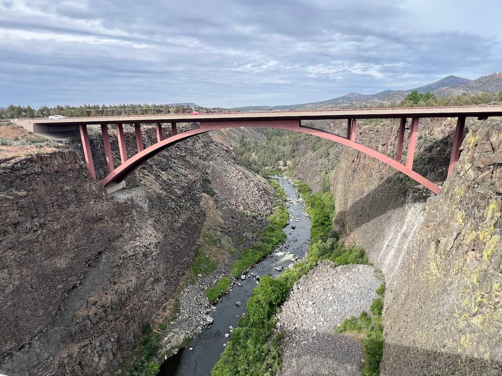
Crooked River Bridge
Our final main stop for the day was the Crooked River High Bridge, which was built in 2000 and is the 22nd highest bridge in the country. It replaces the bridge that was built in 1926 that is now used for people to walk across and look down at Crooked River Gorge below and the new bridge. In fact, there's technically 3 bridges, as one is a railroad bridge that runs parallel also to both, that's still in use today.
There's a small park that leads from the parking lot to the site of all 3 bridges, and it was good to check this out as a short rest stop before continuing on our way.

Wild Oregon Wilderness
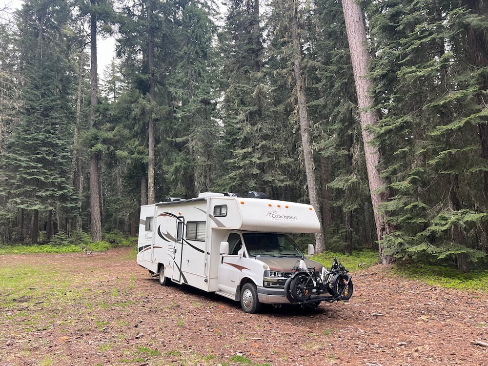
As we north, we saw fertile green fields, with some almost all yellow thanks to the wild flowers that grew without abandon on top of them. This then transformed into dense forests, surrounded by enormous trees that sheltered us from the sun and dropped the temperature significantly as we ascended in altitude. We ended up finding a generous-sized clearing off the road, with forest all around us. It even started to rain not long after we pulled up--what a change in weather! While Internet and phone connection was understandably slower and less reliable here, we were in a peaceful and comfortable spot to stay for the night.
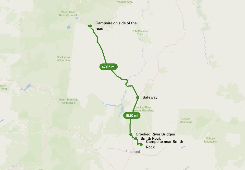
Route Map