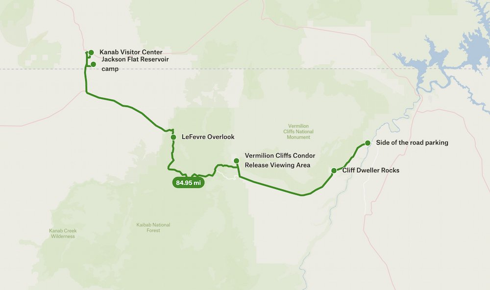
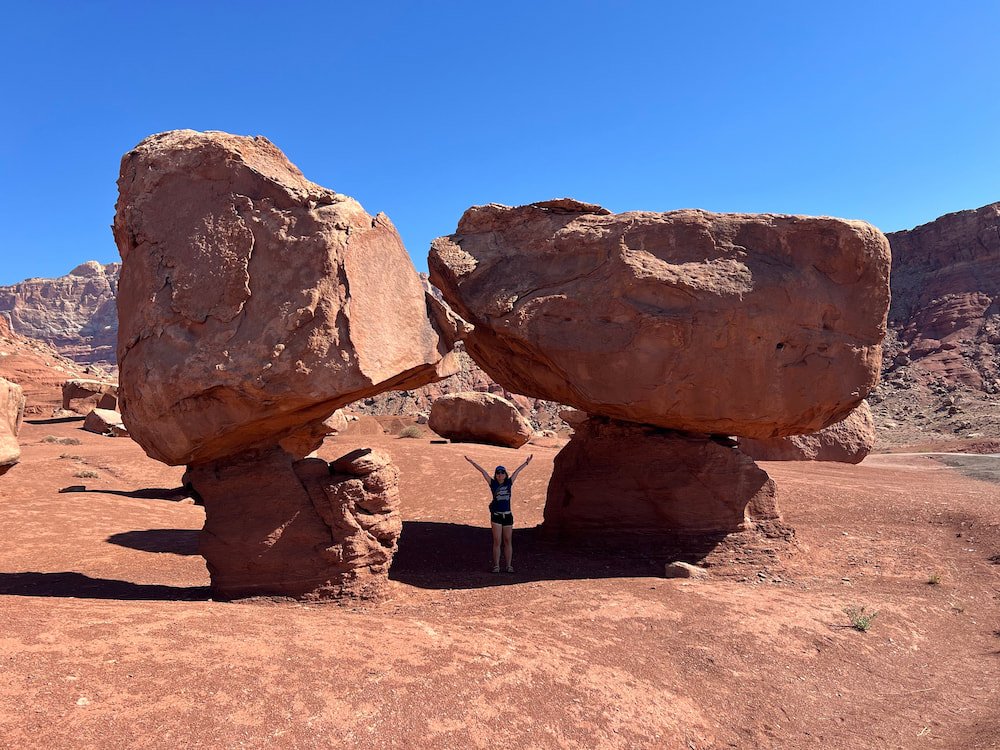
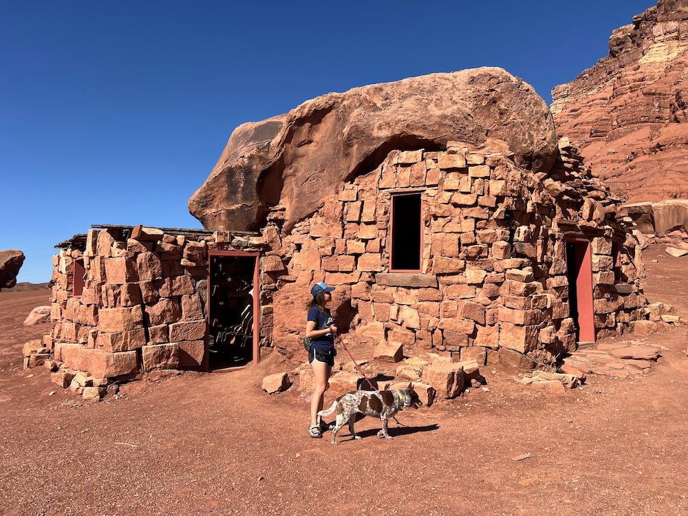
In the morning we woke up to sunny skies so we decided to take advantage of our amazing campsite and have breakfast outside. Afterward we drove to the nearby Cliff Dwellers Stone House for a quick stop before heading for Vermilion Cliffs.
Vermilion Cliffs: Overlooks, Condors and Pronghorns
Vermilion Cliffs National Monument is 280,000 acres of gorgeous red rocks, trails and views, with landscapes like the Paria Plateau, Vermilion Cliffs, Coyote Buttes, and Paria Canyon. It’s tucked between Kaibab National Forest on one side and Glen Canyon National Recreation Area on the other. We drove from where we slept the night before, and loved seeing the brilliant shades of red pigment glistening on the rocks and ground as we cruised along.
We realized that we needed to drive back down to get to Vermilion Cliffs Condor Viewing Site. It’s a bit of a bumpy road to get there, and as we approached we noticed what looked like several deer in front of us, but later realized that they were pronghorns! We could tell that they were pronghorn because of their antlers and distinct white butt. Pronghorns are the fastest land mammal in the Americas, after the cheetah. While they’re sometimes referred to as the American antelope, the pronghorn’s closest living relatives are the giraffe and okapi.
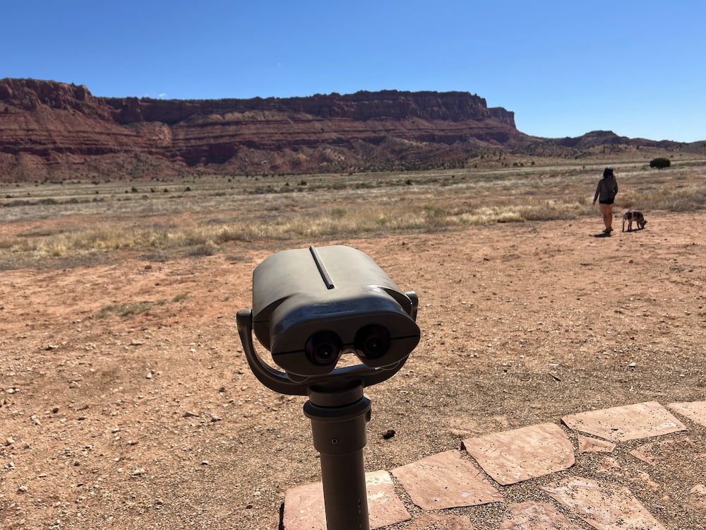
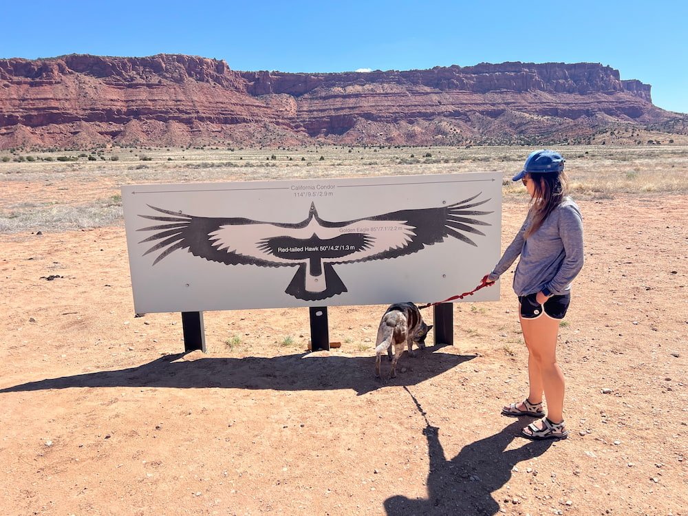
We were thrilled to have encountered our first pronghorn sighting, as unfortunately we didn’t see any condor at the viewing site. The site has a small car park, and an area with a spotting scope to try and see the condor up in the rocks straight ahead. The most we were able to see was the whitened rock, discolored from their poop! Apparently over 200 California condors now live in the wild, from a low of 22 condors in 1982. California condors have been released in Vermilion Cliffs since 1996 by The Peregrine Fund, in partnership with the Bureau of Land Management (BLM), so this site gives visitors a chance to see these endangered birds.
When we were at the condor viewing site, we noticed a couple of people who seemed to be fixing up their cars in the lot. No sooner had they left, when Michael realized that they had been pumping up their tires again, as the gravelly road beyond the viewing site was incredibly bumpy and best to do with deflated tires. If we had driven onwards we could have made it to The Wave, one of the most popular destinations in the area (and to take photos of). Because of its popularity, a permit from BLM is now required to see it, with only 64 people allowed per day. However, because of the rough drive to get there, we had to skip progressing on this road, and continued to the city of Kanab, leaving Arizona and crossing back into Utah.
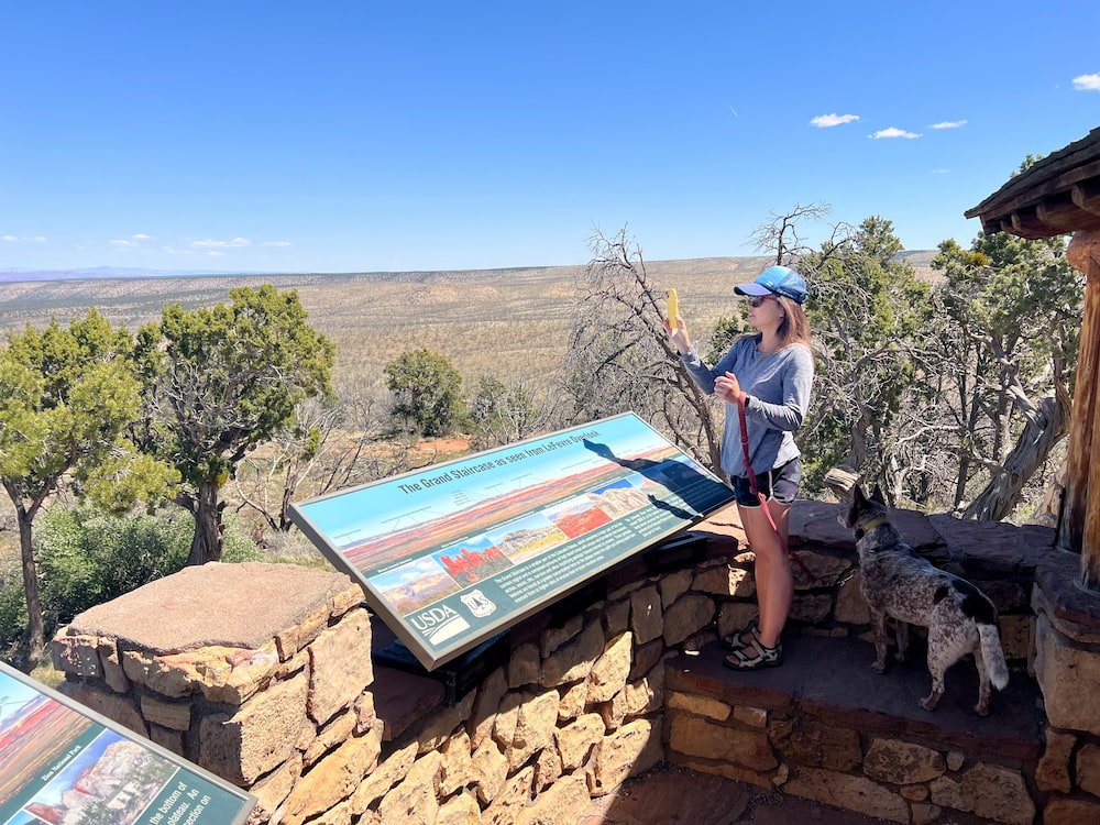
On our way through was a spectacular viewing point -- the Le Fevre Overlook -- where we could look at The Grand Staircase below us, one of the most colorful parts of the Colorado Plateau. Here we could see a vast array of colors, textures, elevations, and how the landscape had evolved over millions of years. The Overlook is just off the highway, making it an easy and amazing stop!
Kanab: The Greatest Earth on Show
Kanab calls itself "The Greatest Earth on Show" (a play on the old circus saying "The Greatest Show on Earth"), thanks to its proximity to many tourist attractions, including Vermilion Cliffs, Bryce Canyon National Park, the North Rim of the Grand Canyon, Zion National Park, and many others. It's also a popular spot to do UTV tours, as we noticed many parked, waiting for tourists to take them for a ride. We figured we'd check out the Visitor Center to orient ourselves to the area, plan where we'd go next, and find a place to rest for the night (hopefully surrounded by beautiful and peaceful scenery as we had the night before). The Kanab Visitor also has some interesting exhibits about the Native American peoples who have inhabited this land, as well as different rock slabs showing how the different colors have formed, from these stacking atop each other over millions of years.
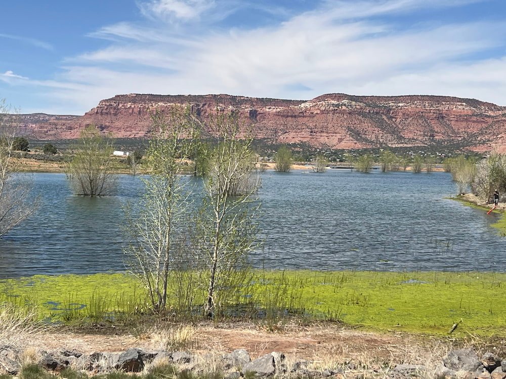
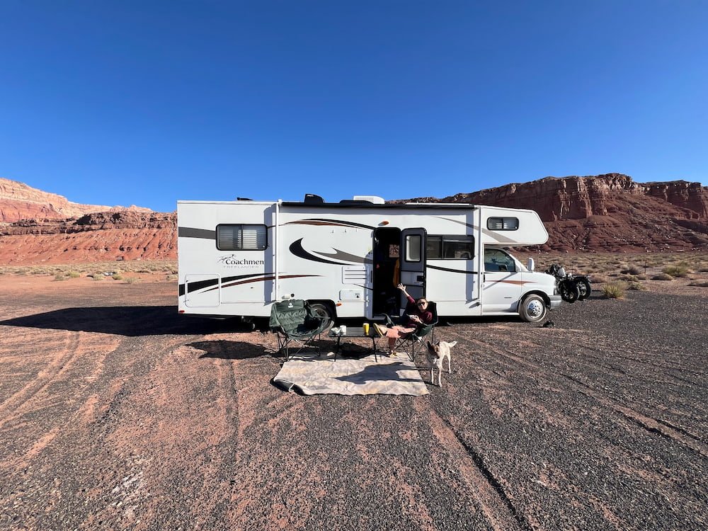
One of the recommendations for us to boondock for the night was Jackson Flat Reservoir, a serene spot to walk along the paved trails, go fishing, canoeing/kayaking, or birdwatching (there were a lot of birds, including Canadian geese, in the water). We loved the views of the water and greenery surrounding us as we pulled up in the late afternoon. It was somewhat warm, although the wind did pick up in the evening, with a slight dust storm rolling in as Lisette and Sheila sat outside, perfectly timed to when Michael opened the RV door from inside to see what was happening!
Still, we count ourselves so lucky to have this opportunity to enjoy so many beautiful natural sights, sounds and smells surrounding us. Lisette vowed to make the most of the scenery and take Sheila for a lovely walk first thing in the morning.
Route Map