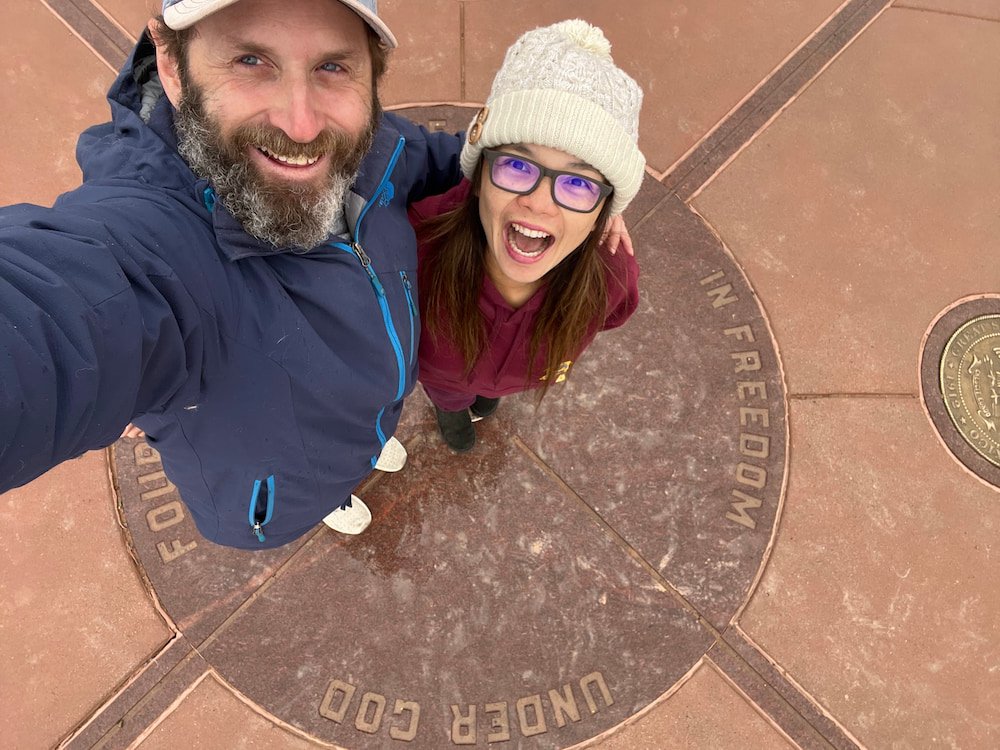
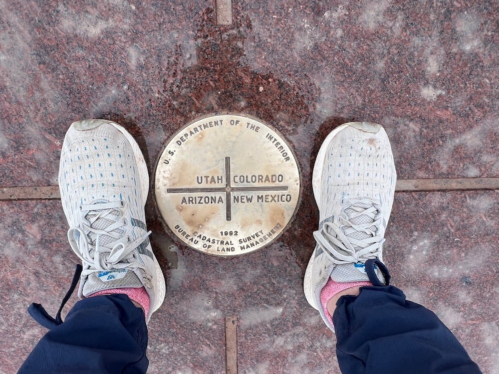
Where 4 US States Meet
The Four Corners Monument is the only place in the US where four states – Utah, Colorado, New Mexico, and Arizona – meet at one point. The monument also sits on the border between two semi-autonomous Native American nations: the Navajo Nation, which manages it as a tourist site, and the Ute Mountain Ute Tribe Reservation. It costs $8 per person (not vehicle) to enter the Monument.
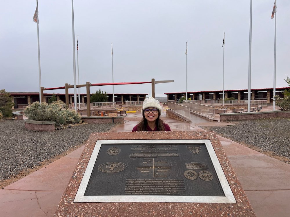
It was cold and grey when we drove in, and it was spitting with rain when we drove in, making the dirt ground around the carpark soft and muddy. There weren’t many visitors there, perhaps due to the less-than-desirable photo conditions, and there also weren’t many Navajo vendors yet at the Monument. We saw a still-closed kiosk that apparently sells Navajo tacos and fry bread, and many of the stalls selling Navajo jewelry and other souvenirs were still empty surrounding the Monument.
Fortunately, the benefit was that we had a lot of time to spend at the Monument to take photos at all angles, and have fun dancing around it, spending time hopping from one state to another (or placing both feet on all four states at the same time)!
Twin Rocks Trading Post
About an hours’ drive away from the Four Corners Monument is the Twin Rocks Trading Post, sitting directly beneath the enormous Navajo Twins rock formation. The Trading Post has beautiful Native American selling artwork, jewelry, rugs and other items, and is also an impressive art gallery. Lisette went in and besides seeing all the wonderful handmade creations with the details of the artists, there are two adorable white labradors hanging out inside. One was immediately lying on its back on the rug as Lisette entered, demanding a belly rub, and the other labrador sauntered into the main room from its relaxing bed in a separate gallery room. Definitely say hi if you are in the area!


Next door is the Twin Rocks Cafe, which serves breakfast, lunch, and dinner. There were quite a few people who were enjoying the local Navajo and American specialties, which made it a tempting stop, had we not had a full fridge of food!
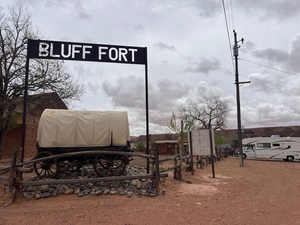
Bluff Fort: A Free Historic Pioneering Site
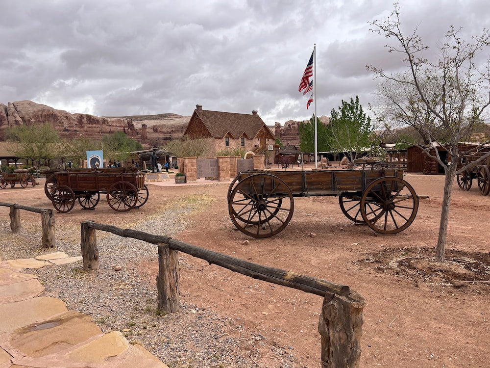
One unplanned and fun visit was to Bluff Fort Historic Site, a throwback to the original town built by Mormon missionaries after they arrived in the San Juan area in 1880. It’s incredibly informative, interactive, and well maintained, which is impressive for a free site run by friendly and helpful volunteers.

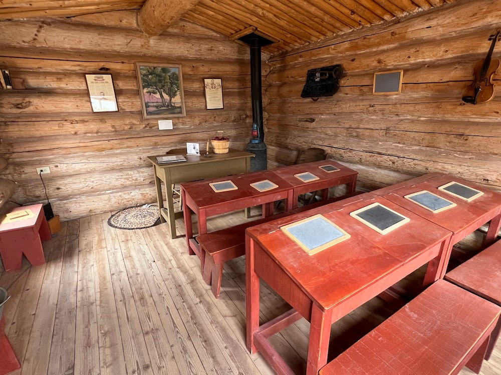
Walking among the recreated log cabins we read about the families that would have once lived in them as we looked at the old furniture and items they would have owned. Within these dwellings and the old classroom, the meetinghouse, the blacksmith’s workshop and other buildings, there are also buttons to listen to audio in several different languages that go into more detail. There are old wagons outside (some donated from Germany), as well as a Navajo hogan and a Ute tipi.
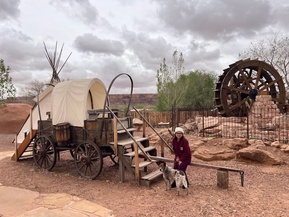


For kids (well, adults too like us!) there’s a lot of fun and interactive activities as well, including a giant waterwheel where visitors can try to pan for gold, and an area where you can try to lasso wooden cattle. Inside the Visitor Center there’s additional exhibits, a gift shop, plus a food kiosk that sells pastries, ice cream, and other snacks.
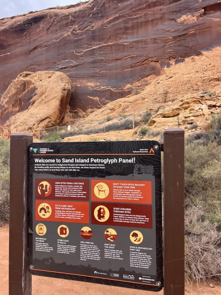
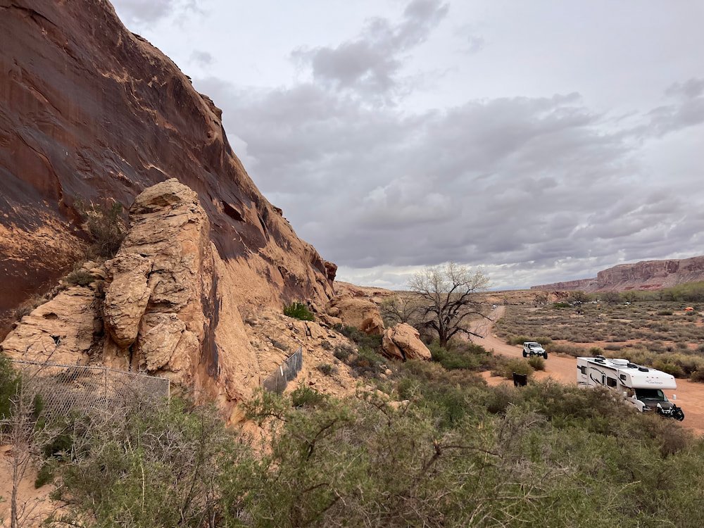
Petroglyphs at Sand Island
A brief stop after Bluff Fort Historic Site was Sand Island Petroglyphs. It’s a short drive off the road, passing a popular campground on the left hand side. The petroglyphs are extensive and amazing – there’s a panel filled with handprints, lots and lots of bighorn sheep, and even Kokopelli playing a flute! There’s also a figure that looks like it has a modern day WiFi signal on it! We aren’t sure what that figure is and what it stands for, but the symbol meant something then, as it does now!
Mexican Hat (Not Called a Sombrero)
As we continued along the road in Utah, we were mesmerized by the scenery in front of us, with majestic rock formations in shades of white, grey, green and red. In some areas, the terrain was completely flat, with a rock monolith rising skywards, like a single commanding tower in the distance. It’s incredible to think how this landscape has formed over millions of years, and how some areas have created these monolithic formations, seemingly out of nowhere.
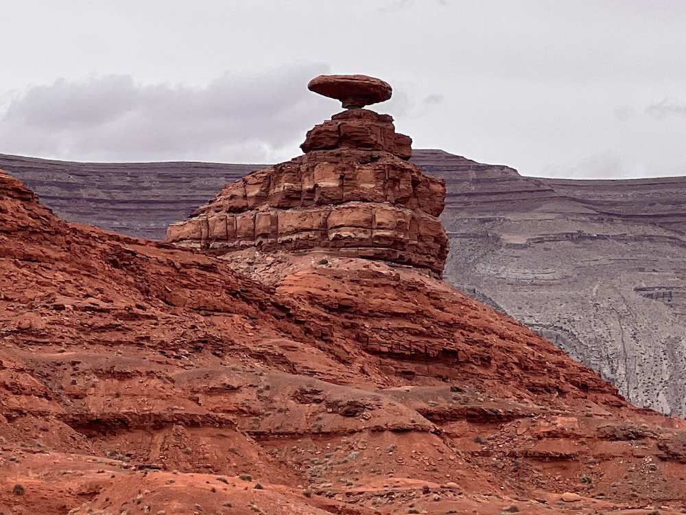
We stopped at one of the more unique and popular rock formations, called Mexican Hat (weirdly, not named ‘sombrero’). It’s a flattened pancake disk shape, perched delicately atop its stouter rock base. We decided to sleep right near it, although make sure to pay online as it’s a paid campsite (the website was listed as we drove in, and the owner will drive right up to you and yell at you if you don’t pay immediately).

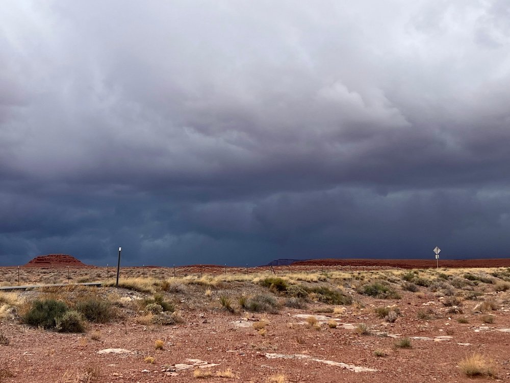


As it turned to dusk, the winds picked up, and dark clouds loomed quickly over us, indicating that a strong storm was imminent. We yelled for Sheila to quickly run inside the RV as the gales blew up piles of red dirt and it wasn’t a moment too soon – it started to rain, and the cold air quickly turned the water into sleet! What a dramatic way to end our fun-filled day.
Note
We were considering checking out some more arches nearby but after researching the road in we decided that it would be impossible (and dangerous) in the RV. Here's a video showing the Moki Dugway Scenic Byway switchbacks.
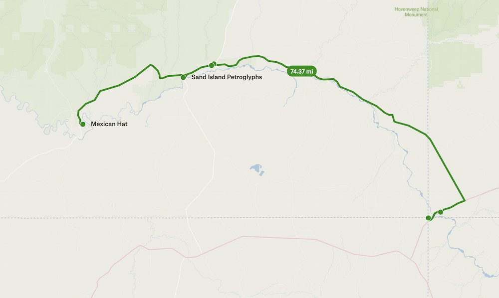
Route Map